Parkland Topo Map Wisconsin
To zoom in, hover over the map of Parkland
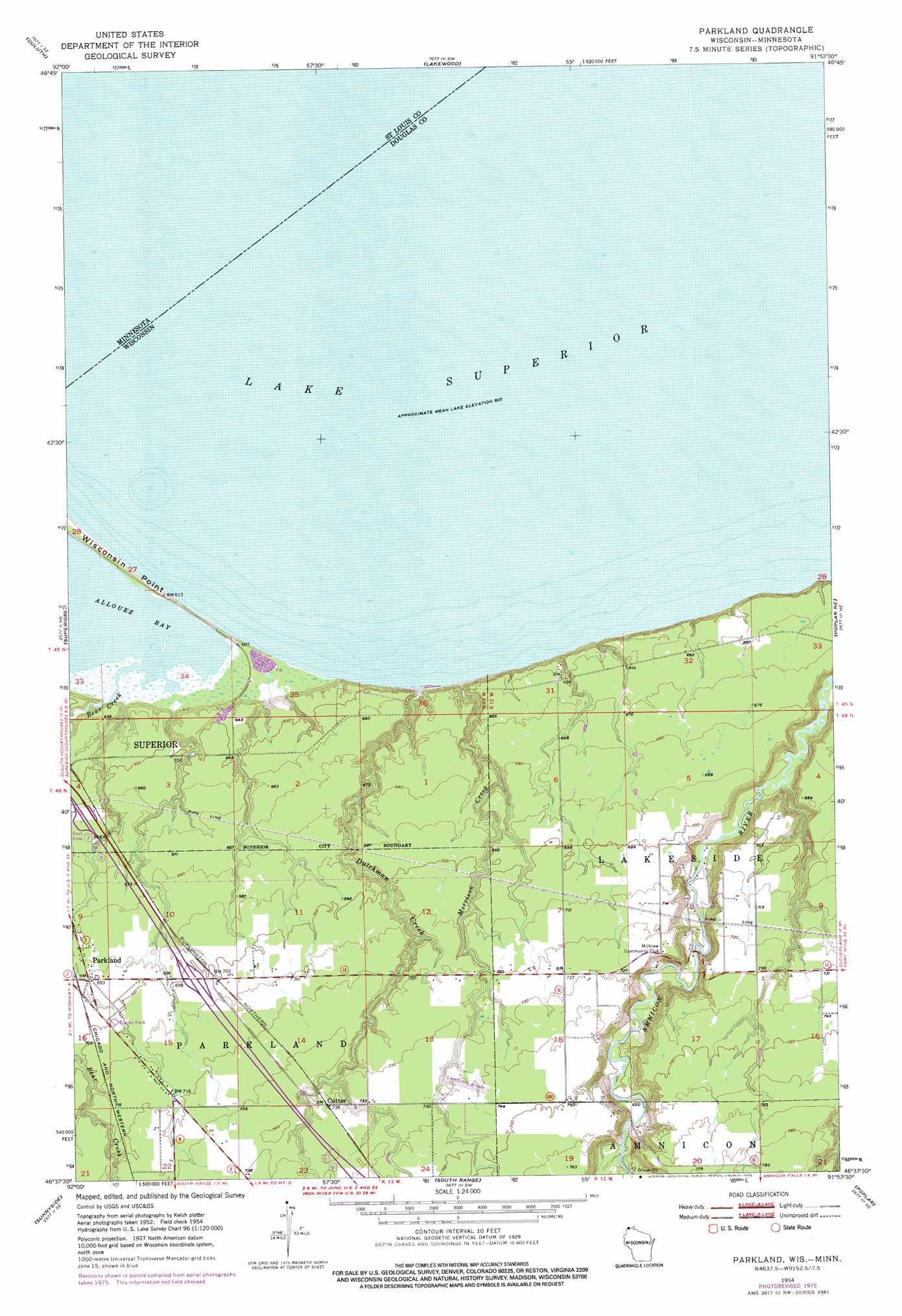
USGS Topo Quad 46091f8 - 1:24,000 scale
| Topo Map Name: | Parkland |
| USGS Topo Quad ID: | 46091f8 |
| Print Size: | ca. 21 1/4" wide x 27" high |
| Southeast Coordinates: | 46.625° N latitude / 91.875° W longitude |
| Map Center Coordinates: | 46.6875° N latitude / 91.9375° W longitude |
| U.S. States: | WI, MN |
| Filename: | o46091f8.jpg |
| Download Map JPG Image: | Parkland topo map 1:24,000 scale |
| Map Type: | Topographic |
| Topo Series: | 7.5´ |
| Map Scale: | 1:24,000 |
| Source of Map Images: | United States Geological Survey (USGS) |
| Alternate Map Versions: |
Parkland WI 1954, updated 1955 Download PDF Buy paper map Parkland WI 1954, updated 1970 Download PDF Buy paper map Parkland WI 1954, updated 1976 Download PDF Buy paper map Parkland WI 2010 Download PDF Buy paper map Parkland WI 2013 Download PDF Buy paper map Parkland WI 2015 Download PDF Buy paper map |
1:24,000 Topo Quads surrounding Parkland
Fredenberg |
Arnold |
French River |
Knife River |
|
Duluth Heights |
Duluth |
Lakewood |
||
West Duluth |
Superior |
Parkland |
Poplar Ne |
Cloverland |
Borea |
Sunnyside |
South Range |
Poplar |
Lake Nebagamon |
Patzau |
Amnicon Lake |
Lyman Lake |
Bennett |
Lake Minnesuing |
> Back to 46091e1 at 1:100,000 scale
> Back to 46090a1 at 1:250,000 scale
> Back to U.S. Topo Maps home
Parkland topo map: Gazetteer
Parkland: Populated Places
Cutter elevation 221m 725′Parkland elevation 211m 692′
Parkland: Streams
Bear Creek elevation 183m 600′Dutchman Creek elevation 183m 600′
Morrison Creek elevation 183m 600′
Parkland digital topo map on disk
Buy this Parkland topo map showing relief, roads, GPS coordinates and other geographical features, as a high-resolution digital map file on DVD: