Kroschel Topo Map Minnesota
To zoom in, hover over the map of Kroschel
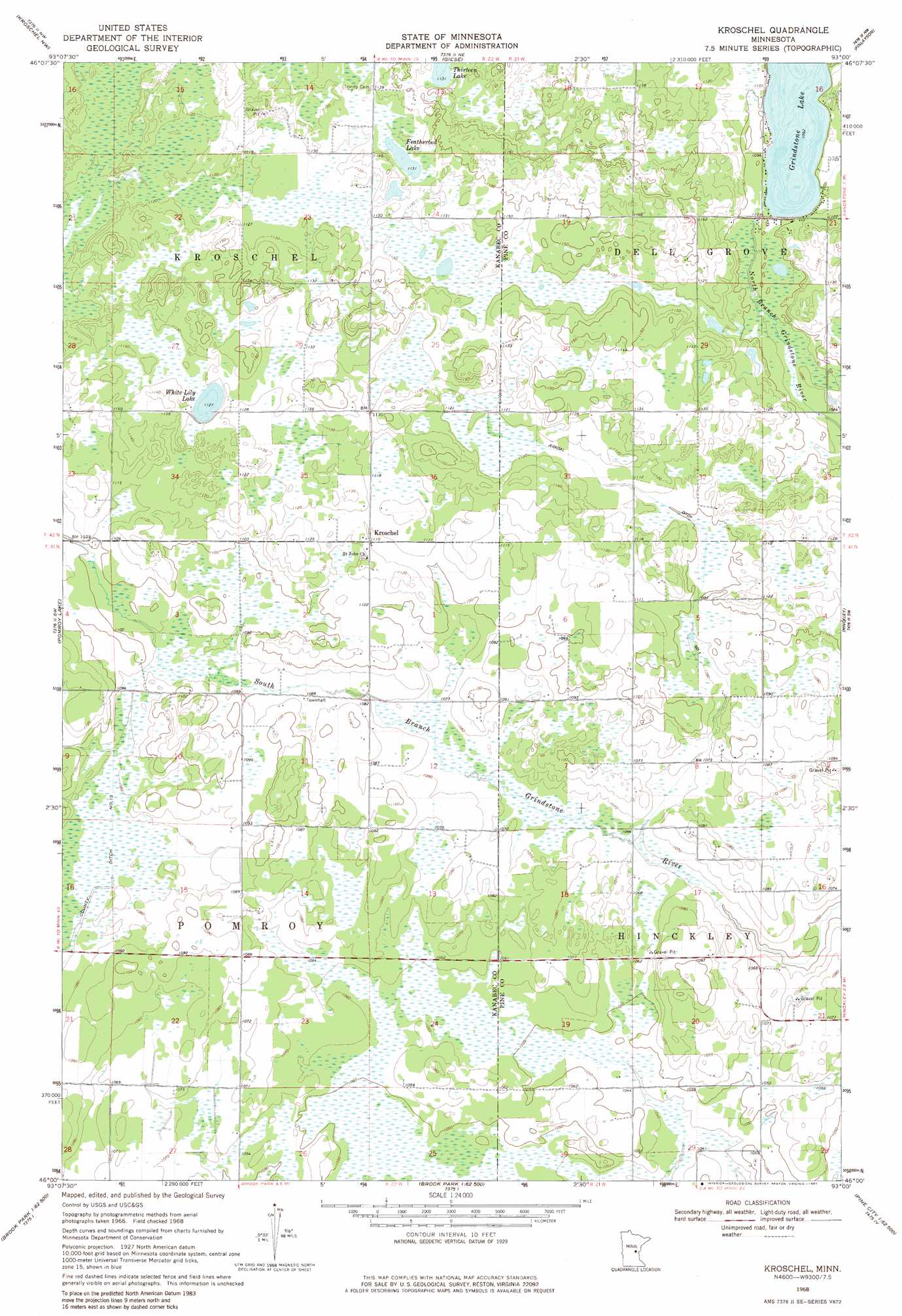
USGS Topo Quad 46093a1 - 1:24,000 scale
| Topo Map Name: | Kroschel |
| USGS Topo Quad ID: | 46093a1 |
| Print Size: | ca. 21 1/4" wide x 27" high |
| Southeast Coordinates: | 46° N latitude / 93° W longitude |
| Map Center Coordinates: | 46.0625° N latitude / 93.0625° W longitude |
| U.S. State: | MN |
| Filename: | o46093a1.jpg |
| Download Map JPG Image: | Kroschel topo map 1:24,000 scale |
| Map Type: | Topographic |
| Topo Series: | 7.5´ |
| Map Scale: | 1:24,000 |
| Source of Map Images: | United States Geological Survey (USGS) |
| Alternate Map Versions: |
Kroschel MN 1968, updated 1970 Download PDF Buy paper map Kroschel MN 2010 Download PDF Buy paper map Kroschel MN 2013 Download PDF Buy paper map Kroschel MN 2016 Download PDF Buy paper map |
1:24,000 Topo Quads surrounding Kroschel
Thor Se |
Solana |
Arthyde |
Denham |
Willow River |
Mcgrath |
Kroschel Nw |
Giese |
Finlayson |
Sandstone North |
Warman |
Pomroy Lake |
Kroschel |
Hinckley |
Sandstone South |
Mora North |
Quamba |
Brook Park |
Beroun |
Cedar Lake |
Mora South |
Grasston |
Henriette |
Pine City |
Bass Creek |
> Back to 46093a1 at 1:100,000 scale
> Back to 46092a1 at 1:250,000 scale
> Back to U.S. Topo Maps home
Kroschel topo map: Gazetteer
Kroschel: Canals
Judicial Ditch Number One elevation 338m 1108′Kroschel: Lakes
Featherbed Lake elevation 344m 1128′Grindstone Lake elevation 332m 1089′
White Lily Lake elevation 342m 1122′
Kroschel: Populated Places
Kroschel elevation 339m 1112′Kroschel digital topo map on disk
Buy this Kroschel topo map showing relief, roads, GPS coordinates and other geographical features, as a high-resolution digital map file on DVD: