Bass Creek Topo Map Minnesota
To zoom in, hover over the map of Bass Creek
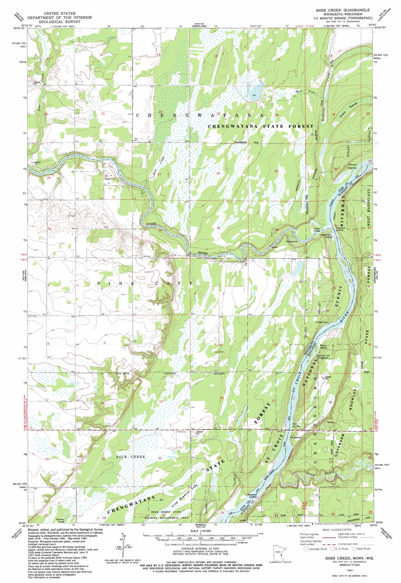
USGS Topo Quad 45092g7 - 1:24,000 scale
| Topo Map Name: | Bass Creek |
| USGS Topo Quad ID: | 45092g7 |
| Print Size: | ca. 21 1/4" wide x 27" high |
| Southeast Coordinates: | 45.75° N latitude / 92.75° W longitude |
| Map Center Coordinates: | 45.8125° N latitude / 92.8125° W longitude |
| U.S. States: | MN, WI |
| Filename: | o45092g7.jpg |
| Download Map JPG Image: | Bass Creek topo map 1:24,000 scale |
| Map Type: | Topographic |
| Topo Series: | 7.5´ |
| Map Scale: | 1:24,000 |
| Source of Map Images: | United States Geological Survey (USGS) |
| Alternate Map Versions: |
Bass Creek MN 1983, updated 1984 Download PDF Buy paper map Bass Creek MN 2010 Download PDF Buy paper map Bass Creek MN 2013 Download PDF Buy paper map Bass Creek MN 2016 Download PDF Buy paper map |
1:24,000 Topo Quads surrounding Bass Creek
Kroschel |
Hinckley |
Sandstone South |
Cloverdale |
Wilbur Lake |
Brook Park |
Beroun |
Cedar Lake |
Lake Clayton |
Saint Johns Landing |
Henriette |
Pine City |
Bass Creek |
Grantsburg |
Falun |
Rush Lake |
Rush City |
Randall |
Trade River |
Trade Lake |
Stark |
North Branch |
Sunrise |
Cushing |
Milltown |
> Back to 45092e1 at 1:100,000 scale
> Back to 45092a1 at 1:250,000 scale
> Back to U.S. Topo Maps home
Bass Creek topo map: Gazetteer
Bass Creek: Dams
Chengwatanna Wildlife Structure Dam elevation 275m 902′Bass Creek: Islands
Seven Islands elevation 245m 803′Bass Creek: Lakes
Long Meadows Lake elevation 261m 856′Bass Creek: Streams
Bass Creek elevation 266m 872′Redhorse Creek elevation 245m 803′
Snake River elevation 245m 803′
West Fork Redhorse Creek elevation 257m 843′
Wood River elevation 240m 787′
Bass Creek: Swamps
Green Swamp elevation 255m 836′Bass Creek digital topo map on disk
Buy this Bass Creek topo map showing relief, roads, GPS coordinates and other geographical features, as a high-resolution digital map file on DVD: