Five Finger Brook Topo Map Maine
To zoom in, hover over the map of Five Finger Brook
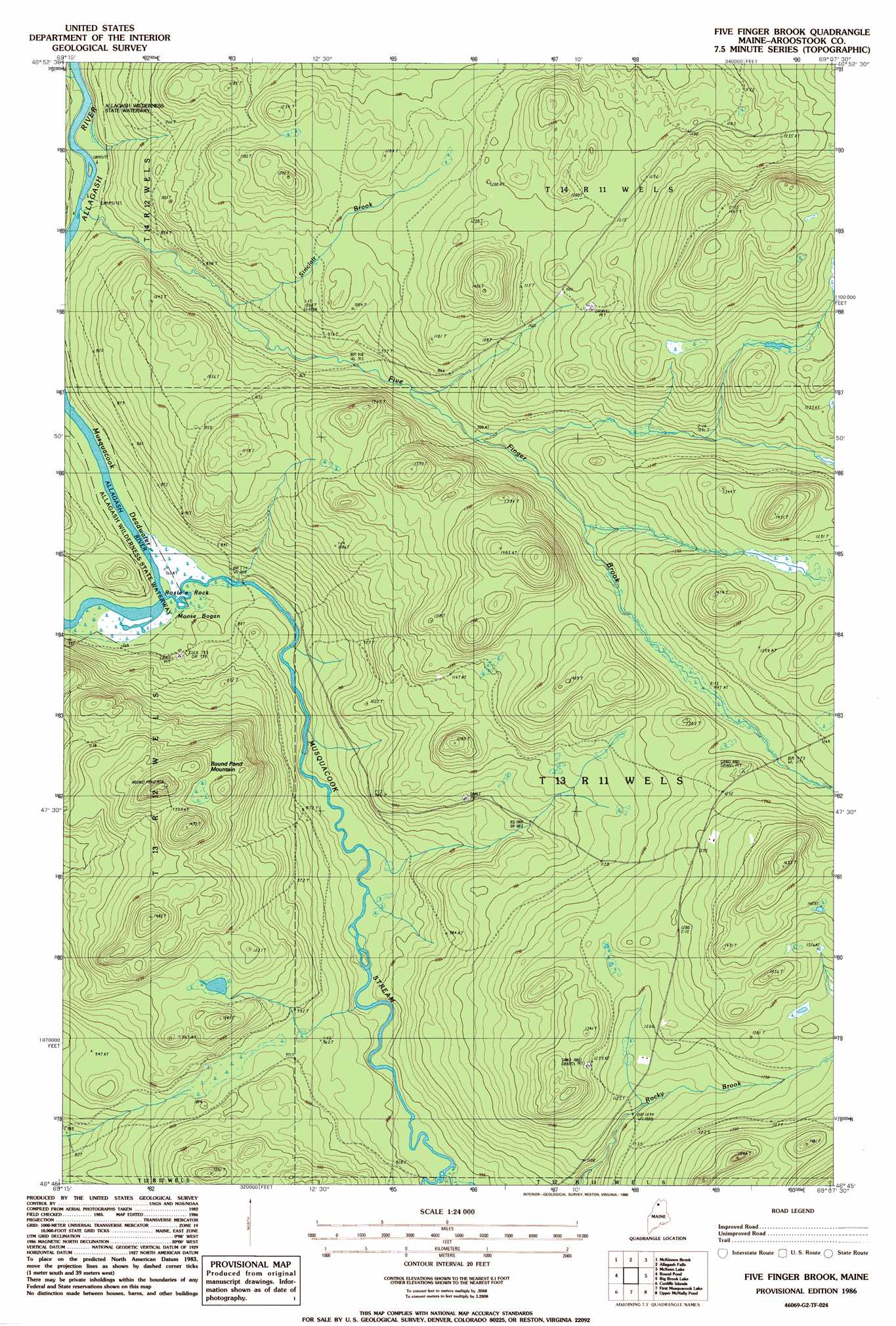
USGS Topo Quad 46069g2 - 1:24,000 scale
| Topo Map Name: | Five Finger Brook |
| USGS Topo Quad ID: | 46069g2 |
| Print Size: | ca. 21 1/4" wide x 27" high |
| Southeast Coordinates: | 46.75° N latitude / 69.125° W longitude |
| Map Center Coordinates: | 46.8125° N latitude / 69.1875° W longitude |
| U.S. State: | ME |
| Filename: | o46069g2.jpg |
| Download Map JPG Image: | Five Finger Brook topo map 1:24,000 scale |
| Map Type: | Topographic |
| Topo Series: | 7.5´ |
| Map Scale: | 1:24,000 |
| Source of Map Images: | United States Geological Survey (USGS) |
| Alternate Map Versions: |
Five Finger Brook ME 1986, updated 1986 Download PDF Buy paper map Five Finger Brook ME 2011 Download PDF Buy paper map Five Finger Brook ME 2014 Download PDF Buy paper map |
1:24,000 Topo Quads surrounding Five Finger Brook
Rocky Mountain Sw |
Schoolhouse Rapids |
Big Rapids |
Allagash |
Second Lake |
Big Black Rapids |
Mckinnon Brook |
Allagash Falls |
Mckeen Lake |
Gardner Pond |
Blue Brook |
Round Pond |
Five Finger Brook |
Big Brook Lake |
Fish River Lake Sw |
Cunliffe Lake |
Cunliffe Islands |
First Musquacook Lake |
Upper Mcnally Pond |
Farrar Pond |
Umaskis Lake West |
Umaskis Lake East |
Third Musquacook Lake |
Fifth Musquacook Lake |
Mooseleuk Lake |
> Back to 46069e1 at 1:100,000 scale
> Back to 46068a1 at 1:250,000 scale
> Back to U.S. Topo Maps home
Five Finger Brook topo map: Gazetteer
Five Finger Brook: Channels
Musquacook Deadwater elevation 235m 770′Five Finger Brook: Islands
Rosies Rock elevation 237m 777′Five Finger Brook: Streams
Bogan Brook elevation 230m 754′Five Finger Brook elevation 234m 767′
Musquacook Stream elevation 236m 774′
Rocky Brook elevation 268m 879′
Sinclair Brook elevation 264m 866′
Five Finger Brook: Summits
Round Pond Mountain elevation 458m 1502′Five Finger Brook: Swamps
Moose Bogan elevation 237m 777′Five Finger Brook digital topo map on disk
Buy this Five Finger Brook topo map showing relief, roads, GPS coordinates and other geographical features, as a high-resolution digital map file on DVD:
Maine, New Hampshire, Rhode Island & Eastern Massachusetts
Buy digital topo maps: Maine, New Hampshire, Rhode Island & Eastern Massachusetts