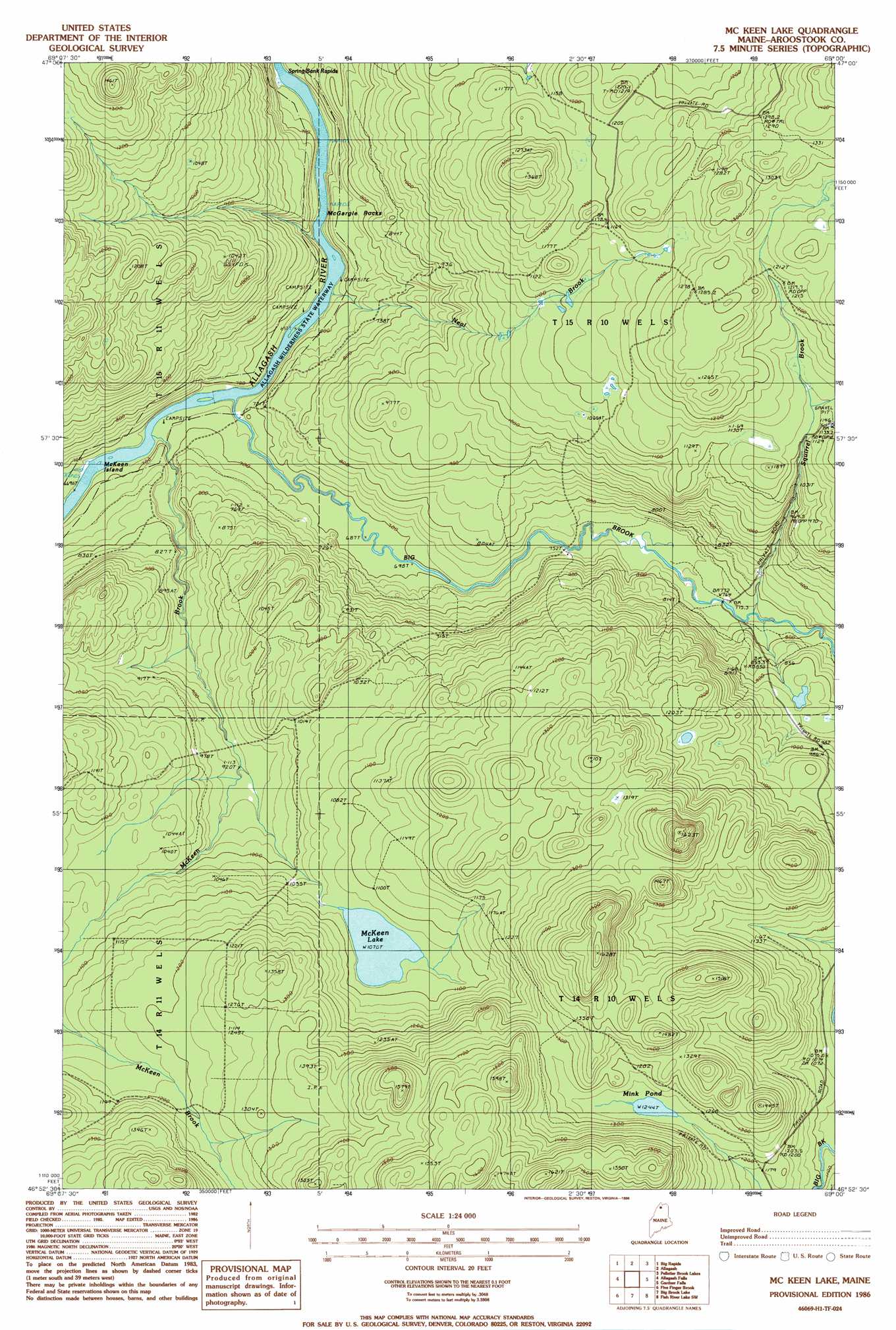
Mckeen Lake Topo Map Maine
To zoom in, hover over the map of Mckeen Lake
USGS Topo Quad 46069h1 - 1:24,000 scale
| Topo Map Name: | Mckeen Lake |
| USGS Topo Quad ID: | 46069h1 |
| Print Size: | ca. 21 1/4" wide x 27" high |
| Southeast Coordinates: | 46.875° N latitude / 69° W longitude |
| Map Center Coordinates: | 46.9375° N latitude / 69.0625° W longitude |
| U.S. State: | ME |
| Filename: | o46069h1.jpg |
| Download Map JPG Image: | Mckeen Lake topo map 1:24,000 scale |
| Map Type: | Topographic |
| Topo Series: | 7.5´ |
| Map Scale: | 1:24,000 |
| Source of Map Images: | United States Geological Survey (USGS) |
| Alternate Map Versions: |
Mc Keen Lake ME 1986, updated 1986 Download PDF Buy paper map McKeen Lake ME 2011 Download PDF Buy paper map McKeen Lake ME 2014 Download PDF Buy paper map |
1:24,000 Topo Quads surrounding Mckeen Lake
Rocky Mountain |
Johnson Brook Mountain |
Falls Brook Lake |
Saint Francis |
Saint John |
Schoolhouse Rapids |
Big Rapids |
Allagash |
Second Lake |
Mclean Mountain |
Mckinnon Brook |
Allagash Falls |
Mckeen Lake |
Gardner Pond |
Deboullie Pond |
Round Pond |
Five Finger Brook |
Big Brook Lake |
Fish River Lake Sw |
Fish River Lake |
Cunliffe Islands |
First Musquacook Lake |
Upper Mcnally Pond |
Farrar Pond |
Big Machias Lake |
> Back to 46069e1 at 1:100,000 scale
> Back to 46068a1 at 1:250,000 scale
> Back to U.S. Topo Maps home
Mckeen Lake topo map: Gazetteer
Mckeen Lake: Islands
McKeen Island elevation 204m 669′Mckeen Lake: Lakes
McKeen Lake elevation 326m 1069′Mink Pond elevation 379m 1243′
Mckeen Lake: Streams
Big Brook elevation 201m 659′McKeen Brook elevation 205m 672′
Squirrel Brook elevation 240m 787′
Mckeen Lake: Summits
McGargle Rocks elevation 217m 711′Mckeen Lake digital topo map on disk
Buy this Mckeen Lake topo map showing relief, roads, GPS coordinates and other geographical features, as a high-resolution digital map file on DVD:
Maine, New Hampshire, Rhode Island & Eastern Massachusetts
Buy digital topo maps: Maine, New Hampshire, Rhode Island & Eastern Massachusetts