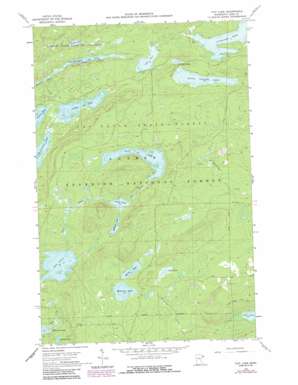
Tait Lake Topo Map Minnesota
To zoom in, hover over the map of Tait Lake
USGS Topo Quad 47090g6 - 1:24,000 scale
| Topo Map Name: | Tait Lake |
| USGS Topo Quad ID: | 47090g6 |
| Print Size: | ca. 21 1/4" wide x 27" high |
| Southeast Coordinates: | 47.75° N latitude / 90.625° W longitude |
| Map Center Coordinates: | 47.8125° N latitude / 90.6875° W longitude |
| U.S. State: | MN |
| Filename: | o47090g6.jpg |
| Download Map JPG Image: | Tait Lake topo map 1:24,000 scale |
| Map Type: | Topographic |
| Topo Series: | 7.5´ |
| Map Scale: | 1:24,000 |
| Source of Map Images: | United States Geological Survey (USGS) |
| Alternate Map Versions: |
Tait Lake MN 1960, updated 1962 Download PDF Buy paper map Tait Lake MN 1960, updated 1965 Download PDF Buy paper map Tait Lake MN 1960, updated 1978 Download PDF Buy paper map Tait Lake MN 1960, updated 1982 Download PDF Buy paper map Tait Lake MN 1960, updated 1986 Download PDF Buy paper map Tait Lake MN 2011 Download PDF Buy paper map Tait Lake MN 2013 Download PDF Buy paper map Tait Lake MN 2016 Download PDF Buy paper map |
| FStopo: | US Forest Service topo Tait Lake is available: Download FStopo PDF Download FStopo TIF |
1:24,000 Topo Quads surrounding Tait Lake
> Back to 47090e1 at 1:100,000 scale
> Back to 47090a1 at 1:250,000 scale
> Back to U.S. Topo Maps home
Tait Lake topo map: Gazetteer
Tait Lake: Lakes
Cascade Lake elevation 548m 1797′Hilly Lake elevation 558m 1830′
Holly Lake elevation 495m 1624′
Jock Mock Lake elevation 562m 1843′
Kinogami Lake elevation 545m 1788′
Lake Clara elevation 512m 1679′
Lake Gust elevation 552m 1811′
Lichen Lake elevation 543m 1781′
Little Cascade Lake elevation 545m 1788′
Mistletoe Lake elevation 495m 1624′
Roast Lake elevation 505m 1656′
Strobus Lake elevation 505m 1656′
Tait Lake elevation 539m 1768′
Williams Lake elevation 530m 1738′
Wills Lake elevation 529m 1735′
Tait Lake digital topo map on disk
Buy this Tait Lake topo map showing relief, roads, GPS coordinates and other geographical features, as a high-resolution digital map file on DVD:


