Turtle Creek Topo Map Montana
To zoom in, hover over the map of Turtle Creek
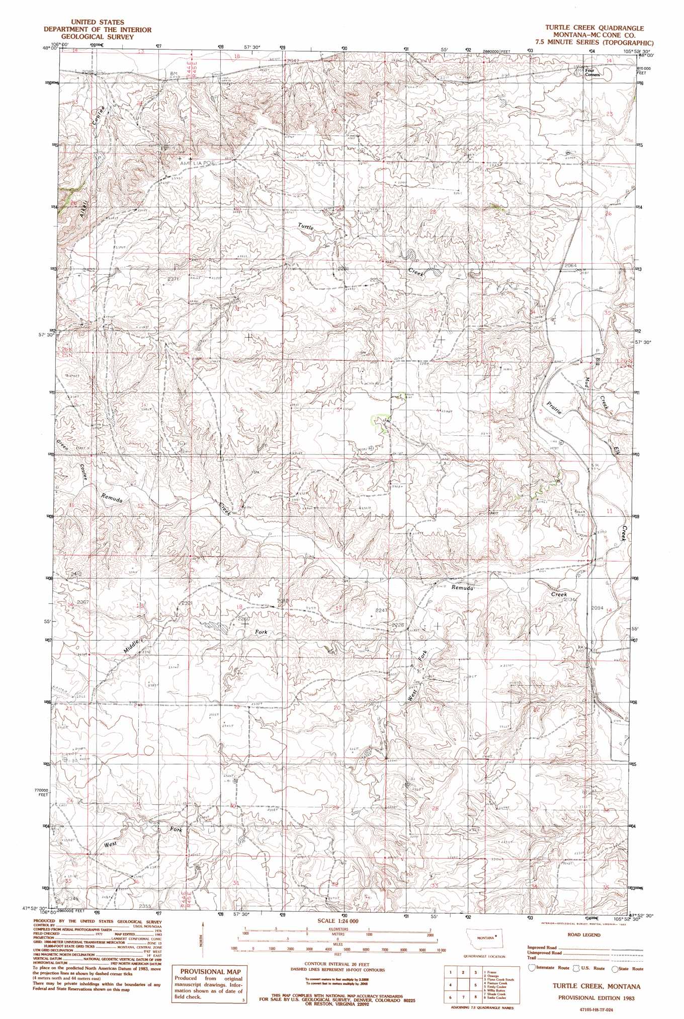
USGS Topo Quad 47105h8 - 1:24,000 scale
| Topo Map Name: | Turtle Creek |
| USGS Topo Quad ID: | 47105h8 |
| Print Size: | ca. 21 1/4" wide x 27" high |
| Southeast Coordinates: | 47.875° N latitude / 105.875° W longitude |
| Map Center Coordinates: | 47.9375° N latitude / 105.9375° W longitude |
| U.S. State: | MT |
| Filename: | o47105h8.jpg |
| Download Map JPG Image: | Turtle Creek topo map 1:24,000 scale |
| Map Type: | Topographic |
| Topo Series: | 7.5´ |
| Map Scale: | 1:24,000 |
| Source of Map Images: | United States Geological Survey (USGS) |
| Alternate Map Versions: |
Turtle Creek MT 1983, updated 1983 Download PDF Buy paper map Turtle Creek MT 2011 Download PDF Buy paper map Turtle Creek MT 2014 Download PDF Buy paper map |
1:24,000 Topo Quads surrounding Turtle Creek
Milk River Coulee |
Dubbe Reservoir |
Oswego Nw |
Flynn Creek North |
Wolf Point Nw |
Kintyre |
Frazer |
Oswego |
Flynn Creek South |
Wolf Point |
Mcrae Springs |
Pasture Creek |
Turtle Creek |
Emily Coulee |
Antelope Creek Res. |
Sand Arroyo |
Willis Buttes |
Shade Creek |
Sadie Coulee |
Dailey Spring |
Bug Creek |
Crow Springs |
Figure Eight Creek |
Pedigo Coulee |
Hudiburgh Res. |
> Back to 47105e1 at 1:100,000 scale
> Back to 47104a1 at 1:250,000 scale
> Back to U.S. Topo Maps home
Turtle Creek topo map: Gazetteer
Turtle Creek: Post Offices
Nina Post Office (historical) elevation 700m 2296′Turtle Creek: Streams
Big Mud Creek elevation 621m 2037′Middle Fork Remuda Creek elevation 650m 2132′
Remuda Creek elevation 635m 2083′
Turtle Creek elevation 619m 2030′
West Fork Remuda Creek elevation 653m 2142′
Turtle Creek: Valleys
Alkali Coulee elevation 637m 2089′Green Coulee elevation 689m 2260′
Turtle Creek: Wells
25N45E09ABBB01 Well elevation 677m 2221′26N44E23AA__01 Well elevation 619m 2030′
26N45E34AAAD01 Well elevation 623m 2043′
Turtle Creek digital topo map on disk
Buy this Turtle Creek topo map showing relief, roads, GPS coordinates and other geographical features, as a high-resolution digital map file on DVD:
Eastern Montana & Western North Dakota
Buy digital topo maps: Eastern Montana & Western North Dakota