Danvers Topo Map Montana
To zoom in, hover over the map of Danvers
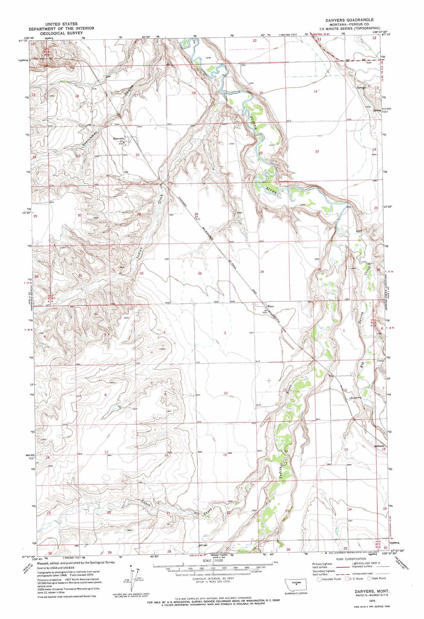
USGS Topo Quad 47109b6 - 1:24,000 scale
| Topo Map Name: | Danvers |
| USGS Topo Quad ID: | 47109b6 |
| Print Size: | ca. 21 1/4" wide x 27" high |
| Southeast Coordinates: | 47.125° N latitude / 109.625° W longitude |
| Map Center Coordinates: | 47.1875° N latitude / 109.6875° W longitude |
| U.S. State: | MT |
| Filename: | o47109b6.jpg |
| Download Map JPG Image: | Danvers topo map 1:24,000 scale |
| Map Type: | Topographic |
| Topo Series: | 7.5´ |
| Map Scale: | 1:24,000 |
| Source of Map Images: | United States Geological Survey (USGS) |
| Alternate Map Versions: |
Danvers MT 1970, updated 1973 Download PDF Buy paper map Danvers MT 2011 Download PDF Buy paper map Danvers MT 2014 Download PDF Buy paper map |
1:24,000 Topo Quads surrounding Danvers
Possum Run Creek |
Soda Spring Coulee |
Wild Bill Flat West |
Wild Bill Flat East |
Hilger Nw |
Denton |
Hoosac |
Toney Bench |
Seventytwo Hills |
Kendall |
Big Spring |
Harwood Bench |
Danvers |
Spring Creek Junction |
Brooks |
Moccasin |
Kolin |
Ross Fork |
Glengarry |
Lewistown |
Ackley Lake |
Sipple |
Moore |
West Fork Beaver Creek |
Castle Butte |
> Back to 47109a1 at 1:100,000 scale
> Back to 47108a1 at 1:250,000 scale
> Back to U.S. Topo Maps home
Danvers topo map: Gazetteer
Danvers: Bridges
Judith River Bridge elevation 1005m 3297′Danvers: Dams
Deigratia Dam elevation 1155m 3789′Danvers: Populated Places
Danvers elevation 1085m 3559′Ware elevation 1097m 3599′
Danvers: Post Offices
Danvers Post Office (historical) elevation 1085m 3559′Ware Post Office (historical) elevation 1098m 3602′
Danvers: Streams
Big Spring Creek elevation 1030m 3379′Indian Creek elevation 1006m 3300′
Little Rock Creek elevation 1083m 3553′
Louse Creek elevation 1065m 3494′
Danvers: Wells
16N16E07BA__01 Well elevation 1148m 3766′Danvers digital topo map on disk
Buy this Danvers topo map showing relief, roads, GPS coordinates and other geographical features, as a high-resolution digital map file on DVD: