Wild Bill Flat East Topo Map Montana
To zoom in, hover over the map of Wild Bill Flat East
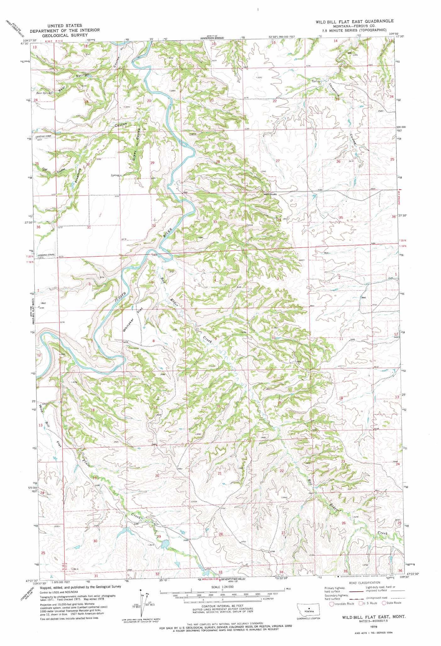
USGS Topo Quad 47109d5 - 1:24,000 scale
| Topo Map Name: | Wild Bill Flat East |
| USGS Topo Quad ID: | 47109d5 |
| Print Size: | ca. 21 1/4" wide x 27" high |
| Southeast Coordinates: | 47.375° N latitude / 109.5° W longitude |
| Map Center Coordinates: | 47.4375° N latitude / 109.5625° W longitude |
| U.S. State: | MT |
| Filename: | o47109d5.jpg |
| Download Map JPG Image: | Wild Bill Flat East topo map 1:24,000 scale |
| Map Type: | Topographic |
| Topo Series: | 7.5´ |
| Map Scale: | 1:24,000 |
| Source of Map Images: | United States Geological Survey (USGS) |
| Alternate Map Versions: |
Wild Bill Flat East MT 1978, updated 1979 Download PDF Buy paper map Wild Bill Flat East MT 1978, updated 1979 Download PDF Buy paper map Wild Bill Flat East MT 2011 Download PDF Buy paper map Wild Bill Flat East MT 2014 Download PDF Buy paper map |
1:24,000 Topo Quads surrounding Wild Bill Flat East
Starve Out Flat |
P N Ranch |
Council Island |
Gallatin Rapids |
Taffy Ridge |
Spring Coulee |
Wolf Creek Falls |
Anderson Bridge |
Winifred West |
Winifred East |
Soda Spring Coulee |
Wild Bill Flat West |
Wild Bill Flat East |
Hilger Nw |
Christina |
Hoosac |
Toney Bench |
Seventytwo Hills |
Kendall |
Hilger |
Harwood Bench |
Danvers |
Spring Creek Junction |
Brooks |
New Year |
> Back to 47109a1 at 1:100,000 scale
> Back to 47108a1 at 1:250,000 scale
> Back to U.S. Topo Maps home
Wild Bill Flat East topo map: Gazetteer
Wild Bill Flat East: Flats
Whitaker Flat elevation 988m 3241′Wild Bill Flat elevation 994m 3261′
Wild Bill Flat East: Springs
Bear Springs elevation 971m 3185′Wild Bill Flat East: Streams
Box Elder Creek elevation 878m 2880′Plum Creek elevation 895m 2936′
Wild Bill Flat East: Valleys
Bear Springs Coulee elevation 860m 2821′Cral Coulee elevation 928m 3044′
Fivemile Coulee elevation 862m 2828′
Gilkey Coulee elevation 899m 2949′
Threemile Coulee elevation 993m 3257′
Wild Bill Flat East digital topo map on disk
Buy this Wild Bill Flat East topo map showing relief, roads, GPS coordinates and other geographical features, as a high-resolution digital map file on DVD: