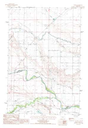
Gilman Topo Map Montana
To zoom in, hover over the map of Gilman
USGS Topo Quad 47112e3 - 1:24,000 scale
| Topo Map Name: | Gilman |
| USGS Topo Quad ID: | 47112e3 |
| Print Size: | ca. 21 1/4" wide x 27" high |
| Southeast Coordinates: | 47.5° N latitude / 112.25° W longitude |
| Map Center Coordinates: | 47.5625° N latitude / 112.3125° W longitude |
| U.S. State: | MT |
| Filename: | o47112e3.jpg |
| Download Map JPG Image: | Gilman topo map 1:24,000 scale |
| Map Type: | Topographic |
| Topo Series: | 7.5´ |
| Map Scale: | 1:24,000 |
| Source of Map Images: | United States Geological Survey (USGS) |
| Alternate Map Versions: |
Gilman MT 1987, updated 1987 Download PDF Buy paper map Gilman MT 2011 Download PDF Buy paper map Gilman MT 2014 Download PDF Buy paper map |
1:24,000 Topo Quads surrounding Gilman
> Back to 47112e1 at 1:100,000 scale
> Back to 47112a1 at 1:250,000 scale
> Back to U.S. Topo Maps home
Gilman topo map: Gazetteer
Gilman: Canals
Sun River Slope Canal elevation 1326m 4350′Gilman: Lakes
Basin Lake elevation 1331m 4366′Meyer Lake elevation 1218m 3996′
Gilman: Parks
Sun River Historical Marker elevation 1276m 4186′Gilman: Populated Places
Gilman elevation 1226m 4022′Gilman: Post Offices
Florence Post Office (historical) elevation 1190m 3904′Florence Springs Post Office (historical) elevation 1190m 3904′
Gilman Post Office (historical) elevation 1226m 4022′
Gilman: Streams
Elk Creek elevation 1183m 3881′Hogan Slough elevation 1215m 3986′
Spring Creek elevation 1176m 3858′
Gilman: Summits
Gilman Hill elevation 1288m 4225′Meyer Hill elevation 1269m 4163′
Gilman: Valleys
Clemons Coulee elevation 1224m 4015′Cutting Shed Coulee elevation 1221m 4005′
Maloney Coulee elevation 1333m 4373′
Gilman: Wells
20N05W07A___01 Well elevation 1188m 3897′20N06W01A___01 Well elevation 1197m 3927′
Gilman digital topo map on disk
Buy this Gilman topo map showing relief, roads, GPS coordinates and other geographical features, as a high-resolution digital map file on DVD:


