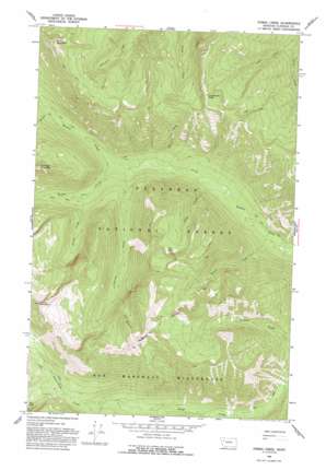
String Creek Topo Map Montana
To zoom in, hover over the map of String Creek
USGS Topo Quad 47113g5 - 1:24,000 scale
| Topo Map Name: | String Creek |
| USGS Topo Quad ID: | 47113g5 |
| Print Size: | ca. 21 1/4" wide x 27" high |
| Southeast Coordinates: | 47.75° N latitude / 113.5° W longitude |
| Map Center Coordinates: | 47.8125° N latitude / 113.5625° W longitude |
| U.S. State: | MT |
| Filename: | o47113g5.jpg |
| Download Map JPG Image: | String Creek topo map 1:24,000 scale |
| Map Type: | Topographic |
| Topo Series: | 7.5´ |
| Map Scale: | 1:24,000 |
| Source of Map Images: | United States Geological Survey (USGS) |
| Alternate Map Versions: |
String Creek MT 1965, updated 1968 Download PDF Buy paper map String Creek MT 1965, updated 1993 Download PDF Buy paper map String Creek MT 1994, updated 1997 Download PDF Buy paper map String Creek MT 2011 Download PDF Buy paper map String Creek MT 2014 Download PDF Buy paper map |
| FStopo: | US Forest Service topo String Creek is available: Download FStopo PDF Download FStopo TIF |
1:24,000 Topo Quads surrounding String Creek
> Back to 47113e1 at 1:100,000 scale
> Back to 47112a1 at 1:250,000 scale
> Back to U.S. Topo Maps home
String Creek topo map: Gazetteer
String Creek: Forests
Flathead National Forest elevation 1578m 5177′String Creek: Lakes
Alcove Lake elevation 2129m 6984′Late Lake elevation 2029m 6656′
String Creek: Streams
Alcove Creek elevation 1424m 4671′Bear Creek elevation 1327m 4353′
Deadfall Creek elevation 1482m 4862′
Inspiration Creek elevation 1488m 4881′
Larch Creek elevation 1318m 4324′
Late Creek elevation 1298m 4258′
Middle Fork Creek elevation 1344m 4409′
Razzle Creek elevation 1265m 4150′
Stadium Creek elevation 1345m 4412′
String Creek elevation 1348m 4422′
Warrior Creek elevation 1437m 4714′
String Creek: Summits
Alcove Mountain elevation 2426m 7959′Bruce Mountain elevation 2327m 7634′
Chipmunk Peak elevation 2199m 7214′
Cinabar Mountain elevation 2209m 7247′
String Creek digital topo map on disk
Buy this String Creek topo map showing relief, roads, GPS coordinates and other geographical features, as a high-resolution digital map file on DVD:


