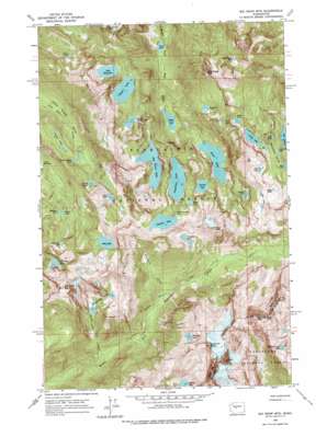
Big Snow Mountain Topo Map Washington
To zoom in, hover over the map of Big Snow Mountain
USGS Topo Quad 47121e3 - 1:24,000 scale
| Topo Map Name: | Big Snow Mountain |
| USGS Topo Quad ID: | 47121e3 |
| Print Size: | ca. 21 1/4" wide x 27" high |
| Southeast Coordinates: | 47.5° N latitude / 121.25° W longitude |
| Map Center Coordinates: | 47.5625° N latitude / 121.3125° W longitude |
| U.S. State: | WA |
| Filename: | o47121e3.jpg |
| Download Map JPG Image: | Big Snow Mountain topo map 1:24,000 scale |
| Map Type: | Topographic |
| Topo Series: | 7.5´ |
| Map Scale: | 1:24,000 |
| Source of Map Images: | United States Geological Survey (USGS) |
| Alternate Map Versions: |
Big Snow Mtn WA 1965, updated 1967 Download PDF Buy paper map Big Snow Mtn WA 1965, updated 1971 Download PDF Buy paper map Big Snow Mtn WA 1965, updated 1979 Download PDF Buy paper map Big Snow Mtn WA 1965, updated 1979 Download PDF Buy paper map Big Snow Mountain WA 2011 Download PDF Buy paper map Big Snow Mountain WA 2014 Download PDF Buy paper map |
| FStopo: | US Forest Service topo Big Snow Mountain is available: Download FStopo PDF Download FStopo TIF |
1:24,000 Topo Quads surrounding Big Snow Mountain
> Back to 47121e1 at 1:100,000 scale
> Back to 47120a1 at 1:250,000 scale
> Back to U.S. Topo Maps home
Big Snow Mountain topo map: Gazetteer
Big Snow Mountain: Falls
Malachite Falls elevation 1209m 3966′Big Snow Mountain: Lakes
Angeline Lake elevation 1406m 4612′Azure Lake elevation 1499m 4917′
Azurite Lake elevation 1379m 4524′
Bald Eagle Lake elevation 1385m 4543′
Big Heart Lake elevation 1387m 4550′
Big Snow Lake elevation 1498m 4914′
Bonnie Lake elevation 1486m 4875′
Camp Robber Lake elevation 1144m 3753′
Cecils Lake elevation 1266m 4153′
Charlie Lakes elevation 1206m 3956′
Chetwoot Lake elevation 1496m 4908′
Cloudy Lake elevation 1463m 4799′
Copper Lake elevation 1209m 3966′
Crawford Lake elevation 1571m 5154′
Delta Lake elevation 986m 3234′
Emerald Lake elevation 1433m 4701′
Foehn Lake elevation 1744m 5721′
Fools Gold Lake elevation 1424m 4671′
Gold Lake elevation 1476m 4842′
Gus Lake elevation 1289m 4229′
Hardscrabble Lakes elevation 1399m 4589′
Hinter Lake elevation 1324m 4343′
Iceberg Lake elevation 1483m 4865′
Jade Lake elevation 1407m 4616′
Jewel Lake elevation 1362m 4468′
Lake Iiswoot elevation 1400m 4593′
Lake Malachite elevation 1248m 4094′
Little Chetwoot Lake elevation 1485m 4872′
Little Heart Lake elevation 1283m 4209′
Locket Lake elevation 1413m 4635′
Marlene Lake elevation 1225m 4019′
Moira Lake elevation 1192m 3910′
Nazanne Lake elevation 1435m 4708′
Necklace Valley Lakes elevation 1435m 4708′
Opal Lake elevation 1459m 4786′
Otter Lake elevation 1198m 3930′
Overcoat Lake elevation 1756m 5761′
Snowflake Lake elevation 1508m 4947′
Summit Chief Lake elevation 1630m 5347′
Tahl Lake elevation 1732m 5682′
Tank Lakes elevation 1793m 5882′
Trout Lake elevation 621m 2037′
View Lake elevation 1606m 5269′
Big Snow Mountain: Streams
Crawford Creek elevation 1009m 3310′Hardscrabble Creek elevation 859m 2818′
Big Snow Mountain: Summits
Bald Eagle Peak elevation 1874m 6148′Big Snow Mountain elevation 2029m 6656′
Chimney Rock elevation 2307m 7568′
Iron Cap Mountain elevation 1904m 6246′
Malachite Peak elevation 1826m 5990′
Overcoat Peak elevation 2231m 7319′
Silver Eagle Peak elevation 1759m 5770′
Summit Chief Mountain elevation 2228m 7309′
Big Snow Mountain: Valleys
Necklace Valley elevation 1406m 4612′Big Snow Mountain digital topo map on disk
Buy this Big Snow Mountain topo map showing relief, roads, GPS coordinates and other geographical features, as a high-resolution digital map file on DVD:


