Chelsea Nw Topo Map Montana
To zoom in, hover over the map of Chelsea Nw
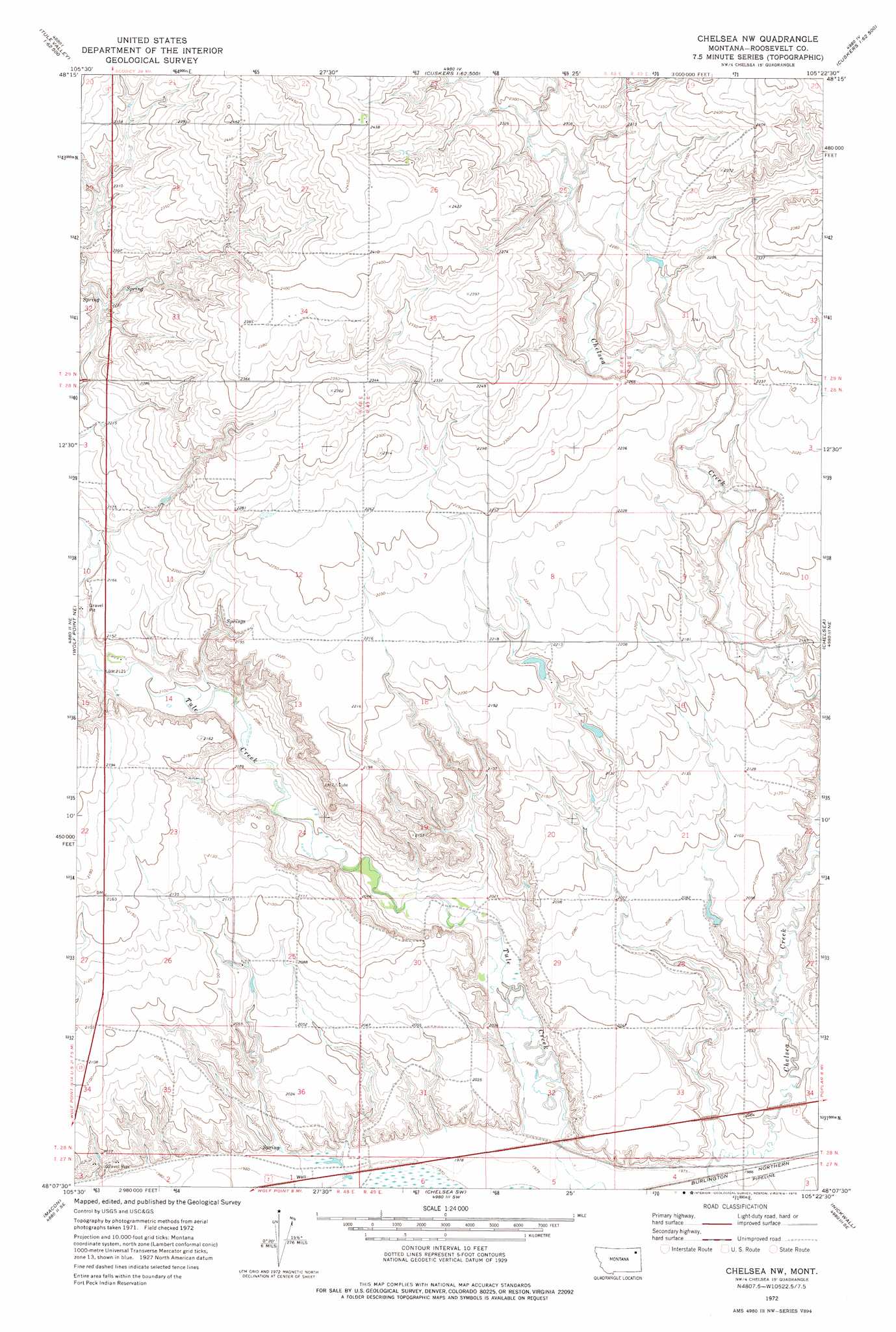
USGS Topo Quad 48105b4 - 1:24,000 scale
| Topo Map Name: | Chelsea Nw |
| USGS Topo Quad ID: | 48105b4 |
| Print Size: | ca. 21 1/4" wide x 27" high |
| Southeast Coordinates: | 48.125° N latitude / 105.375° W longitude |
| Map Center Coordinates: | 48.1875° N latitude / 105.4375° W longitude |
| U.S. State: | MT |
| Filename: | o48105b4.jpg |
| Download Map JPG Image: | Chelsea Nw topo map 1:24,000 scale |
| Map Type: | Topographic |
| Topo Series: | 7.5´ |
| Map Scale: | 1:24,000 |
| Source of Map Images: | United States Geological Survey (USGS) |
| Alternate Map Versions: |
Chelsea NW MT 1972, updated 1975 Download PDF Buy paper map Chelsea NW MT 2011 Download PDF Buy paper map Chelsea NW MT 2014 Download PDF Buy paper map |
1:24,000 Topo Quads surrounding Chelsea Nw
Volt |
Reed Springs |
Bears Nest |
Windy Butte |
Hay Creek Nw |
Tule Valley West |
Tule Valley East |
Sims Spring |
Long Creek West |
Long Creek East |
Wolf Point Nw |
Wolf Point Ne |
Chelsea Nw |
Chelsea |
Badger Creek |
Wolf Point |
Macon |
Chelsea Sw |
Nickwall |
Poplar |
Antelope Creek Res. |
Rock Creek |
Gady Coulee |
Dowse Coulee |
Sullivan Coulee |
> Back to 48105a1 at 1:100,000 scale
> Back to 48104a1 at 1:250,000 scale
> Back to U.S. Topo Maps home
Chelsea Nw topo map: Gazetteer
Chelsea Nw: Bridges
Tule Creek Bridge elevation 645m 2116′Chelsea Nw: Dams
Anderson Reservoir Number 1 Dam elevation 672m 2204′L Sayer-Magdelena Dam elevation 635m 2083′
Chelsea Nw: Springs
28N48E11DDAB01 Spring elevation 670m 2198′28N48E12CCCC01 Spring elevation 667m 2188′
Chelsea Nw: Wells
27N48E02BA__01 Well elevation 615m 2017′27N49E05AB__01 Well elevation 602m 1975′
28N48E01DA__01 Well elevation 704m 2309′
28N48E25CB__01 Well elevation 635m 2083′
28N48E25CBBA01 Well elevation 638m 2093′
28N48E36DD__01 Well elevation 613m 2011′
28N48E36DD__02 Well elevation 613m 2011′
28N49E15BACA01 Well elevation 645m 2116′
28N49E16BA__01 Well elevation 666m 2185′
28N49E16BA__02 Well elevation 666m 2185′
28N49E17AA__01 Well elevation 672m 2204′
28N49E17AA__02 Well elevation 672m 2204′
28N49E18BD__01 Well elevation 674m 2211′
28N49E33DD__01 Well elevation 607m 1991′
28N49E34BC__01 Well elevation 617m 2024′
28N49E34DC__01 Well elevation 607m 1991′
29N48E22DDDD01 Well elevation 744m 2440′
Chelsea Nw digital topo map on disk
Buy this Chelsea Nw topo map showing relief, roads, GPS coordinates and other geographical features, as a high-resolution digital map file on DVD:
Eastern Montana & Western North Dakota
Buy digital topo maps: Eastern Montana & Western North Dakota