Nicholls Topo Map Georgia
To zoom in, hover over the map of Nicholls
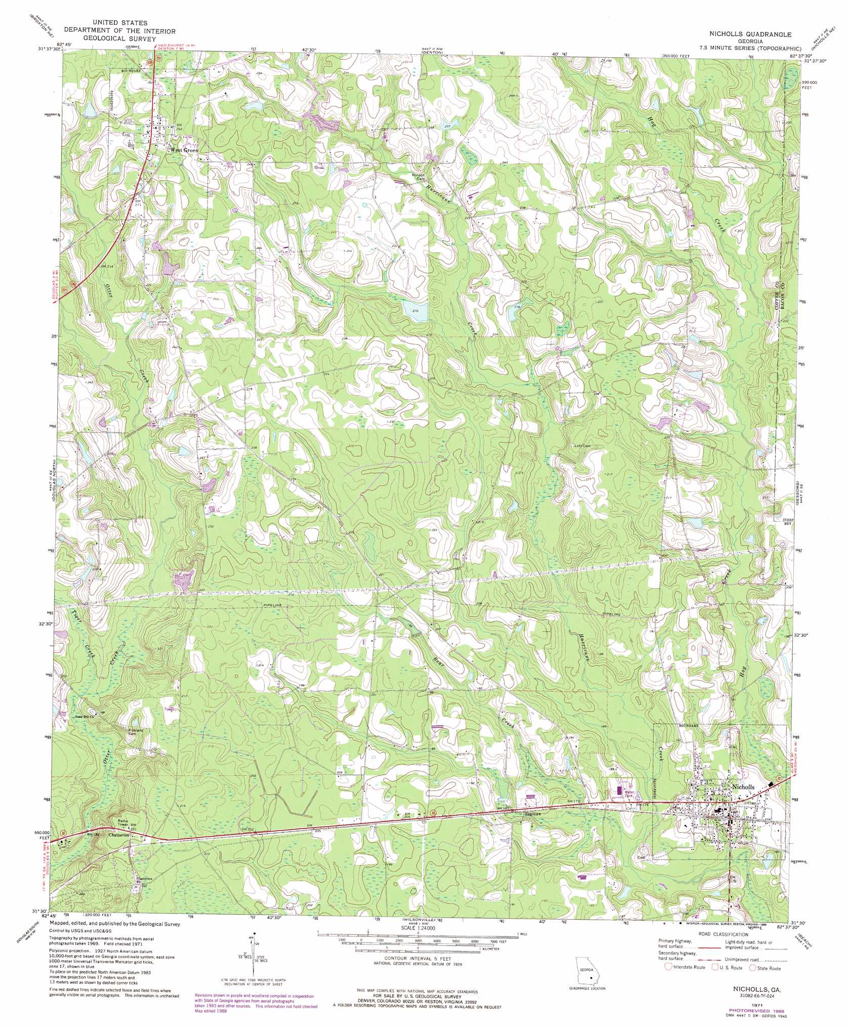
USGS Topo Quad 31082e6 - 1:24,000 scale
| Topo Map Name: | Nicholls |
| USGS Topo Quad ID: | 31082e6 |
| Print Size: | ca. 21 1/4" wide x 27" high |
| Southeast Coordinates: | 31.5° N latitude / 82.625° W longitude |
| Map Center Coordinates: | 31.5625° N latitude / 82.6875° W longitude |
| U.S. State: | GA |
| Filename: | o31082e6.jpg |
| Download Map JPG Image: | Nicholls topo map 1:24,000 scale |
| Map Type: | Topographic |
| Topo Series: | 7.5´ |
| Map Scale: | 1:24,000 |
| Source of Map Images: | United States Geological Survey (USGS) |
| Alternate Map Versions: |
Nicholls GA 1971, updated 1974 Download PDF Buy paper map Nicholls GA 1971, updated 1988 Download PDF Buy paper map Nicholls GA 2011 Download PDF Buy paper map Nicholls GA 2014 Download PDF Buy paper map |
1:24,000 Topo Quads surrounding Nicholls
Jacksonville |
Snipesville |
Roper |
Hazlehurst South |
Pine Grove |
Broxton North |
Broxton Ne |
Denton |
Nicholls Ne |
Alma Nw |
Broxton South |
Douglas North |
Nicholls |
Sessoms |
Alma |
Mora |
Douglas South |
Wilsonville |
Beach |
Crawley |
Kirkland |
Pearson |
Axson |
Talmo |
Dixie Union |
> Back to 31082e1 at 1:100,000 scale
> Back to 31082a1 at 1:250,000 scale
> Back to U.S. Topo Maps home
Nicholls topo map: Gazetteer
Nicholls: Populated Places
Chatterton elevation 68m 223′Nicholls elevation 58m 190′
Saginaw elevation 56m 183′
West Green elevation 79m 259′
Nicholls: Streams
Bear Creek elevation 48m 157′Otter Creek elevation 50m 164′
Tiger Creek elevation 52m 170′
Nicholls digital topo map on disk
Buy this Nicholls topo map showing relief, roads, GPS coordinates and other geographical features, as a high-resolution digital map file on DVD: