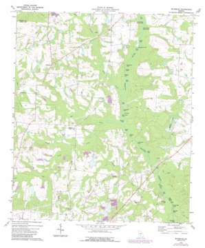
Waterloo Topo Map Georgia
To zoom in, hover over the map of Waterloo
USGS Topo Quad 31083e4 - 1:24,000 scale
| Topo Map Name: | Waterloo |
| USGS Topo Quad ID: | 31083e4 |
| Print Size: | ca. 21 1/4" wide x 27" high |
| Southeast Coordinates: | 31.5° N latitude / 83.375° W longitude |
| Map Center Coordinates: | 31.5625° N latitude / 83.4375° W longitude |
| U.S. State: | GA |
| Filename: | o31083e4.jpg |
| Download Map JPG Image: | Waterloo topo map 1:24,000 scale |
| Map Type: | Topographic |
| Topo Series: | 7.5´ |
| Map Scale: | 1:24,000 |
| Source of Map Images: | United States Geological Survey (USGS) |
| Alternate Map Versions: |
Waterloo GA 1973, updated 1975 Download PDF Buy paper map Waterloo GA 2011 Download PDF Buy paper map Waterloo GA 2014 Download PDF Buy paper map |
1:24,000 Topo Quads surrounding Waterloo
> Back to 31083e1 at 1:100,000 scale
> Back to 31082a1 at 1:250,000 scale
> Back to U.S. Topo Maps home
Waterloo topo map: Gazetteer
Waterloo: Dams
Adcock-Morris Lake Dam elevation 97m 318′Adcock-Morris Lake North Dam elevation 93m 305′
Adcock-Morris Lake Number One Dam elevation 99m 324′
Bisbin Lake Dam elevation 99m 324′
Chiles Lake Dam elevation 96m 314′
Fletcher Pond Dam elevation 93m 305′
Fletchers Lake Dam elevation 86m 282′
Hall Lake Dam elevation 88m 288′
Lathon Lake Dam elevation 92m 301′
Lathon Lake North Dam elevation 98m 321′
McDaniel Lake Dam elevation 88m 288′
Morris Lake Dam elevation 93m 305′
Rankin Lake Dam elevation 93m 305′
Stevens Lake Dam elevation 99m 324′
Tifton Fishing Club Lake Dam elevation 89m 291′
Waterloo: Lakes
Big Mud Lake elevation 76m 249′Cat Lake elevation 82m 269′
Cat Lake elevation 78m 255′
Double Lake elevation 80m 262′
Flat Lake elevation 79m 259′
Ford Lake elevation 81m 265′
Goodman Lake elevation 78m 255′
Graveyard Lake elevation 79m 259′
Graveyard Lake elevation 80m 262′
Graveyard Lake elevation 77m 252′
Gun Lake elevation 78m 255′
Horse Ford Lake elevation 79m 259′
Lige Lake elevation 79m 259′
Little Mud Lake elevation 76m 249′
Lower Reedy Branch Lake elevation 81m 265′
Moss Lake elevation 77m 252′
Mudcat Lake elevation 78m 255′
Redbug Lake elevation 80m 262′
Roberts Lake elevation 78m 255′
Sand Hill Lake elevation 76m 249′
Shikel Lake elevation 78m 255′
Smith Lake elevation 82m 269′
Steep Bank Lake elevation 82m 269′
Upper Reedy Branch Lake elevation 81m 265′
Waterloo: Populated Places
Brighton elevation 115m 377′Harding elevation 95m 311′
Hoganville (historical) elevation 100m 328′
Waterloo elevation 112m 367′
Waterloo: Reservoirs
Adcock-Morris Lake elevation 97m 318′Adcock-Morris Lake North elevation 93m 305′
Adcock-Morris Lake Number One elevation 99m 324′
Bisbin Lake elevation 99m 324′
Chiles Lake elevation 96m 314′
Fletcher Pond elevation 93m 305′
Fletchers Lake elevation 86m 282′
Hall Lake elevation 88m 288′
Lathon Lake elevation 92m 301′
Lathon Lake North elevation 98m 321′
McDaniel Lake elevation 88m 288′
Morris Lake elevation 93m 305′
Rankin Lake elevation 93m 305′
Stevens Lake elevation 99m 324′
Tifton Fishing Club Lake elevation 89m 291′
Waterloo: Streams
Hat Creek elevation 79m 259′Jack Creek elevation 77m 252′
Little Sand Creek elevation 84m 275′
Middle Creek elevation 79m 259′
Pine Log Creek elevation 82m 269′
Rough Creek elevation 76m 249′
Sand Creek elevation 79m 259′
Thick Creek elevation 76m 249′
Waterloo digital topo map on disk
Buy this Waterloo topo map showing relief, roads, GPS coordinates and other geographical features, as a high-resolution digital map file on DVD:


