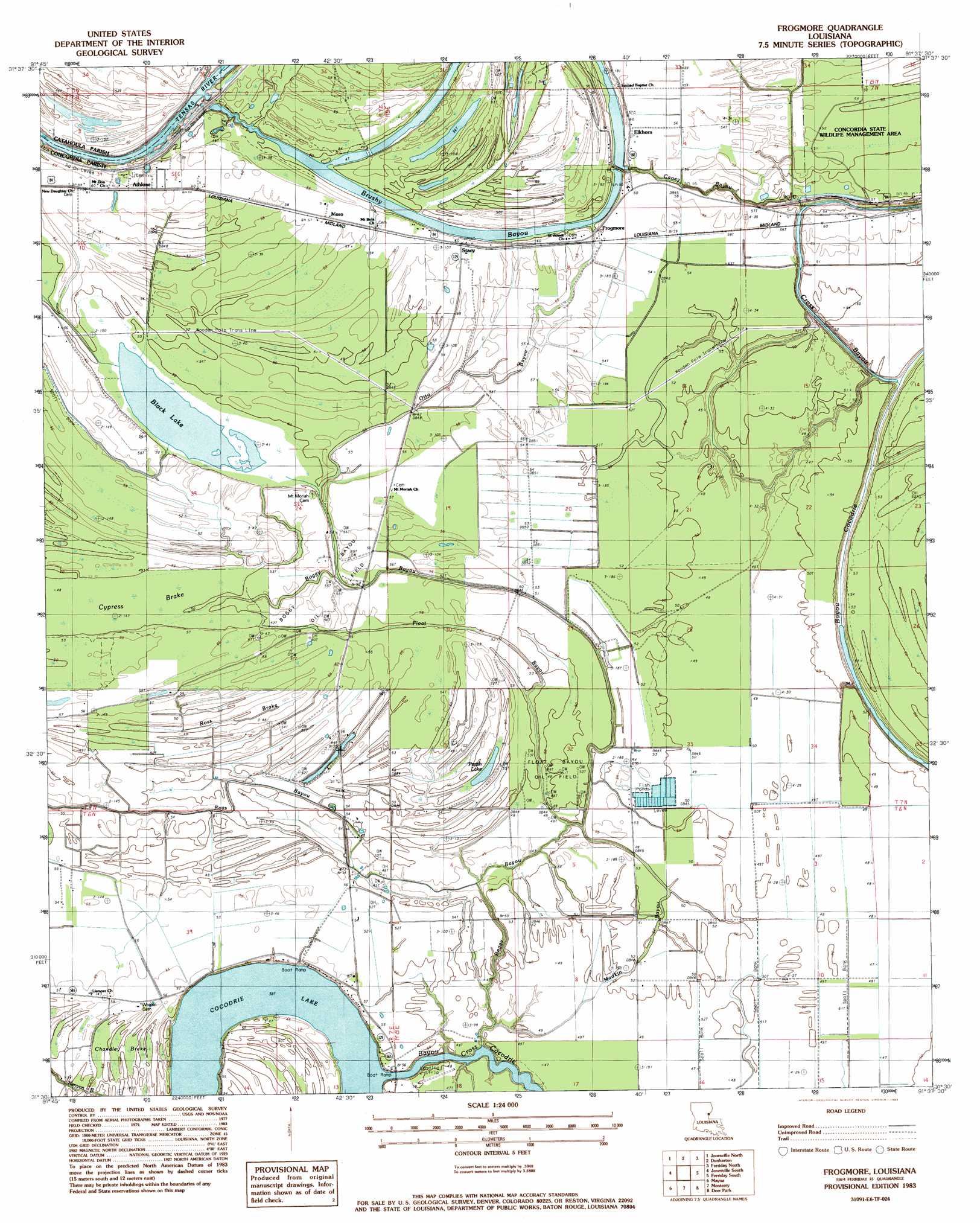
Frogmore Topo Map Louisiana
To zoom in, hover over the map of Frogmore
USGS Topo Quad 31091e6 - 1:24,000 scale
| Topo Map Name: | Frogmore |
| USGS Topo Quad ID: | 31091e6 |
| Print Size: | ca. 21 1/4" wide x 27" high |
| Southeast Coordinates: | 31.5° N latitude / 91.625° W longitude |
| Map Center Coordinates: | 31.5625° N latitude / 91.6875° W longitude |
| U.S. State: | LA |
| Filename: | o31091e6.jpg |
| Download Map JPG Image: | Frogmore topo map 1:24,000 scale |
| Map Type: | Topographic |
| Topo Series: | 7.5´ |
| Map Scale: | 1:24,000 |
| Source of Map Images: | United States Geological Survey (USGS) |
| Alternate Map Versions: |
Frogmore LA 1983, updated 1983 Download PDF Buy paper map Frogmore LA 1994, updated 1997 Download PDF Buy paper map Frogmore LA 2012 Download PDF Buy paper map Frogmore LA 2015 Download PDF Buy paper map |
1:24,000 Topo Quads surrounding Frogmore
Aimwell |
Harrisonburg |
Sicily Island |
Foules |
Waterproof |
Manifest |
Jonesville North |
Dunbarton |
Ferriday North |
Spokane |
Walters |
Jonesville South |
Frogmore |
Ferriday South |
Natchez |
Larto Lake North |
Mayna |
Monterey |
Deer Park |
Sibley |
Larto Lake South |
Acme |
Slocum |
Fairview |
Buck Island |
> Back to 31091e1 at 1:100,000 scale
> Back to 31090a1 at 1:250,000 scale
> Back to U.S. Topo Maps home
Frogmore topo map: Gazetteer
Frogmore: Guts
Boggy Bayou elevation 13m 42′Brushy Bayou elevation 14m 45′
Buck Bayou elevation 15m 49′
Caney Bayou elevation 14m 45′
Cross Bayou elevation 12m 39′
Float Bayou elevation 14m 45′
Madkin Bayou elevation 14m 45′
Otto Bayou elevation 17m 55′
Frogmore: Lakes
Black Lake elevation 14m 45′Cocodrie Lake elevation 11m 36′
Parish Lake elevation 14m 45′
Frogmore: Oilfields
Baggy Bayou Oil Field elevation 17m 55′Cocodrie Lake Oil Field elevation 15m 49′
Float Bayou Oil Field elevation 15m 49′
Horseshoe Oil Field elevation 13m 42′
South Horseshoe Bayou Oil Field elevation 16m 52′
Stacy Oil Field elevation 17m 55′
Frogmore: Parks
Concordia State Wildlife Management Area elevation 16m 52′Frogmore: Populated Places
Athlone elevation 18m 59′Elkhorn elevation 17m 55′
Frogmore elevation 18m 59′
Moro elevation 18m 59′
Stacy elevation 18m 59′
Frogmore: Post Offices
Frogmore Post Office elevation 18m 59′Frogmore: Streams
Ross Bayou elevation 12m 39′Frogmore: Swamps
Chandley Brake elevation 15m 49′Cypress Brake elevation 14m 45′
Ross Brake elevation 15m 49′
Frogmore digital topo map on disk
Buy this Frogmore topo map showing relief, roads, GPS coordinates and other geographical features, as a high-resolution digital map file on DVD: