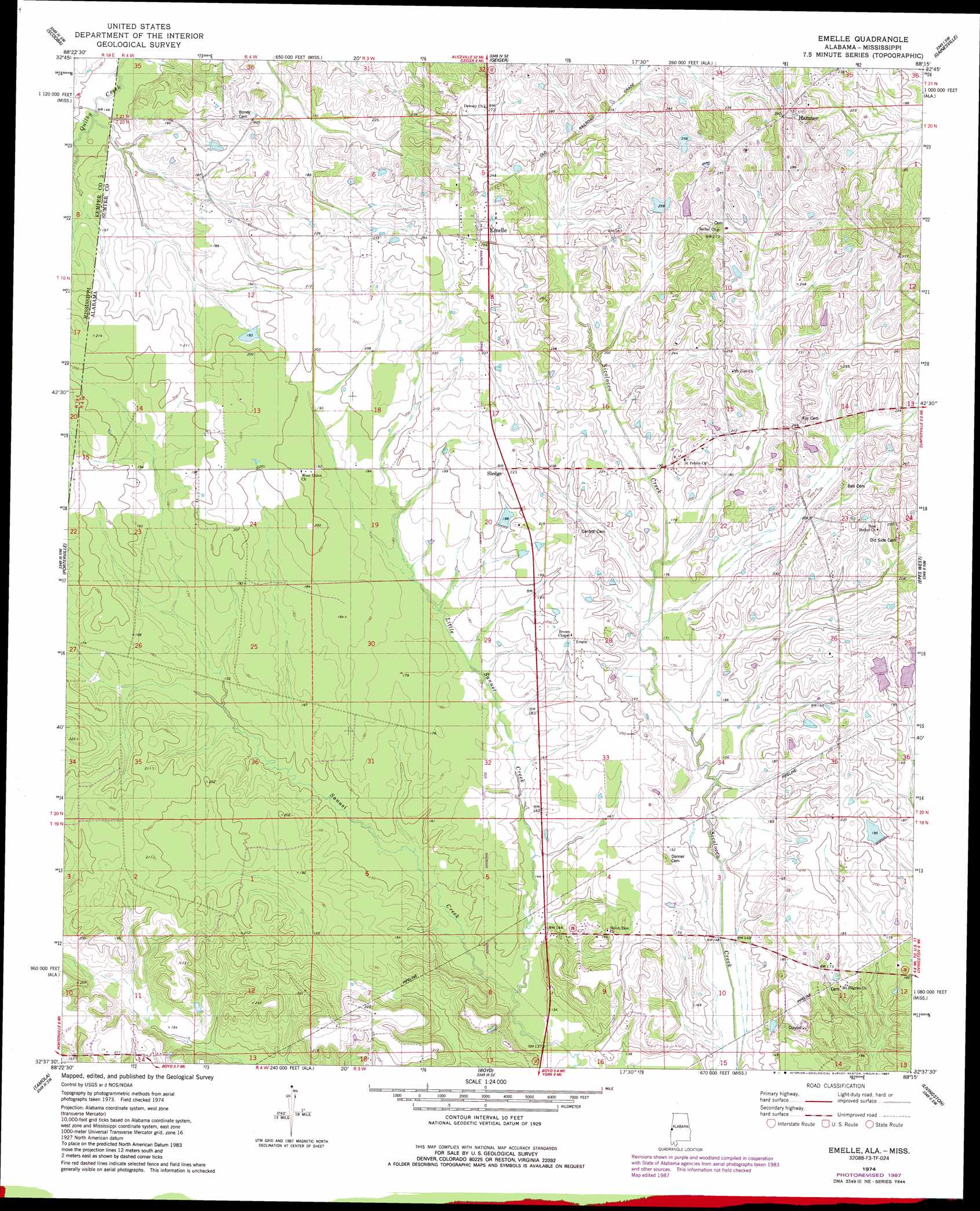
Emelle Topo Map Alabama
To zoom in, hover over the map of Emelle
USGS Topo Quad 32088f3 - 1:24,000 scale
| Topo Map Name: | Emelle |
| USGS Topo Quad ID: | 32088f3 |
| Print Size: | ca. 21 1/4" wide x 27" high |
| Southeast Coordinates: | 32.625° N latitude / 88.25° W longitude |
| Map Center Coordinates: | 32.6875° N latitude / 88.3125° W longitude |
| U.S. States: | AL, MS |
| Filename: | o32088f3.jpg |
| Download Map JPG Image: | Emelle topo map 1:24,000 scale |
| Map Type: | Topographic |
| Topo Series: | 7.5´ |
| Map Scale: | 1:24,000 |
| Source of Map Images: | United States Geological Survey (USGS) |
| Alternate Map Versions: |
Emelle AL 1974, updated 1978 Download PDF Buy paper map Emelle AL 1974, updated 1987 Download PDF Buy paper map Emelle AL 2011 Download PDF Buy paper map Emelle AL 2014 Download PDF Buy paper map |
1:24,000 Topo Quads surrounding Emelle
Shuqualak |
Paulette |
Panola |
Warsaw |
West Greene |
Townsend |
Scooba |
Geiger |
Gainesville |
Boligee |
Oak Grove |
Porterville |
Emelle |
Epes West |
Epes East |
Lauderdale |
Tamola |
Boyd |
Livingston |
Brewersville |
Toomsuba |
Kewanee |
York |
Bellamy |
Coatopa |
> Back to 32088e1 at 1:100,000 scale
> Back to 32088a1 at 1:250,000 scale
> Back to U.S. Topo Maps home
Emelle topo map: Gazetteer
Emelle: Areas
Grindstone Prairie elevation 69m 226′Emelle: Dams
C E Boyd Dam elevation 60m 196′Emelle: Populated Places
Bethel (historical) elevation 82m 269′Emelle elevation 79m 259′
Hamner elevation 94m 308′
Sledge elevation 68m 223′
Emelle: Post Offices
Emelle Post Office elevation 80m 262′Emelle: Reservoirs
C E Boyd Lake elevation 60m 196′Emelle: Streams
Little Sanusi Creek elevation 40m 131′Looksookolo Creek elevation 52m 170′
Emelle digital topo map on disk
Buy this Emelle topo map showing relief, roads, GPS coordinates and other geographical features, as a high-resolution digital map file on DVD:
Gulf Coast (LA, MS, AL, FL) & Southwestern Georgia
Buy digital topo maps: Gulf Coast (LA, MS, AL, FL) & Southwestern Georgia
 & Southwestern Georgia map DVD")