Longstreet Topo Map Louisiana
To zoom in, hover over the map of Longstreet
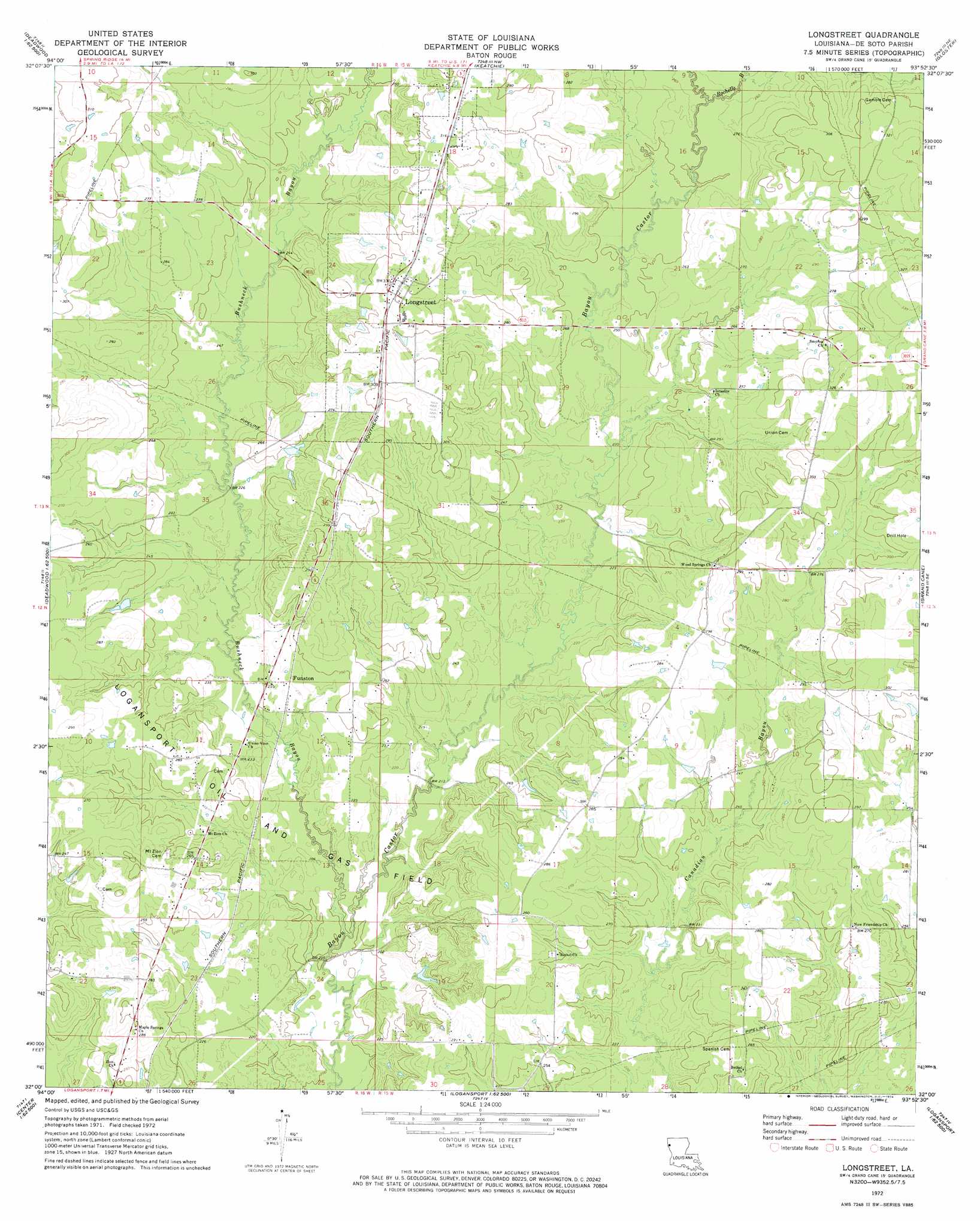
USGS Topo Quad 32093a8 - 1:24,000 scale
| Topo Map Name: | Longstreet |
| USGS Topo Quad ID: | 32093a8 |
| Print Size: | ca. 21 1/4" wide x 27" high |
| Southeast Coordinates: | 32° N latitude / 93.875° W longitude |
| Map Center Coordinates: | 32.0625° N latitude / 93.9375° W longitude |
| U.S. State: | LA |
| Filename: | o32093a8.jpg |
| Download Map JPG Image: | Longstreet topo map 1:24,000 scale |
| Map Type: | Topographic |
| Topo Series: | 7.5´ |
| Map Scale: | 1:24,000 |
| Source of Map Images: | United States Geological Survey (USGS) |
| Alternate Map Versions: |
Longstreet LA 1972, updated 1974 Download PDF Buy paper map Longstreet LA 2012 Download PDF Buy paper map Longstreet LA 2015 Download PDF Buy paper map |
1:24,000 Topo Quads surrounding Longstreet
De Berry |
Panola |
Spring Ridge |
Stonewall |
Wallace Lake |
River Hill |
Old Panola |
Keatchie |
Gloster |
Holly |
Old Center |
Galloway |
Longstreet |
Grand Cane |
Mansfield |
Tenaha East |
Logansport West |
Logansport East |
Hunter |
Trenton |
Center |
Shelbyville |
Huxley |
Union Springs |
Converse |
> Back to 32093a1 at 1:100,000 scale
> Back to 32092a1 at 1:250,000 scale
> Back to U.S. Topo Maps home
Longstreet topo map: Gazetteer
Longstreet: Oilfields
Logansport Oil and Gas Field elevation 73m 239′Longstreet: Populated Places
Dona (historical) elevation 78m 255′Funston elevation 67m 219′
Longstreet elevation 98m 321′
Smyrna elevation 92m 301′
Wood Springs elevation 91m 298′
Longstreet: Streams
Bushneck Bayou elevation 59m 193′Rochelle Bayou elevation 76m 249′
Longstreet digital topo map on disk
Buy this Longstreet topo map showing relief, roads, GPS coordinates and other geographical features, as a high-resolution digital map file on DVD: