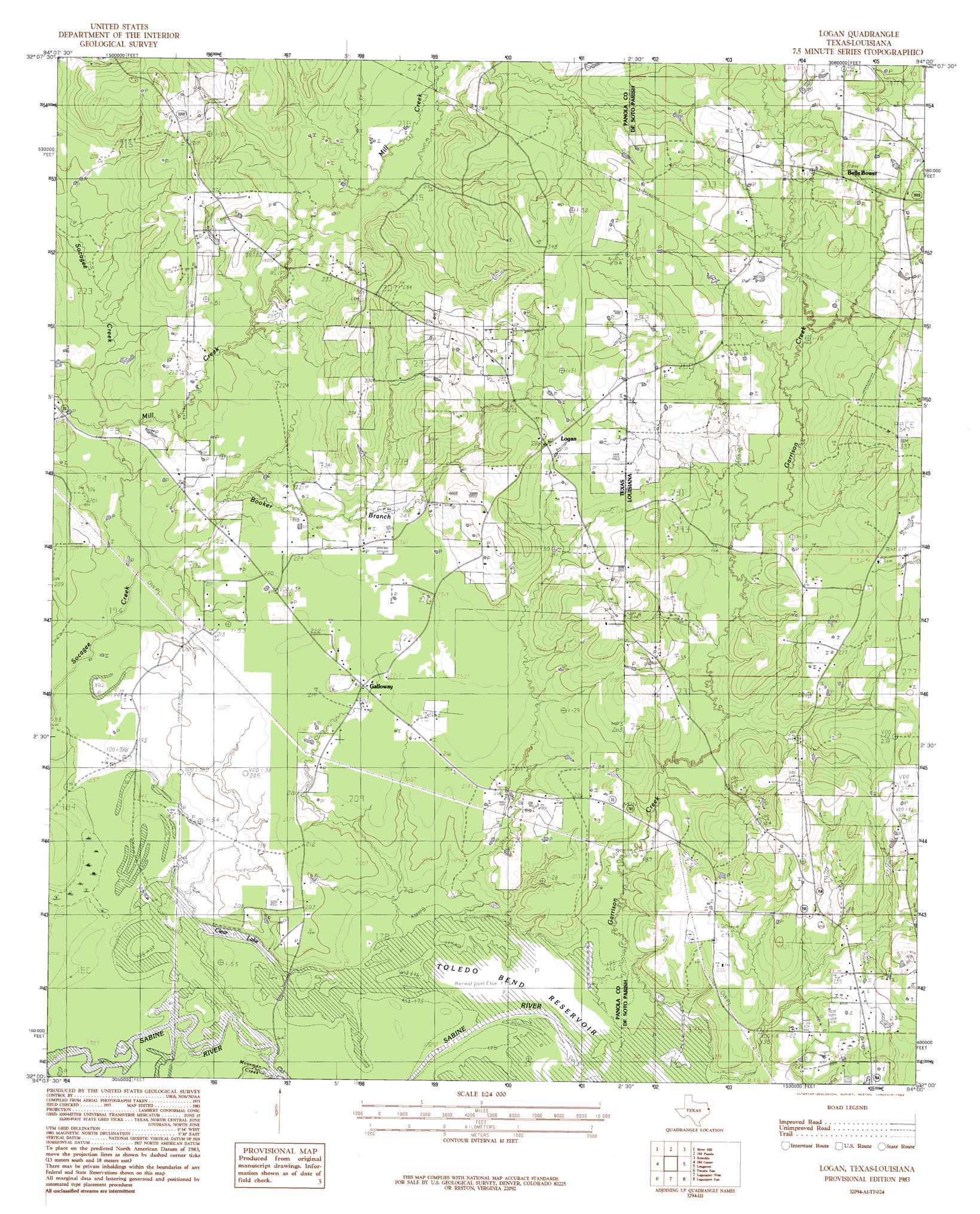
Galloway Topo Map Texas
To zoom in, hover over the map of Galloway
USGS Topo Quad 32094a1 - 1:24,000 scale
| Topo Map Name: | Galloway |
| USGS Topo Quad ID: | 32094a1 |
| Print Size: | ca. 21 1/4" wide x 27" high |
| Southeast Coordinates: | 32° N latitude / 94° W longitude |
| Map Center Coordinates: | 32.0625° N latitude / 94.0625° W longitude |
| U.S. States: | TX, LA |
| Filename: | o32094a1.jpg |
| Download Map JPG Image: | Galloway topo map 1:24,000 scale |
| Map Type: | Topographic |
| Topo Series: | 7.5´ |
| Map Scale: | 1:24,000 |
| Source of Map Images: | United States Geological Survey (USGS) |
| Alternate Map Versions: |
Logan TX 1983, updated 1983 Download PDF Buy paper map Galloway TX 1983, updated 1999 Download PDF Buy paper map Galloway TX 2010 Download PDF Buy paper map Galloway TX 2013 Download PDF Buy paper map Galloway TX 2016 Download PDF Buy paper map |
1:24,000 Topo Quads surrounding Galloway
Grand Bluff |
De Berry |
Panola |
Spring Ridge |
Stonewall |
Carthage |
River Hill |
Old Panola |
Keatchie |
Gloster |
Gary |
Old Center |
Galloway |
Longstreet |
Grand Cane |
Tenaha West |
Tenaha East |
Logansport West |
Logansport East |
Hunter |
Arcadia |
Center |
Shelbyville |
Huxley |
Union Springs |
> Back to 32094a1 at 1:100,000 scale
> Back to 32094a1 at 1:250,000 scale
> Back to U.S. Topo Maps home
Galloway topo map: Gazetteer
Galloway: Lakes
Clear Lake elevation 52m 170′Galloway: Oilfields
Belle Bower Oil and Gas Field elevation 84m 275′Galloway: Parks
International Boundary Marker elevation 67m 219′Galloway: Populated Places
Belle Bower elevation 86m 282′Galloway elevation 67m 219′
Logan elevation 88m 288′
Teel (historical) elevation 85m 278′
Galloway: Streams
Booker Branch elevation 56m 183′Garrison Creek elevation 52m 170′
Mill Creek elevation 58m 190′
Mill Creek elevation 58m 190′
Moorman Creek elevation 52m 170′
Galloway digital topo map on disk
Buy this Galloway topo map showing relief, roads, GPS coordinates and other geographical features, as a high-resolution digital map file on DVD: