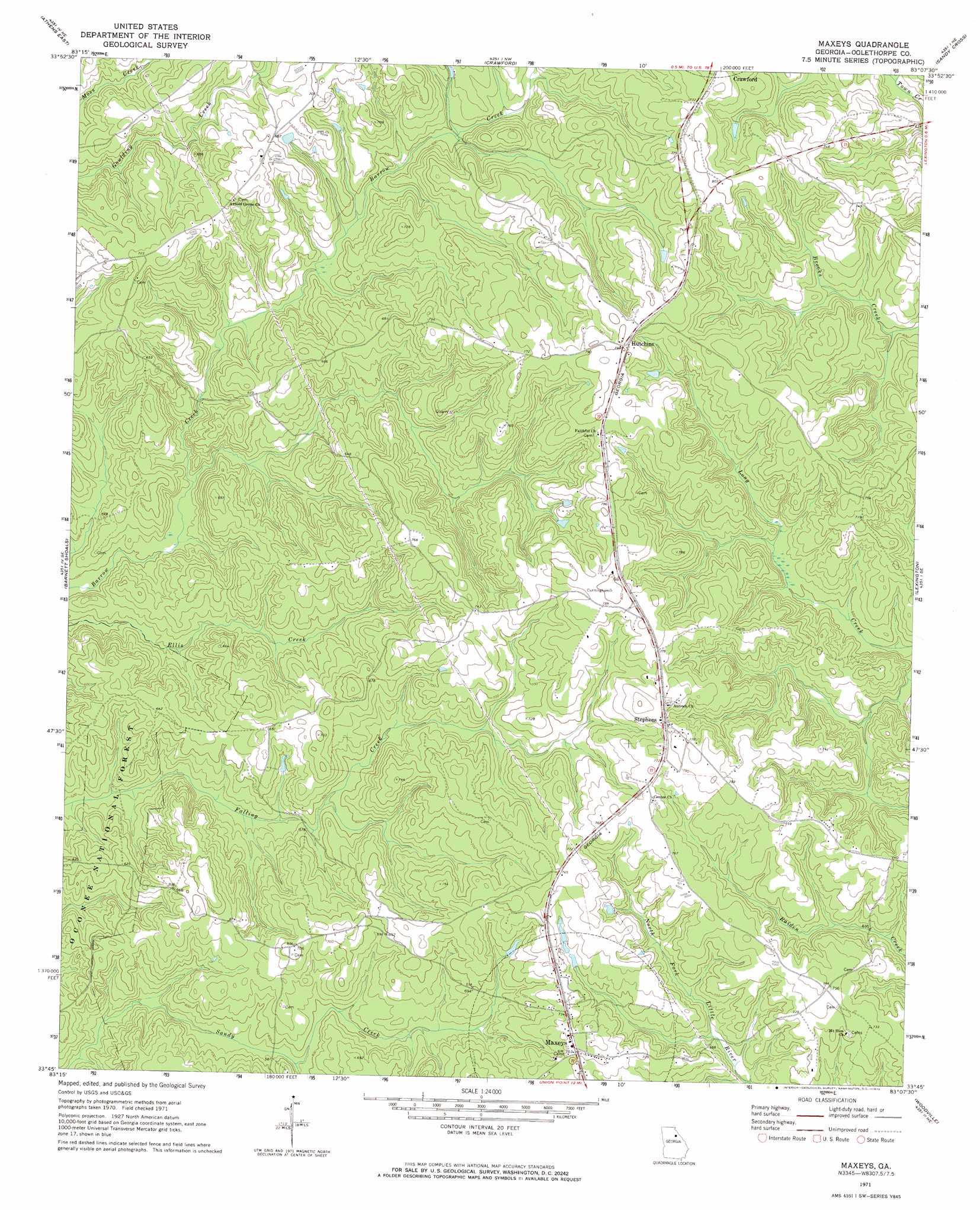
Maxeys Topo Map Georgia
To zoom in, hover over the map of Maxeys
USGS Topo Quad 33083g2 - 1:24,000 scale
| Topo Map Name: | Maxeys |
| USGS Topo Quad ID: | 33083g2 |
| Print Size: | ca. 21 1/4" wide x 27" high |
| Southeast Coordinates: | 33.75° N latitude / 83.125° W longitude |
| Map Center Coordinates: | 33.8125° N latitude / 83.1875° W longitude |
| U.S. State: | GA |
| Filename: | o33083g2.jpg |
| Download Map JPG Image: | Maxeys topo map 1:24,000 scale |
| Map Type: | Topographic |
| Topo Series: | 7.5´ |
| Map Scale: | 1:24,000 |
| Source of Map Images: | United States Geological Survey (USGS) |
| Alternate Map Versions: |
Maxeys GA 1971, updated 1973 Download PDF Buy paper map Maxeys GA 2011 Download PDF Buy paper map Maxeys GA 2014 Download PDF Buy paper map |
| FStopo: | US Forest Service topo Maxeys is available: Download FStopo PDF Download FStopo TIF |
1:24,000 Topo Quads surrounding Maxeys
Nicholson |
Hull |
Danielsville South |
Carlton |
Elberton West |
Athens West |
Athens East |
Crawford |
Sandy Cross |
Vesta |
Watkinsville |
Barnett Shoals |
Maxeys |
Lexington |
Rayle |
Apalachee |
Greshamville |
Penfield |
Woodville |
Philomath |
Madison |
Buckhead |
Greensboro |
Union Point |
Crawfordville |
> Back to 33083e1 at 1:100,000 scale
> Back to 33082a1 at 1:250,000 scale
> Back to U.S. Topo Maps home
Maxeys topo map: Gazetteer
Maxeys: Dams
Lake Oglethorpe Dam elevation 182m 597′Maxeys: Populated Places
Bowling Green (historical) elevation 231m 757′Hutchins elevation 241m 790′
Maxeys elevation 229m 751′
Stephens elevation 233m 764′
Maxeys: Reservoirs
Lake Oglethorpe elevation 182m 597′Maxeys: Streams
Odums Branch elevation 177m 580′Maxeys digital topo map on disk
Buy this Maxeys topo map showing relief, roads, GPS coordinates and other geographical features, as a high-resolution digital map file on DVD:
South Carolina, Western North Carolina & Northeastern Georgia
Buy digital topo maps: South Carolina, Western North Carolina & Northeastern Georgia