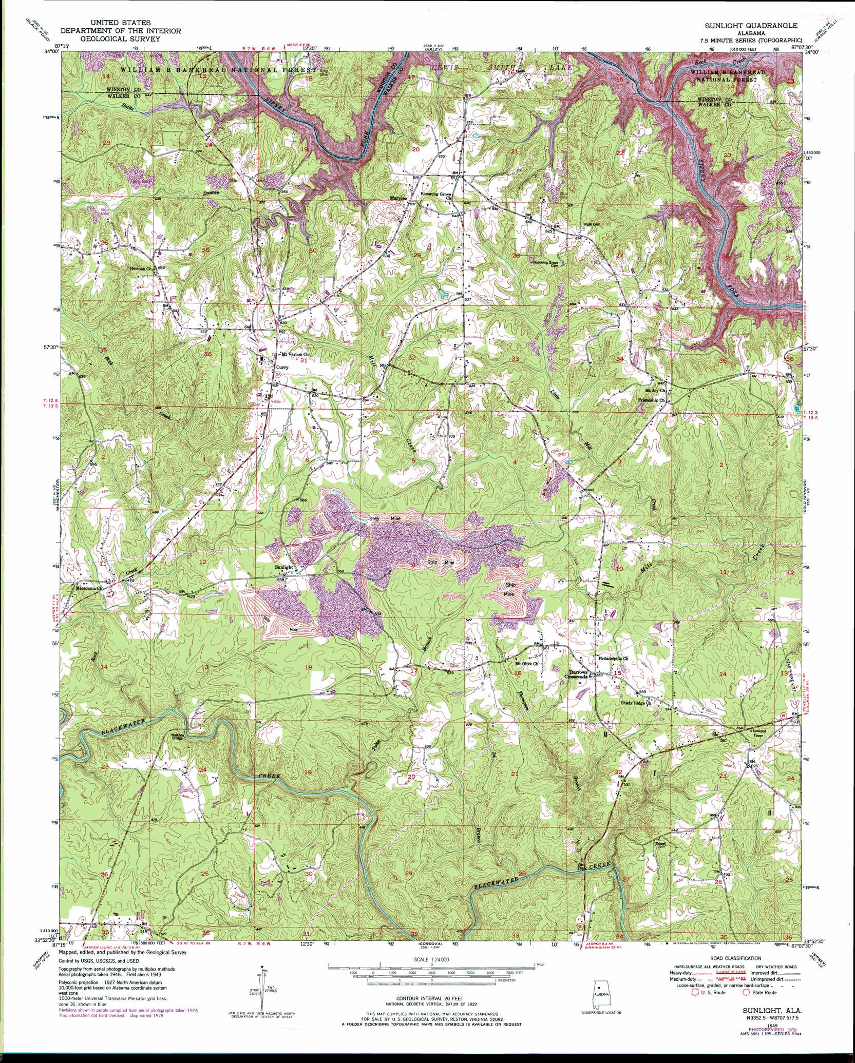
Sunlight Topo Map Alabama
To zoom in, hover over the map of Sunlight
USGS Topo Quad 33087h2 - 1:24,000 scale
| Topo Map Name: | Sunlight |
| USGS Topo Quad ID: | 33087h2 |
| Print Size: | ca. 21 1/4" wide x 27" high |
| Southeast Coordinates: | 33.875° N latitude / 87.125° W longitude |
| Map Center Coordinates: | 33.9375° N latitude / 87.1875° W longitude |
| U.S. State: | AL |
| Filename: | o33087h2.jpg |
| Download Map JPG Image: | Sunlight topo map 1:24,000 scale |
| Map Type: | Topographic |
| Topo Series: | 7.5´ |
| Map Scale: | 1:24,000 |
| Source of Map Images: | United States Geological Survey (USGS) |
| Alternate Map Versions: |
Sunlight AL 1949, updated 1973 Download PDF Buy paper map Sunlight AL 1949, updated 1978 Download PDF Buy paper map Sunlight AL 1949, updated 1997 Download PDF Buy paper map Sunlight AL 1951 Download PDF Buy paper map Sunlight AL 2000, updated 2003 Download PDF Buy paper map Sunlight AL 2011 Download PDF Buy paper map Sunlight AL 2014 Download PDF Buy paper map |
| FStopo: | US Forest Service topo Sunlight is available: Download FStopo PDF Download FStopo TIF |
1:24,000 Topo Quads surrounding Sunlight
Double Springs |
Houston |
Addison |
Jones Chapel |
West Point |
Poplar Springs |
Black Pond |
Arley |
Crane Hill |
Trimble |
Nauvoo |
Manchester |
Sunlight |
Cold Springs |
Arkadelphia |
Townley |
Jasper |
Cordova |
Sipsey |
Creel |
Oakman |
Parrish |
Goodsprings |
Dora |
Brookside |
> Back to 33087e1 at 1:100,000 scale
> Back to 33086a1 at 1:250,000 scale
> Back to U.S. Topo Maps home
Sunlight topo map: Gazetteer
Sunlight: Bridges
Walston Bridge elevation 107m 351′Sunlight: Mines
Mill Creek Mine elevation 170m 557′Sunlight: Populated Places
Burrows Crossroads elevation 167m 547′Curry elevation 190m 623′
Lake Shore Subdivision elevation 169m 554′
Lone Oak Subdivision elevation 162m 531′
Marylee elevation 190m 623′
Sunlight elevation 168m 551′
Sunlight: Streams
Battle Branch elevation 155m 508′Bear Branch elevation 155m 508′
Duncan Creek elevation 155m 508′
Ice Branch elevation 96m 314′
Little Mill Creek elevation 125m 410′
Racoon Branch elevation 155m 508′
Rock Creek elevation 155m 508′
Rock Creek elevation 107m 351′
Thompson Branch elevation 96m 314′
Tubbs Branch elevation 100m 328′
Sunlight digital topo map on disk
Buy this Sunlight topo map showing relief, roads, GPS coordinates and other geographical features, as a high-resolution digital map file on DVD: