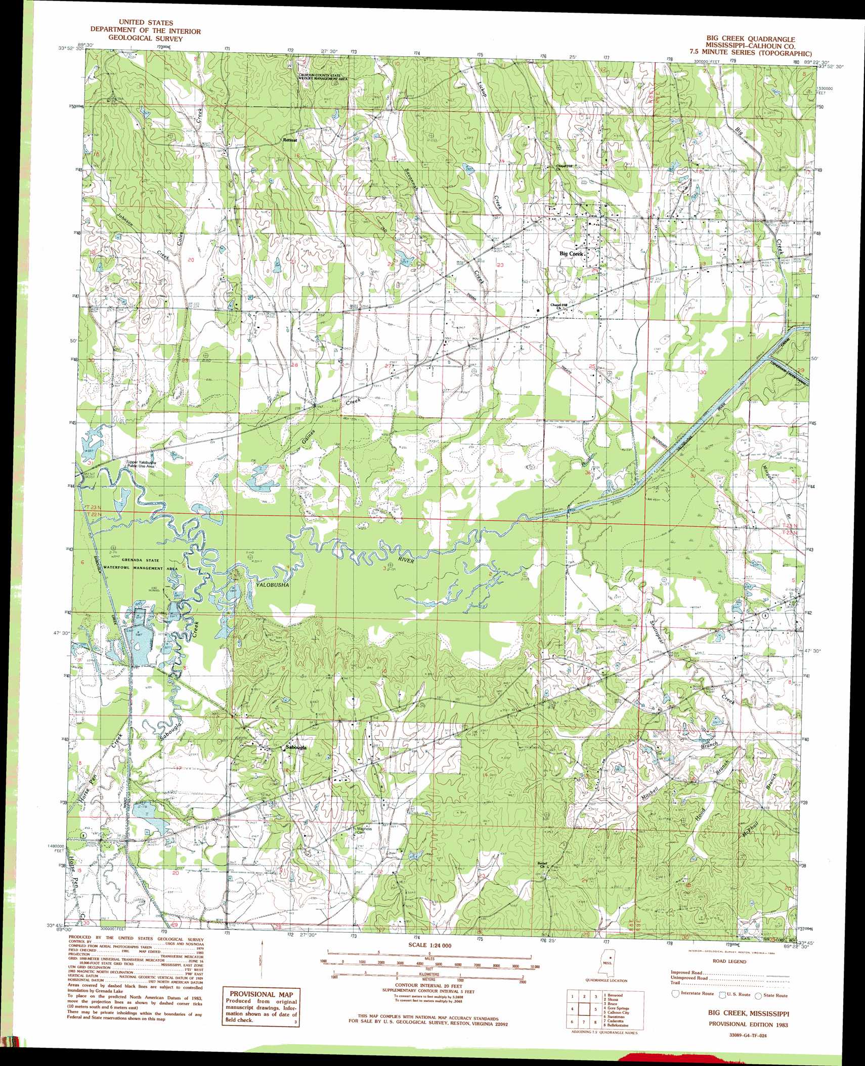
Big Creek Topo Map Mississippi
To zoom in, hover over the map of Big Creek
USGS Topo Quad 33089g4 - 1:24,000 scale
| Topo Map Name: | Big Creek |
| USGS Topo Quad ID: | 33089g4 |
| Print Size: | ca. 21 1/4" wide x 27" high |
| Southeast Coordinates: | 33.75° N latitude / 89.375° W longitude |
| Map Center Coordinates: | 33.8125° N latitude / 89.4375° W longitude |
| U.S. State: | MS |
| Filename: | o33089g4.jpg |
| Download Map JPG Image: | Big Creek topo map 1:24,000 scale |
| Map Type: | Topographic |
| Topo Series: | 7.5´ |
| Map Scale: | 1:24,000 |
| Source of Map Images: | United States Geological Survey (USGS) |
| Alternate Map Versions: |
Big Creek MS 1983, updated 1984 Download PDF Buy paper map Big Creek MS 2012 Download PDF Buy paper map Big Creek MS 2015 Download PDF Buy paper map |
1:24,000 Topo Quads surrounding Big Creek
Velma |
Pine Valley |
Banner |
Sarepta |
Robbs |
Coffeeville |
Benwood |
Skuna |
Bruce |
Vardaman |
Kincaid |
Gore Springs |
Big Creek |
Calhoun City |
Atlanta |
Duck Hill |
Sweatman |
Cadaretta |
Bellefontaine |
Hohenlinden |
Eskridge |
Lodi |
Little Sand Creek |
Eupora |
Sapa |
> Back to 33089e1 at 1:100,000 scale
> Back to 33088a1 at 1:250,000 scale
> Back to U.S. Topo Maps home
Big Creek topo map: Gazetteer
Big Creek: Dams
Mageehee Lake Dam elevation 83m 272′Big Creek: Parks
Grenada State Waterfowl Management Area elevation 66m 216′Upper Yalobusha Public Use Area elevation 69m 226′
Big Creek: Populated Places
Big Creek elevation 84m 275′Retreat elevation 99m 324′
Sabougla elevation 102m 334′
Big Creek: Streams
Big Creek elevation 73m 239′Coles Creek elevation 67m 219′
Gaines Creek elevation 67m 219′
Hood Branch elevation 73m 239′
Horse Pen Creek elevation 70m 229′
Johnson Creek elevation 73m 239′
Lickup Creek elevation 76m 249′
Little Horse Pen Creek elevation 69m 226′
McPhail Branch elevation 74m 242′
Mitchell Branch elevation 71m 232′
Morgan Branch elevation 72m 236′
Sabougla Creek elevation 67m 219′
Savannah Creek elevation 69m 226′
Shutispear Creek elevation 70m 229′
Big Creek digital topo map on disk
Buy this Big Creek topo map showing relief, roads, GPS coordinates and other geographical features, as a high-resolution digital map file on DVD: