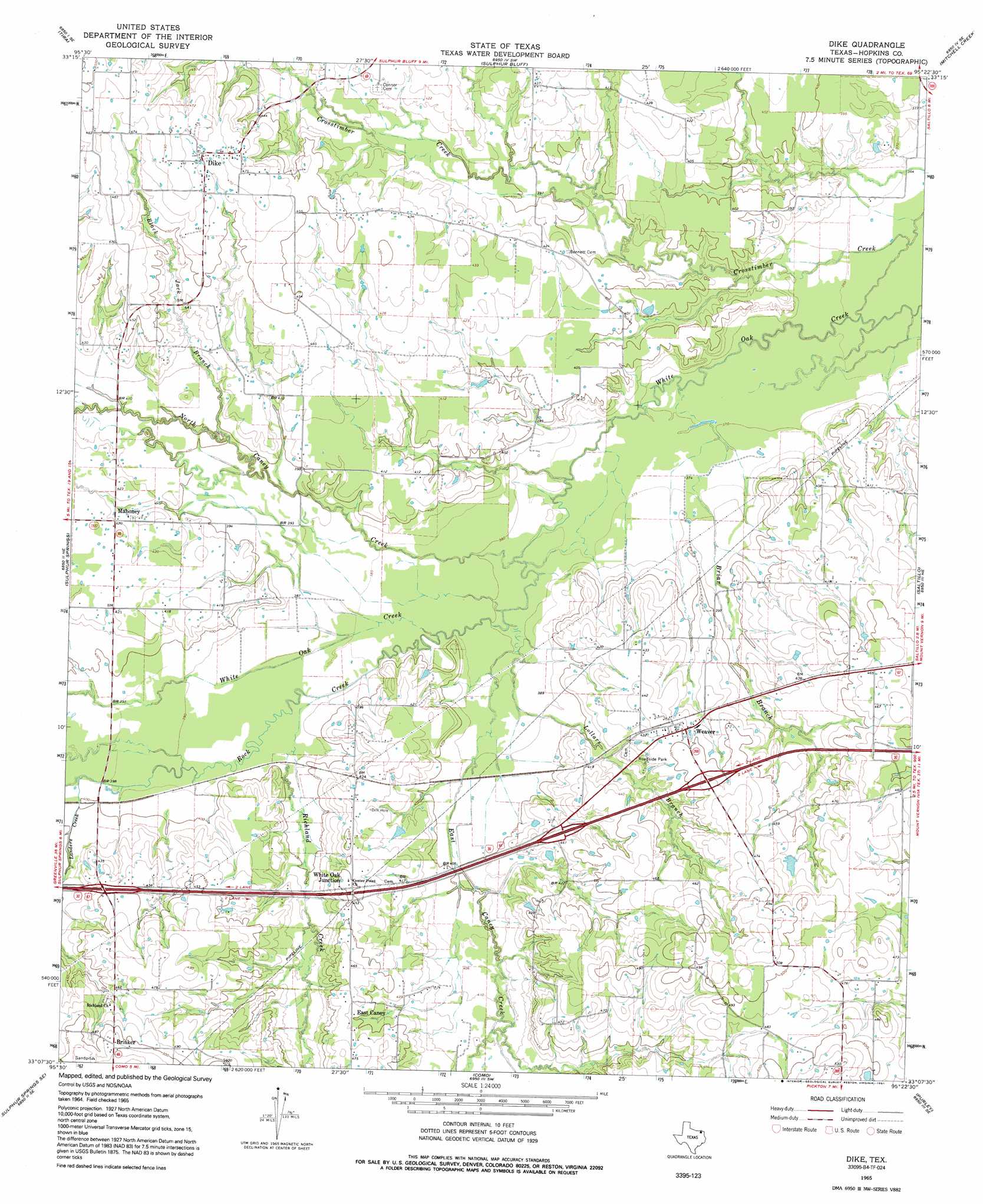
Dike Topo Map Texas
To zoom in, hover over the map of Dike
USGS Topo Quad 33095b4 - 1:24,000 scale
| Topo Map Name: | Dike |
| USGS Topo Quad ID: | 33095b4 |
| Print Size: | ca. 21 1/4" wide x 27" high |
| Southeast Coordinates: | 33.125° N latitude / 95.375° W longitude |
| Map Center Coordinates: | 33.1875° N latitude / 95.4375° W longitude |
| U.S. State: | TX |
| Filename: | o33095b4.jpg |
| Download Map JPG Image: | Dike topo map 1:24,000 scale |
| Map Type: | Topographic |
| Topo Series: | 7.5´ |
| Map Scale: | 1:24,000 |
| Source of Map Images: | United States Geological Survey (USGS) |
| Alternate Map Versions: |
Dike TX 1965, updated 1968 Download PDF Buy paper map Dike TX 1965, updated 1991 Download PDF Buy paper map Dike TX 2010 Download PDF Buy paper map Dike TX 2013 Download PDF Buy paper map Dike TX 2016 Download PDF Buy paper map |
1:24,000 Topo Quads surrounding Dike
Cooper North |
Charleston |
Minter |
Cunningham |
Bogata |
Cooper South |
Tira |
Sulphur Bluff |
Mitchell Creek |
Hagansport |
Gafford Chapel |
Sulphur Springs |
Dike |
Saltillo |
Mount Vernon |
Brashear |
Sulphur Springs Se |
Como |
Purley |
New Hope |
Arbala |
Yantis |
Pleasant Grove |
Winnsboro |
Newsome |
> Back to 33095a1 at 1:100,000 scale
> Back to 33094a1 at 1:250,000 scale
> Back to U.S. Topo Maps home
Dike topo map: Gazetteer
Dike: Dams
Patterson Lake Dam elevation 131m 429′Wholecattle Feeders Dam B elevation 118m 387′
Dike: Populated Places
Brinker elevation 157m 515′Dike elevation 144m 472′
East Caney elevation 138m 452′
Mahoney elevation 128m 419′
Weaver elevation 134m 439′
White Oak Junction elevation 137m 449′
Dike: Reservoirs
Patterson Lake elevation 131m 429′Wholecattle Feeders Lake B elevation 118m 387′
Dike: Streams
Black Jack Branch elevation 119m 390′Briar Branch elevation 111m 364′
East Caney Creek elevation 114m 374′
Landers Creek elevation 120m 393′
Lollars Branch elevation 116m 380′
North Caney Creek elevation 114m 374′
Richland Creek elevation 117m 383′
Rock Creek elevation 114m 374′
Dike digital topo map on disk
Buy this Dike topo map showing relief, roads, GPS coordinates and other geographical features, as a high-resolution digital map file on DVD: