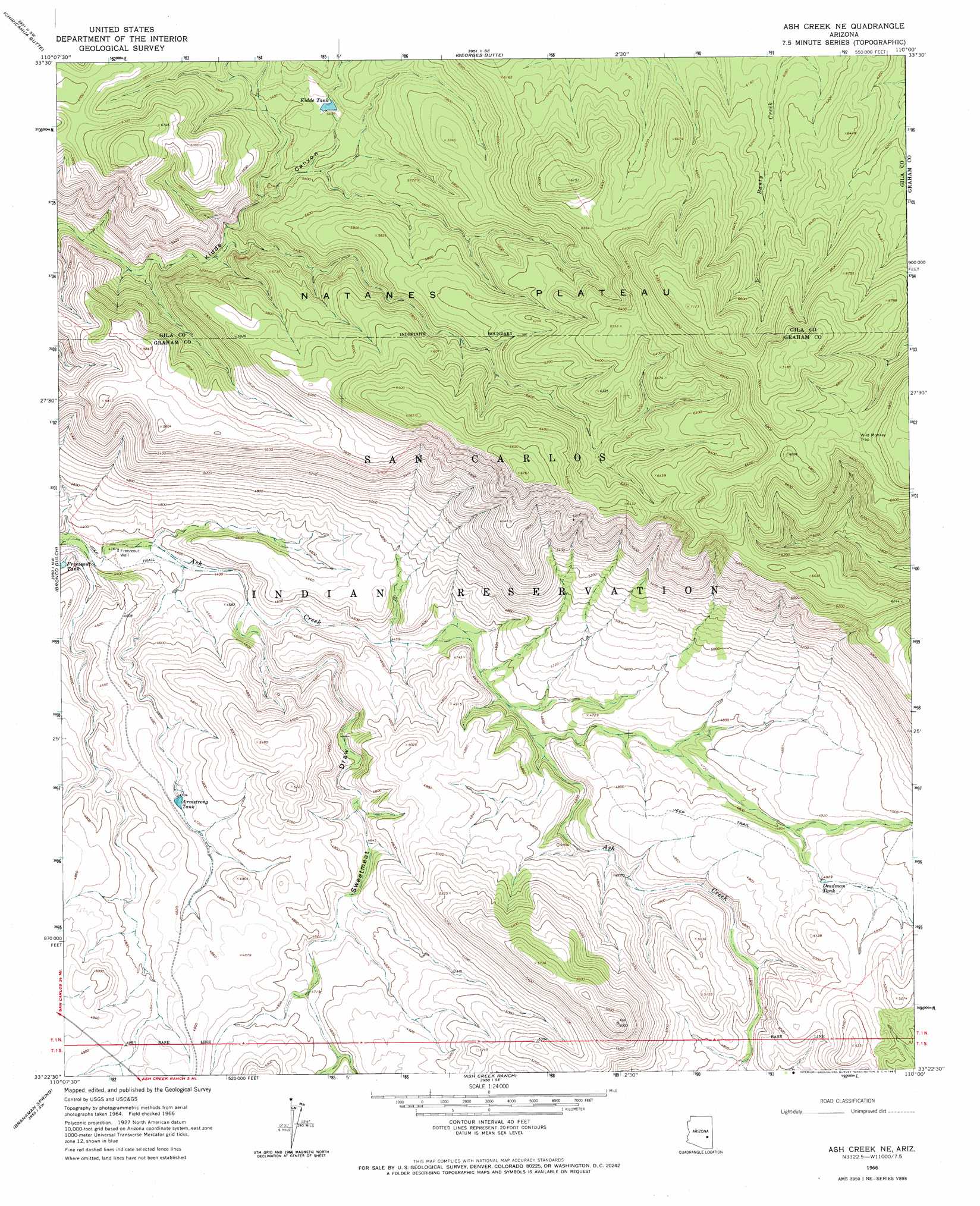
Ash Creek Ne Topo Map Arizona
To zoom in, hover over the map of Ash Creek Ne
USGS Topo Quad 33110d1 - 1:24,000 scale
| Topo Map Name: | Ash Creek Ne |
| USGS Topo Quad ID: | 33110d1 |
| Print Size: | ca. 21 1/4" wide x 27" high |
| Southeast Coordinates: | 33.375° N latitude / 110° W longitude |
| Map Center Coordinates: | 33.4375° N latitude / 110.0625° W longitude |
| U.S. State: | AZ |
| Filename: | o33110d1.jpg |
| Download Map JPG Image: | Ash Creek Ne topo map 1:24,000 scale |
| Map Type: | Topographic |
| Topo Series: | 7.5´ |
| Map Scale: | 1:24,000 |
| Source of Map Images: | United States Geological Survey (USGS) |
| Alternate Map Versions: |
Ash Creek NE AZ 1966, updated 1967 Download PDF Buy paper map Ash Creek NE AZ 2011 Download PDF Buy paper map Ash Creek NE AZ 2014 Download PDF Buy paper map |
1:24,000 Topo Quads surrounding Ash Creek Ne
Popcorn Canyon |
Forks Butte |
Velasquez Butte |
Bonito Prairie |
Corn Creek |
Sontag Creek |
Chiricahua Butte |
Georges Butte |
Elwood Canyon |
West Poker Mountain |
Sontag Mesa |
Bronco Gulch |
Ash Creek Ne |
Natanes Mountains Nw |
Natanes Mountains Ne |
Mount Triplet |
Branaman Spring |
Ash Creek Ranch |
Tule Tubs |
Point Of Pines West |
Dewey Flat |
Calva |
Bylas |
Gila Peak |
Bonita Tank |
> Back to 33110a1 at 1:100,000 scale
> Back to 33110a1 at 1:250,000 scale
> Back to U.S. Topo Maps home
Ash Creek Ne topo map: Gazetteer
Ash Creek Ne: Cliffs
Wild Monkey Trap elevation 2047m 6715′Ash Creek Ne: Dams
Armstrong Dam elevation 1435m 4708′Juniper Dam elevation 1482m 4862′
Kidde Dam elevation 1659m 5442′
Ash Creek Ne: Reservoirs
Armstrong Tank elevation 1427m 4681′Deadman Tank elevation 1500m 4921′
Kidde Tank elevation 1660m 5446′
Ash Creek Ne: Valleys
Sweetmeat Draw elevation 1346m 4416′Ash Creek Ne: Wells
Freezeout Well elevation 1329m 4360′Ash Creek Ne digital topo map on disk
Buy this Ash Creek Ne topo map showing relief, roads, GPS coordinates and other geographical features, as a high-resolution digital map file on DVD: