Charlie Died Tank Topo Map Arizona
To zoom in, hover over the map of Charlie Died Tank
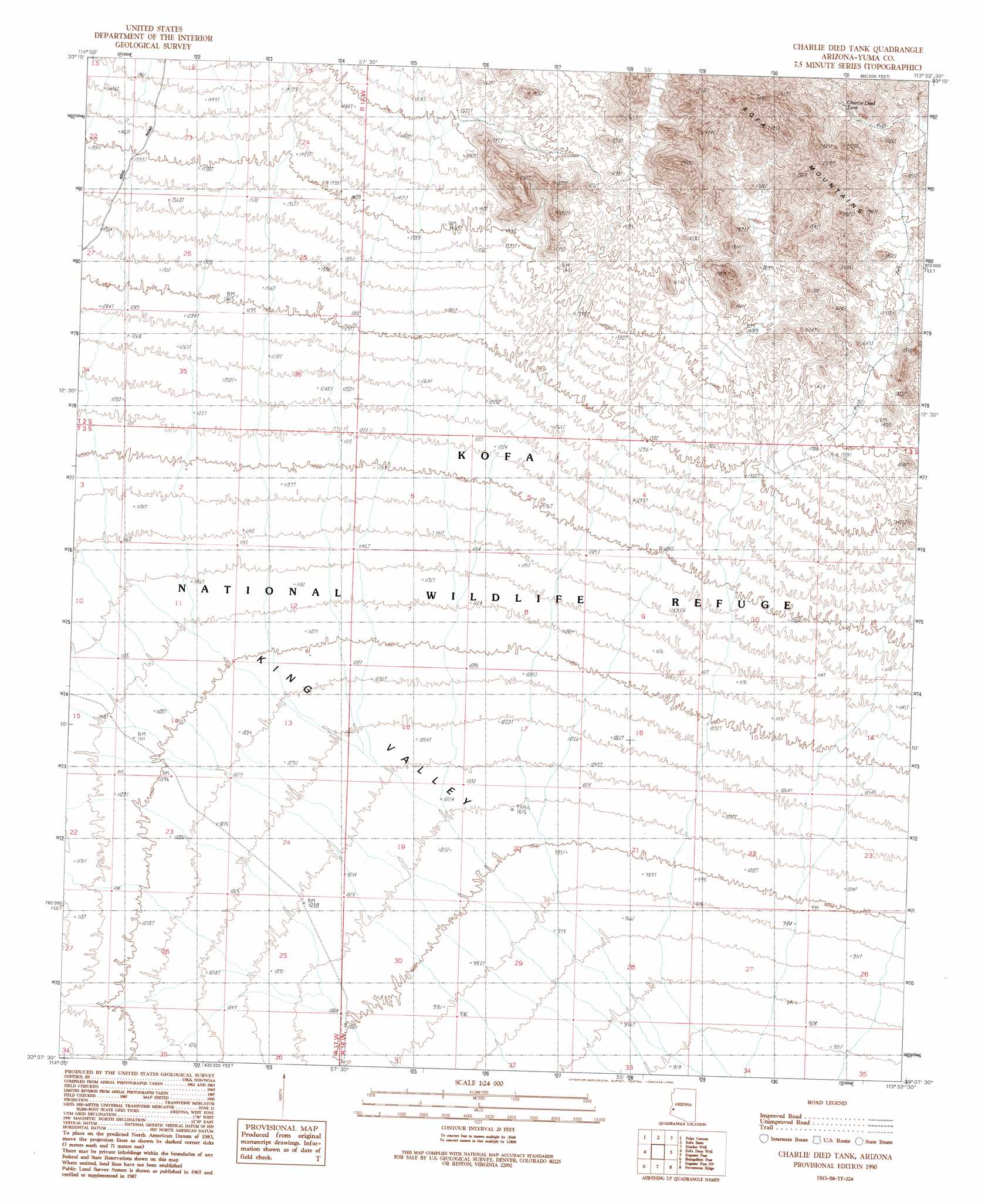
USGS Topo Quad 33113b8 - 1:24,000 scale
| Topo Map Name: | Charlie Died Tank |
| USGS Topo Quad ID: | 33113b8 |
| Print Size: | ca. 21 1/4" wide x 27" high |
| Southeast Coordinates: | 33.125° N latitude / 113.875° W longitude |
| Map Center Coordinates: | 33.1875° N latitude / 113.9375° W longitude |
| U.S. State: | AZ |
| Filename: | o33113b8.jpg |
| Download Map JPG Image: | Charlie Died Tank topo map 1:24,000 scale |
| Map Type: | Topographic |
| Topo Series: | 7.5´ |
| Map Scale: | 1:24,000 |
| Source of Map Images: | United States Geological Survey (USGS) |
| Alternate Map Versions: |
Charlie Died Tank AZ 1990, updated 1990 Download PDF Buy paper map Charlie Died Tank AZ 2011 Download PDF Buy paper map Charlie Died Tank AZ 2014 Download PDF Buy paper map |
1:24,000 Topo Quads surrounding Charlie Died Tank
Livingston Hills Nw |
Livingston Hills |
Owl Head |
Cholla Tank |
Coyote Peak |
Stone Cabin |
Palm Canyon |
Kofa Butte |
Hoodoo Well |
Cementosa Wash |
Arch Tank |
Kofa Deep Well |
Charlie Died Tank |
Engesser Pass |
Palomas Mountains Nw |
Castle Dome Peak |
Slumgullion Pass |
Engesser Pass Sw |
Neversweat Ridge |
Palomas Mountains Sw |
Red Bluff Mountain Nw |
Salton Tanks |
North Of Roll |
Mesquite Jim Well |
Kofa |
> Back to 33113a1 at 1:100,000 scale
> Back to 33112a1 at 1:250,000 scale
> Back to U.S. Topo Maps home
Charlie Died Tank topo map: Gazetteer
Charlie Died Tank: Reservoirs
Charlie Died Tank elevation 616m 2020′Charlie Died Tank digital topo map on disk
Buy this Charlie Died Tank topo map showing relief, roads, GPS coordinates and other geographical features, as a high-resolution digital map file on DVD: