Panola Topo Map Oklahoma
To zoom in, hover over the map of Panola
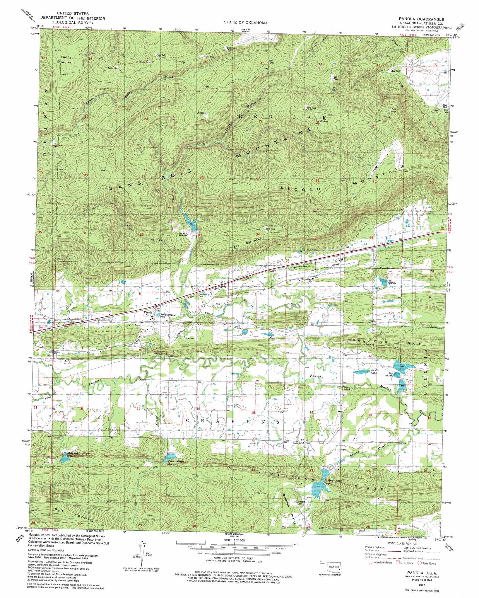
USGS Topo Quad 34095h2 - 1:24,000 scale
| Topo Map Name: | Panola |
| USGS Topo Quad ID: | 34095h2 |
| Print Size: | ca. 21 1/4" wide x 27" high |
| Southeast Coordinates: | 34.875° N latitude / 95.125° W longitude |
| Map Center Coordinates: | 34.9375° N latitude / 95.1875° W longitude |
| U.S. State: | OK |
| Filename: | o34095h2.jpg |
| Download Map JPG Image: | Panola topo map 1:24,000 scale |
| Map Type: | Topographic |
| Topo Series: | 7.5´ |
| Map Scale: | 1:24,000 |
| Source of Map Images: | United States Geological Survey (USGS) |
| Alternate Map Versions: |
Panola OK 1979, updated 1980 Download PDF Buy paper map Panola OK 1979, updated 1986 Download PDF Buy paper map Panola OK 2010 Download PDF Buy paper map Panola OK 2013 Download PDF Buy paper map Panola OK 2016 Download PDF Buy paper map |
1:24,000 Topo Quads surrounding Panola
Enterprise |
Quinton North |
Sans Bois |
Lafayette |
Mccurtain |
Featherston |
Quinton South |
Kinta |
Lequire |
Mccurtain Sw |
Gowen |
Wilburton |
Panola |
Red Oak |
Leflore |
Higgins |
Damon |
Baker Mountain |
Talihina |
Blackjack Ridge |
Sardis |
Yanush |
Kiamichi |
Albion |
Whitesboro |
> Back to 34095e1 at 1:100,000 scale
> Back to 34094a1 at 1:250,000 scale
> Back to U.S. Topo Maps home
Panola topo map: Gazetteer
Panola: Dams
Fourche Maline Creek Site 1 Dam elevation 202m 662′Fourche Maline Creek Site 10 Dam elevation 187m 613′
Fourche Maline Creek Site 11 Dam elevation 181m 593′
Fourche Maline Creek Site 9 Dam elevation 177m 580′
Oknoname 077001 Dam elevation 171m 561′
Oknoname 077003 Dam elevation 171m 561′
Panola: Flats
Baldwin Prairie elevation 193m 633′Panola: Gaps
Buzzard Gap elevation 192m 629′Courthouse Gap elevation 189m 620′
Spring Creek Gap elevation 183m 600′
Panola: Lakes
Austin Lake elevation 170m 557′Panola: Populated Places
Panola elevation 196m 643′Panola: Reservoirs
Fourche Maline Creek Site 1 Reservoir elevation 202m 662′Fourche Maline Creek Site 10 Reservoir elevation 187m 613′
Fourche Maline Creek Site 11 Reservoir elevation 181m 593′
Fourche Maline Creek Site 9 Reservoir elevation 177m 580′
Oknoname 077001 Reservoir elevation 171m 561′
Oknoname 077003 Reservoir elevation 171m 561′
Panola: Ridges
Limestone Ridge elevation 263m 862′Panola: Streams
Bandy Creek elevation 177m 580′Clear Creek elevation 171m 561′
Dry Creek elevation 188m 616′
Horse Creek elevation 171m 561′
Little Fourche Maline elevation 166m 544′
Spring Creek elevation 165m 541′
Panola: Summits
First Mountain elevation 331m 1085′Second Mountain elevation 528m 1732′
Yancy Mountain elevation 479m 1571′
Panola digital topo map on disk
Buy this Panola topo map showing relief, roads, GPS coordinates and other geographical features, as a high-resolution digital map file on DVD: