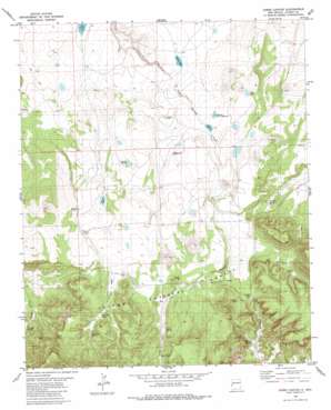
Jones Canyon Topo Map New Mexico
To zoom in, hover over the map of Jones Canyon
USGS Topo Quad 34108a8 - 1:24,000 scale
| Topo Map Name: | Jones Canyon |
| USGS Topo Quad ID: | 34108a8 |
| Print Size: | ca. 21 1/4" wide x 27" high |
| Southeast Coordinates: | 34° N latitude / 108.875° W longitude |
| Map Center Coordinates: | 34.0625° N latitude / 108.9375° W longitude |
| U.S. State: | NM |
| Filename: | o34108a8.jpg |
| Download Map JPG Image: | Jones Canyon topo map 1:24,000 scale |
| Map Type: | Topographic |
| Topo Series: | 7.5´ |
| Map Scale: | 1:24,000 |
| Source of Map Images: | United States Geological Survey (USGS) |
| Alternate Map Versions: |
Jones Canyon NM 1981, updated 1981 Download PDF Buy paper map Jones Canyon NM 1999, updated 2002 Download PDF Buy paper map Jones Canyon NM 2011 Download PDF Buy paper map Jones Canyon NM 2013 Download PDF Buy paper map Jones Canyon NM 2017 Download PDF Buy paper map |
| FStopo: | US Forest Service topo Jones Canyon is available: Download FStopo PDF Download FStopo TIF |
1:24,000 Topo Quads surrounding Jones Canyon
> Back to 34108a1 at 1:100,000 scale
> Back to 34108a1 at 1:250,000 scale
> Back to U.S. Topo Maps home
Jones Canyon topo map: Gazetteer
Jones Canyon: Flats
Hay Vega elevation 2524m 8280′Jones Canyon: Gaps
Knight Gap elevation 2472m 8110′Jones Canyon: Lakes
Cout Lake elevation 2345m 7693′Cout Lake elevation 2345m 7693′
Gasoline Lake elevation 2478m 8129′
Jones Lake elevation 2443m 8015′
Laguna Abel elevation 2395m 7857′
Laguna de la Manzana elevation 2426m 7959′
Laguna Honda elevation 2456m 8057′
Laguna Verde elevation 2407m 7896′
Jones Canyon: Reservoirs
Bear Tank elevation 2453m 8047′Beard Tank elevation 2498m 8195′
Corner Tank elevation 2526m 8287′
Corner Tank elevation 2483m 8146′
Dogie Tank elevation 2478m 8129′
Hay Vega Tank elevation 2511m 8238′
Jones Tank elevation 2566m 8418′
Jones Tank elevation 2510m 8234′
Martin Reservoir elevation 2422m 7946′
Mesa Storage Tank elevation 2583m 8474′
Orona Tank elevation 2510m 8234′
Orona Tank elevation 2567m 8421′
Pine Tank elevation 2380m 7808′
Powerline Tank elevation 2541m 8336′
Tin Cup Tank elevation 2579m 8461′
Jones Canyon: Springs
B Knight elevation 2393m 7851′Canovas Spring elevation 2489m 8166′
Hay Vega Spring elevation 2551m 8369′
Jones Spring elevation 2550m 8366′
Knight Spring elevation 2390m 7841′
Mangitas Spring elevation 2408m 7900′
Tin Cup Spring elevation 2587m 8487′
Jones Canyon: Valleys
Jones Canyon elevation 2455m 8054′Jones Canyon: Wells
Upper Jones Well elevation 2554m 8379′Jones Canyon digital topo map on disk
Buy this Jones Canyon topo map showing relief, roads, GPS coordinates and other geographical features, as a high-resolution digital map file on DVD:


