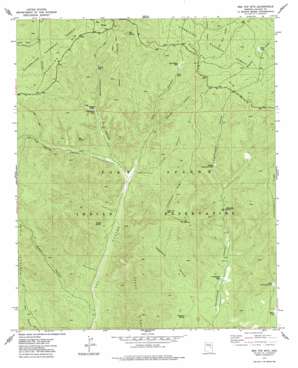
Red Top Mountain Topo Map Arizona
To zoom in, hover over the map of Red Top Mountain
USGS Topo Quad 34110b2 - 1:24,000 scale
| Topo Map Name: | Red Top Mountain |
| USGS Topo Quad ID: | 34110b2 |
| Print Size: | ca. 21 1/4" wide x 27" high |
| Southeast Coordinates: | 34.125° N latitude / 110.125° W longitude |
| Map Center Coordinates: | 34.1875° N latitude / 110.1875° W longitude |
| U.S. State: | AZ |
| Filename: | o34110b2.jpg |
| Download Map JPG Image: | Red Top Mountain topo map 1:24,000 scale |
| Map Type: | Topographic |
| Topo Series: | 7.5´ |
| Map Scale: | 1:24,000 |
| Source of Map Images: | United States Geological Survey (USGS) |
| Alternate Map Versions: |
Red Top Mtn. AZ 1977, updated 1978 Download PDF Buy paper map Red Top Mountain AZ 1998, updated 2000 Download PDF Buy paper map Red Top Mountain AZ 2011 Download PDF Buy paper map Red Top Mountain AZ 2014 Download PDF Buy paper map |
| FStopo: | US Forest Service topo Red Top Mountain is available: Download FStopo PDF Download FStopo TIF |
1:24,000 Topo Quads surrounding Red Top Mountain
> Back to 34110a1 at 1:100,000 scale
> Back to 34110a1 at 1:250,000 scale
> Back to U.S. Topo Maps home
Red Top Mountain topo map: Gazetteer
Red Top Mountain: Dams
Hop Canyon Tank Dam elevation 1999m 6558′Red Top Mountain: Reservoirs
Charco Tank elevation 1830m 6003′Cottonwood Tank elevation 1832m 6010′
Fence Tank elevation 1975m 6479′
Hop Canyon Tank elevation 1994m 6541′
Joe Tank elevation 1988m 6522′
Juniper Tank elevation 1929m 6328′
Lower Cottonwood Tank elevation 1864m 6115′
Middle Cottonwood Tank elevation 1924m 6312′
Sand Tank elevation 1980m 6496′
Walnut Tank elevation 1984m 6509′
Yellowjacket Tank elevation 2048m 6719′
Yellowstone Tank elevation 1926m 6318′
Red Top Mountain: Ridges
Cottonwood Ridge elevation 2009m 6591′Telephone Ridge elevation 2052m 6732′
Red Top Mountain: Springs
Box Spring elevation 1939m 6361′Cottonwood Spring elevation 1887m 6190′
Hop Spring elevation 2048m 6719′
Telephone Spring elevation 1830m 6003′
Turkey Spring elevation 1865m 6118′
Red Top Mountain: Summits
Hop Mountain elevation 2094m 6870′Red Top Mountain elevation 2099m 6886′
Red Top Mountain: Valleys
Cub Canyon elevation 1862m 6108′Hog Spring Canyon elevation 1871m 6138′
McCleve Canyon elevation 2019m 6624′
Middle Canyon elevation 1781m 5843′
Telephone Canyon elevation 1805m 5921′
Walnut Canyon elevation 1913m 6276′
Yellowstone Canyon elevation 1845m 6053′
Red Top Mountain digital topo map on disk
Buy this Red Top Mountain topo map showing relief, roads, GPS coordinates and other geographical features, as a high-resolution digital map file on DVD:


