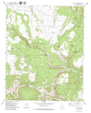
Hell Point Topo Map Arizona
To zoom in, hover over the map of Hell Point
USGS Topo Quad 34112h3 - 1:24,000 scale
| Topo Map Name: | Hell Point |
| USGS Topo Quad ID: | 34112h3 |
| Print Size: | ca. 21 1/4" wide x 27" high |
| Southeast Coordinates: | 34.875° N latitude / 112.25° W longitude |
| Map Center Coordinates: | 34.9375° N latitude / 112.3125° W longitude |
| U.S. State: | AZ |
| Filename: | o34112h3.jpg |
| Download Map JPG Image: | Hell Point topo map 1:24,000 scale |
| Map Type: | Topographic |
| Topo Series: | 7.5´ |
| Map Scale: | 1:24,000 |
| Source of Map Images: | United States Geological Survey (USGS) |
| Alternate Map Versions: |
Hell Point AZ 1979, updated 1979 Download PDF Buy paper map Hell Point AZ 2012 Download PDF Buy paper map Hell Point AZ 2014 Download PDF Buy paper map |
| FStopo: | US Forest Service topo Hell Point is available: Download FStopo PDF Download FStopo TIF |
1:24,000 Topo Quads surrounding Hell Point
> Back to 34112e1 at 1:100,000 scale
> Back to 34112a1 at 1:250,000 scale
> Back to U.S. Topo Maps home
Hell Point topo map: Gazetteer
Hell Point: Airports
Bar Heart Ranch Airport elevation 1348m 4422′Hell Point: Cliffs
Hell Point elevation 1288m 4225′Hell Point: Dams
Wagon Tire Dam elevation 1404m 4606′Hell Point: Flats
Page Flat elevation 1395m 4576′Hell Point: Mines
United States Mine elevation 1236m 4055′Hell Point: Populated Places
Mack elevation 1334m 4376′Hell Point: Reservoirs
Bear Tank elevation 1357m 4452′Bettys Tank elevation 1346m 4416′
Daisey Tank elevation 1307m 4288′
Daisy Tank elevation 1284m 4212′
Deep Hole Tank elevation 1359m 4458′
Eds Tank elevation 1407m 4616′
Grindstone Tank elevation 1364m 4475′
Juniper Tank elevation 1310m 4297′
King Tank elevation 1340m 4396′
Little Page Tank elevation 1394m 4573′
Little Rattlesnake Tank elevation 1327m 4353′
Little Rattlesnake Tank elevation 1332m 4370′
Lucky Tank elevation 1321m 4333′
M C Tank elevation 1373m 4504′
Mack Tank elevation 1306m 4284′
McClure Tank elevation 1305m 4281′
Middle Trail Tank elevation 1321m 4333′
Midway Tank elevation 1336m 4383′
Page Flat Tank elevation 1383m 4537′
Pothole Tank elevation 1320m 4330′
S R P Trick Tank elevation 1417m 4648′
Schwanbeck Tank elevation 1328m 4356′
Wagon Tire Tank elevation 1398m 4586′
White Tank elevation 1303m 4274′
Hell Point: Springs
Duff Spring elevation 1238m 4061′Fig Tree Spring elevation 1402m 4599′
King Spring elevation 1284m 4212′
Hell Point: Streams
Grindstone Wash elevation 1228m 4028′Page Wash elevation 1257m 4124′
Rattlesnake Wash elevation 1295m 4248′
Wagon Tire Wash elevation 1262m 4140′
Hell Point: Summits
Bald Hill elevation 1425m 4675′Red Butte elevation 1403m 4603′
Hell Point: Valleys
Barney Draw elevation 1366m 4481′Bear Canyon elevation 1204m 3950′
Bull Basin Canyon elevation 1248m 4094′
Hell Canyon elevation 1203m 3946′
King Canyon elevation 1254m 4114′
M C Canyon elevation 1216m 3989′
Muldoon Canyon elevation 1267m 4156′
Hell Point: Wells
Glidden Well elevation 1343m 4406′Hell Point digital topo map on disk
Buy this Hell Point topo map showing relief, roads, GPS coordinates and other geographical features, as a high-resolution digital map file on DVD:


