Kelso Dunes Topo Map California
To zoom in, hover over the map of Kelso Dunes
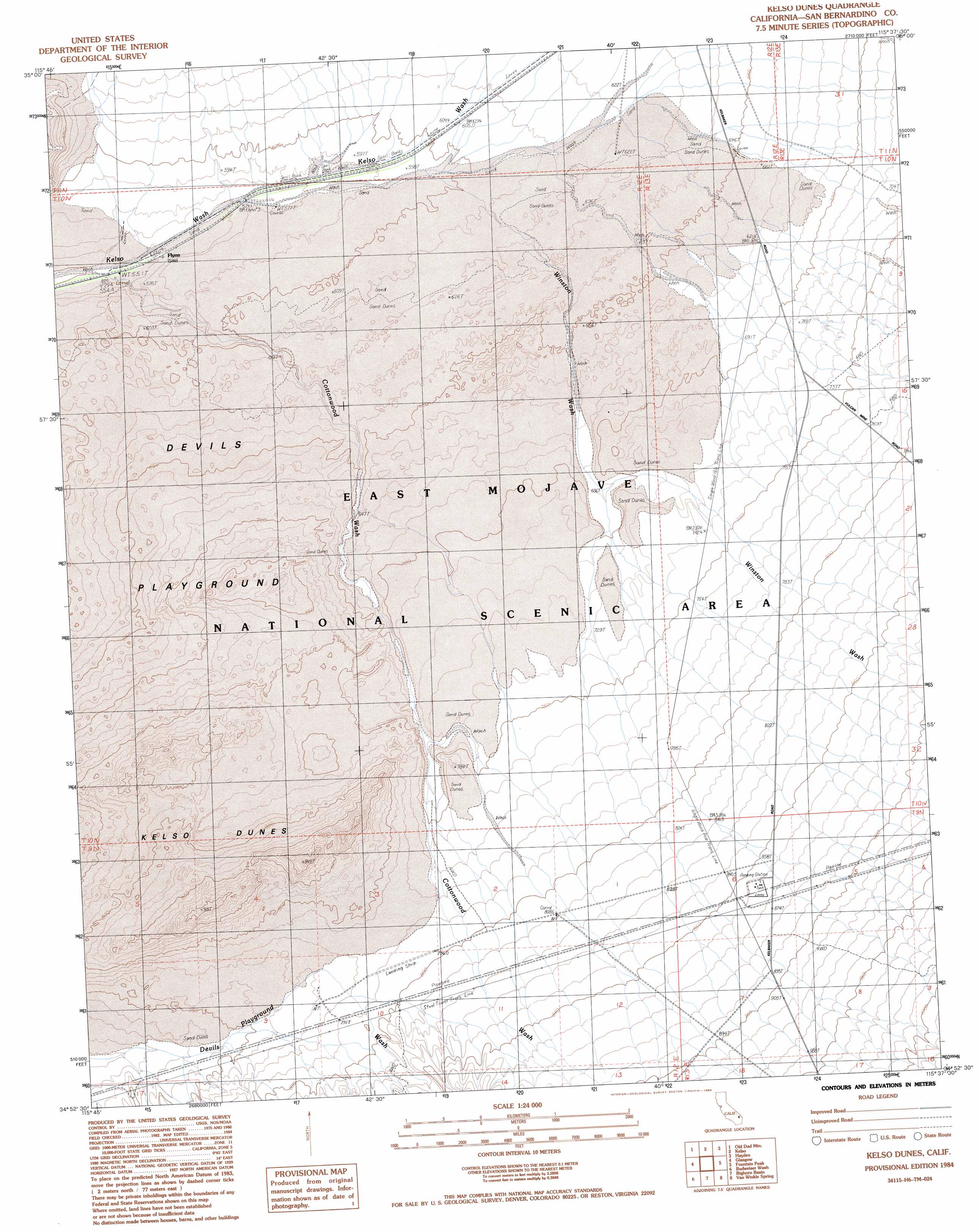
USGS Topo Quad 34115h6 - 1:24,000 scale
| Topo Map Name: | Kelso Dunes |
| USGS Topo Quad ID: | 34115h6 |
| Print Size: | ca. 21 1/4" wide x 27" high |
| Southeast Coordinates: | 34.875° N latitude / 115.625° W longitude |
| Map Center Coordinates: | 34.9375° N latitude / 115.6875° W longitude |
| U.S. State: | CA |
| Filename: | o34115h6.jpg |
| Download Map JPG Image: | Kelso Dunes topo map 1:24,000 scale |
| Map Type: | Topographic |
| Topo Series: | 7.5´ |
| Map Scale: | 1:24,000 |
| Source of Map Images: | United States Geological Survey (USGS) |
| Alternate Map Versions: |
Kelso Dunes CA 1984, updated 1985 Download PDF Buy paper map Kelso Dunes CA 1984, updated 1985 Download PDF Buy paper map Kelso Dunes CA 2012 Download PDF Buy paper map Kelso Dunes CA 2015 Download PDF Buy paper map |
1:24,000 Topo Quads surrounding Kelso Dunes
Seventeenmile Point |
Indian Spring |
Marl Mountains |
Cima |
Mid Hills |
Cowhole Mountain |
Old Dad Mountain |
Kelso |
Hayden |
Columbia Mountain |
West Of Glasgow |
Glasgow |
Kelso Dunes |
Fountain Peak |
Colton Well |
West Of Budweiser Wash |
Budweiser Wash |
Bighorn Basin |
Van Winkle Spring |
West Of Blind Hills |
Siberia |
East Of Siberia |
Brown Buttes |
Van Winkle Wash |
Castle Dome |
> Back to 34115e1 at 1:100,000 scale
> Back to 34114a1 at 1:250,000 scale
> Back to U.S. Topo Maps home
Kelso Dunes topo map: Gazetteer
Kelso Dunes: Airports
Dick Taylor Airstrip elevation 739m 2424′Kelso Dunes: Populated Places
Flynn elevation 567m 1860′Kelso Dunes: Streams
Cottonwood Wash elevation 561m 1840′Winston Wash elevation 869m 2851′
Kelso Dunes: Summits
Kelso Dunes elevation 773m 2536′Kelso Dunes: Valleys
Winston Wash elevation 593m 1945′Kelso Dunes digital topo map on disk
Buy this Kelso Dunes topo map showing relief, roads, GPS coordinates and other geographical features, as a high-resolution digital map file on DVD: