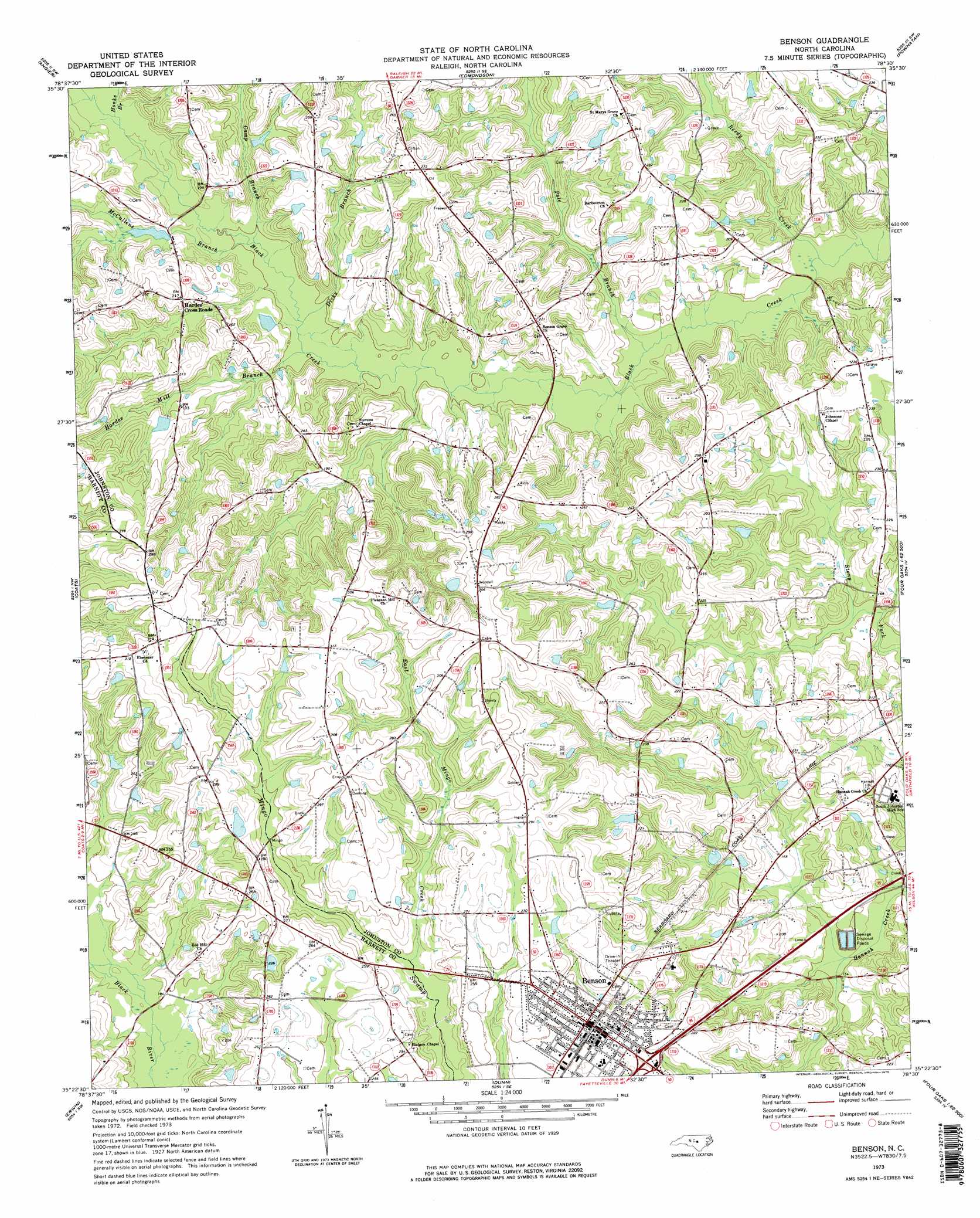
Benson Topo Map North Carolina
To zoom in, hover over the map of Benson
USGS Topo Quad 35078d5 - 1:24,000 scale
| Topo Map Name: | Benson |
| USGS Topo Quad ID: | 35078d5 |
| Print Size: | ca. 21 1/4" wide x 27" high |
| Southeast Coordinates: | 35.375° N latitude / 78.5° W longitude |
| Map Center Coordinates: | 35.4375° N latitude / 78.5625° W longitude |
| U.S. State: | NC |
| Filename: | o35078d5.jpg |
| Download Map JPG Image: | Benson topo map 1:24,000 scale |
| Map Type: | Topographic |
| Topo Series: | 7.5´ |
| Map Scale: | 1:24,000 |
| Source of Map Images: | United States Geological Survey (USGS) |
| Alternate Map Versions: |
Benson NC 1973, updated 1975 Download PDF Buy paper map Benson NC 1997, updated 2000 Download PDF Buy paper map Benson NC 2010 Download PDF Buy paper map Benson NC 2013 Download PDF Buy paper map Benson NC 2016 Download PDF Buy paper map |
1:24,000 Topo Quads surrounding Benson
Apex |
Lake Wheeler |
Garner |
Clayton |
Flowers |
Fuquay-Varina |
Angier |
Edmondson |
Powhatan |
Selma |
Lillington |
Coats |
Benson |
Four Oaks |
Four Oaks Ne |
Bunnlevel |
Erwin |
Dunn |
Peacocks Crossroads |
Newton Grove North |
Slocomb |
Wade |
Mingo |
Timothy |
Newton Grove South |
> Back to 35078a1 at 1:100,000 scale
> Back to 35078a1 at 1:250,000 scale
> Back to U.S. Topo Maps home
Benson topo map: Gazetteer
Benson: Dams
G R Barbour Pond Dam elevation 73m 239′Massengill Mill Pond Dam elevation 51m 167′
Benson: Populated Places
Benson elevation 74m 242′Hardee Cross Roads elevation 65m 213′
Benson: Reservoirs
G R Barbour Pond elevation 73m 239′Massengill Mill Pond elevation 51m 167′
Benson: Streams
Camp Branch elevation 48m 157′Dicks Branch elevation 47m 154′
East Mingo Creek elevation 66m 216′
Hardee Mill Branch elevation 47m 154′
Hooks Branch elevation 51m 167′
McCullens Branch elevation 48m 157′
Pole Branch elevation 43m 141′
Reedy Creek elevation 40m 131′
Benson digital topo map on disk
Buy this Benson topo map showing relief, roads, GPS coordinates and other geographical features, as a high-resolution digital map file on DVD:
South Carolina, Western North Carolina & Northeastern Georgia
Buy digital topo maps: South Carolina, Western North Carolina & Northeastern Georgia