West Of Window Rock Topo Map Arizona
To zoom in, hover over the map of West Of Window Rock
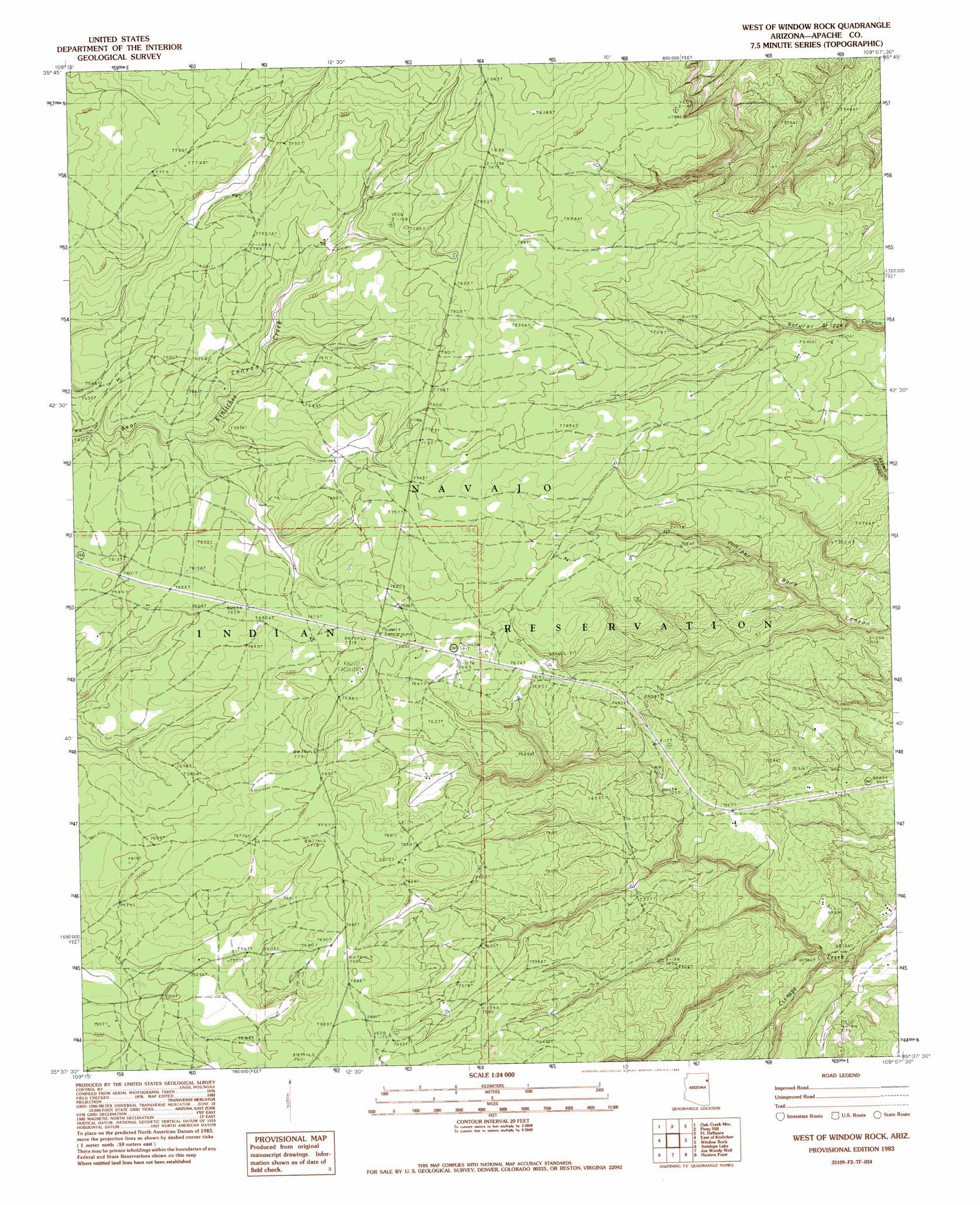
USGS Topo Quad 35109f2 - 1:24,000 scale
| Topo Map Name: | West Of Window Rock |
| USGS Topo Quad ID: | 35109f2 |
| Print Size: | ca. 21 1/4" wide x 27" high |
| Southeast Coordinates: | 35.625° N latitude / 109.125° W longitude |
| Map Center Coordinates: | 35.6875° N latitude / 109.1875° W longitude |
| U.S. State: | AZ |
| Filename: | o35109f2.jpg |
| Download Map JPG Image: | West Of Window Rock topo map 1:24,000 scale |
| Map Type: | Topographic |
| Topo Series: | 7.5´ |
| Map Scale: | 1:24,000 |
| Source of Map Images: | United States Geological Survey (USGS) |
| Alternate Map Versions: |
Zith-Tusayan Butte 4 NW AZ 1955, updated 1957 Download PDF Buy paper map West of Window Rock AZ 1983, updated 1983 Download PDF Buy paper map West of Window Rock AZ 2011 Download PDF Buy paper map West of Window Rock AZ 2014 Download PDF Buy paper map |
1:24,000 Topo Quads surrounding West Of Window Rock
Nazlini |
White Rock Wash |
Sawmill |
Buell Park |
Todilto Park |
Red Clay Wash |
Oak Creek Mountain |
Piney Hill |
Fort Defiance |
Crevasse Canyon |
Kinlichee |
East Of Kinlichee |
West Of Window Rock |
Window Rock |
Tse Bonita School |
Tudecoz Spring |
Antelope Lake |
Joe Woody Well |
Hunters Point |
Samson Lake |
Wide Ruins |
Pine Springs |
Uranium Spring |
Surrender Canyon |
Manuelito |
> Back to 35109e1 at 1:100,000 scale
> Back to 35108a1 at 1:250,000 scale
> Back to U.S. Topo Maps home
No gazetteer data is available for the West Of Window Rock topo map sheet.
West Of Window Rock digital topo map on disk
Buy this West Of Window Rock topo map showing relief, roads, GPS coordinates and other geographical features, as a high-resolution digital map file on DVD: