Hidden Valley Topo Map Nevada
To zoom in, hover over the map of Hidden Valley
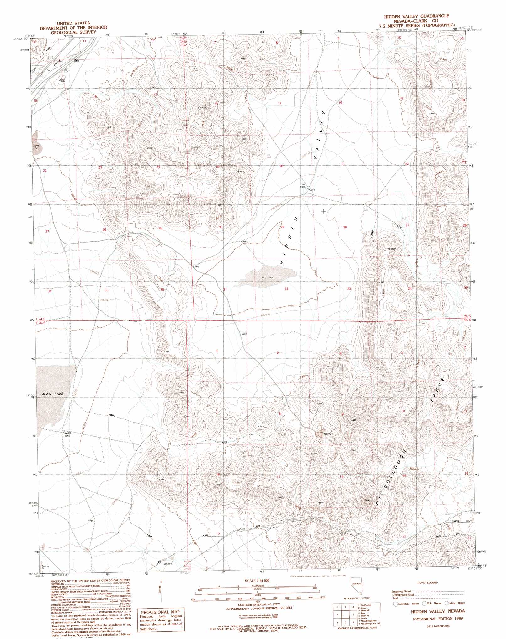
USGS Topo Quad 35115g2 - 1:24,000 scale
| Topo Map Name: | Hidden Valley |
| USGS Topo Quad ID: | 35115g2 |
| Print Size: | ca. 21 1/4" wide x 27" high |
| Southeast Coordinates: | 35.75° N latitude / 115.125° W longitude |
| Map Center Coordinates: | 35.8125° N latitude / 115.1875° W longitude |
| U.S. State: | NV |
| Filename: | o35115g2.jpg |
| Download Map JPG Image: | Hidden Valley topo map 1:24,000 scale |
| Map Type: | Topographic |
| Topo Series: | 7.5´ |
| Map Scale: | 1:24,000 |
| Source of Map Images: | United States Geological Survey (USGS) |
| Alternate Map Versions: |
Hidden Valley NV 1989, updated 1990 Download PDF Buy paper map Hidden Valley NV 2012 Download PDF Buy paper map Hidden Valley NV 2014 Download PDF Buy paper map |
1:24,000 Topo Quads surrounding Hidden Valley
Blue Diamond |
Blue Diamond Se |
Las Vegas Sw |
Las Vegas Se |
Henderson |
Cottonwood Pass |
Bird Spring |
Sloan |
Sloan Ne |
Boulder City Nw |
Goodsprings |
Jean |
Hidden Valley |
Sloan Se |
Boulder City Sw |
State Line Pass |
Roach |
Mccullough Pass |
Mccullough Mountain Ne |
Keyhole Canyon |
Ivanpah Lake |
Desert |
Mccullough Mountain |
Highland Spring |
Nelson Sw |
> Back to 35115e1 at 1:100,000 scale
> Back to 35114a1 at 1:250,000 scale
> Back to U.S. Topo Maps home
Hidden Valley topo map: Gazetteer
Hidden Valley: Basins
Hidden Valley elevation 926m 3038′Hidden Valley: Populated Places
Erie elevation 951m 3120′Hidden Valley digital topo map on disk
Buy this Hidden Valley topo map showing relief, roads, GPS coordinates and other geographical features, as a high-resolution digital map file on DVD:
Southern Sierra Nevada, California & Southern Nevada
Buy digital topo maps: Southern Sierra Nevada, California & Southern Nevada