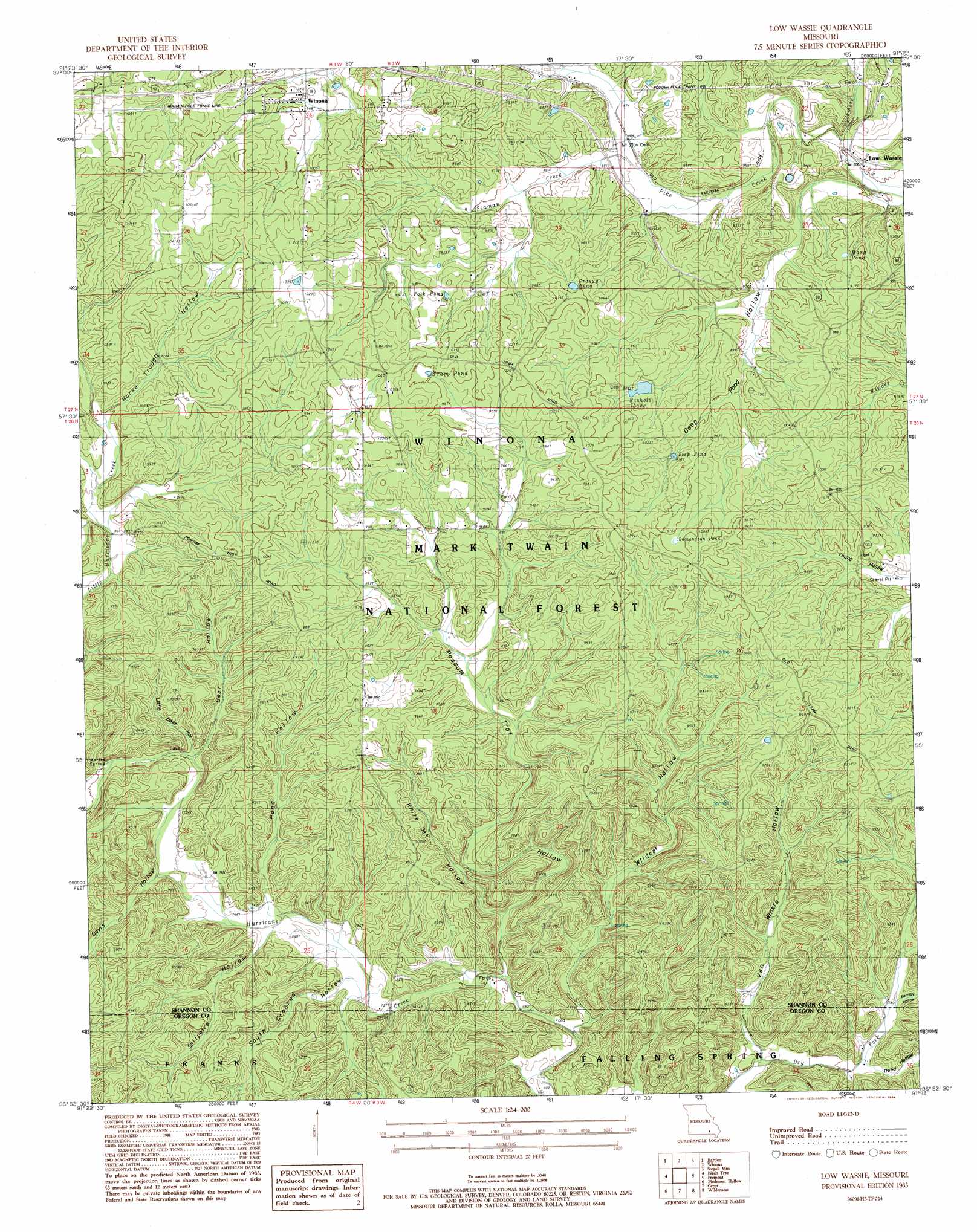
Low Wassie Topo Map Missouri
To zoom in, hover over the map of Low Wassie
USGS Topo Quad 36091h3 - 1:24,000 scale
| Topo Map Name: | Low Wassie |
| USGS Topo Quad ID: | 36091h3 |
| Print Size: | ca. 21 1/4" wide x 27" high |
| Southeast Coordinates: | 36.875° N latitude / 91.25° W longitude |
| Map Center Coordinates: | 36.9375° N latitude / 91.3125° W longitude |
| U.S. State: | MO |
| Filename: | o36091h3.jpg |
| Download Map JPG Image: | Low Wassie topo map 1:24,000 scale |
| Map Type: | Topographic |
| Topo Series: | 7.5´ |
| Map Scale: | 1:24,000 |
| Source of Map Images: | United States Geological Survey (USGS) |
| Alternate Map Versions: |
Low Wassie MO 1983, updated 1984 Download PDF Buy paper map Low Wassie MO 1997, updated 2000 Download PDF Buy paper map Low Wassie MO 2012 Download PDF Buy paper map Low Wassie MO 2015 Download PDF Buy paper map |
| FStopo: | US Forest Service topo Low Wassie is available: Download FStopo PDF Download FStopo TIF |
1:24,000 Topo Quads surrounding Low Wassie
Summersville Ne |
Alley Spring |
Eminence |
Powder Mill Ferry |
Exchange |
Jam Up Cave |
Bartlett |
Winona |
Stegall Mountain |
Van Buren North |
Montier |
Birch Tree |
Low Wassie |
Fremont |
Van Buren South |
Thomasville |
Peidmont Hollow |
Greer |
Wilderness |
Handy |
Rover |
Alton |
Many Springs |
Riverton |
Bardley |
> Back to 36091e1 at 1:100,000 scale
> Back to 36090a1 at 1:250,000 scale
> Back to U.S. Topo Maps home
Low Wassie topo map: Gazetteer
Low Wassie: Lakes
Deep Pond elevation 280m 918′Edmondson Pond elevation 304m 997′
Folk Pond elevation 306m 1003′
Grassy Pond elevation 301m 987′
Marg Pond elevation 278m 912′
Low Wassie: Populated Places
Low Wassie elevation 244m 800′Low Wassie: Reservoirs
Nichols Lake elevation 289m 948′Tram Pond elevation 305m 1000′
Low Wassie: Springs
Martin Spring elevation 253m 830′Low Wassie: Streams
Dry Fork elevation 245m 803′Seaman Creek elevation 262m 859′
Sycamore Creek elevation 244m 800′
Low Wassie: Valleys
Barnlog Hollow elevation 226m 741′Bear Hollow elevation 238m 780′
Davis Hollow elevation 232m 761′
Deep Pond Hollow elevation 243m 797′
Horse Trough Hollow elevation 274m 898′
Little Bear Hollow elevation 238m 780′
Pond Hollow elevation 230m 754′
Possum Trot Hollow elevation 213m 698′
Reed Hollow elevation 218m 715′
Saltpetre Hollow elevation 229m 751′
South Crooked Hollow elevation 225m 738′
Spring Hollow elevation 216m 708′
Whiteoak Hollow elevation 219m 718′
Wildcat Hollow elevation 216m 708′
Low Wassie digital topo map on disk
Buy this Low Wassie topo map showing relief, roads, GPS coordinates and other geographical features, as a high-resolution digital map file on DVD: