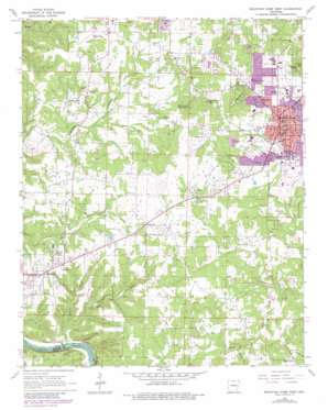
Mountain Home West Topo Map Arkansas
To zoom in, hover over the map of Mountain Home West
USGS Topo Quad 36092c4 - 1:24,000 scale
| Topo Map Name: | Mountain Home West |
| USGS Topo Quad ID: | 36092c4 |
| Print Size: | ca. 21 1/4" wide x 27" high |
| Southeast Coordinates: | 36.25° N latitude / 92.375° W longitude |
| Map Center Coordinates: | 36.3125° N latitude / 92.4375° W longitude |
| U.S. State: | AR |
| Filename: | o36092c4.jpg |
| Download Map JPG Image: | Mountain Home West topo map 1:24,000 scale |
| Map Type: | Topographic |
| Topo Series: | 7.5´ |
| Map Scale: | 1:24,000 |
| Source of Map Images: | United States Geological Survey (USGS) |
| Alternate Map Versions: |
Mountain Home West AR 1966, updated 1967 Download PDF Buy paper map Mountain Home West AR 1966, updated 1982 Download PDF Buy paper map Mountain Home West AR 1979, updated 1981 Download PDF Buy paper map Mountain Home West AR 2011 Download PDF Buy paper map Mountain Home West AR 2014 Download PDF Buy paper map |
1:24,000 Topo Quads surrounding Mountain Home West
> Back to 36092a1 at 1:100,000 scale
> Back to 36092a1 at 1:250,000 scale
> Back to U.S. Topo Maps home
Mountain Home West topo map: Gazetteer
Mountain Home West: Airports
Baxter County Regional Airport elevation 276m 905′Baxter County Regional Hospital Heliport elevation 259m 849′
Lahar Field elevation 260m 853′
Mountain Home West: Dams
Gardner Lake Dam elevation 256m 839′Higginbottom Lake Dam elevation 261m 856′
Ozark Acres Lake Dam elevation 229m 751′
Mountain Home West: Populated Places
Colfax elevation 244m 800′Conville (historical) elevation 226m 741′
Gassville elevation 233m 764′
Independence (historical) elevation 232m 761′
Monkey Run elevation 215m 705′
Mountain Home elevation 244m 800′
Shady Grove elevation 238m 780′
Spring Lake Estates elevation 261m 856′
Western Hills Subdivision elevation 239m 784′
Whiteville elevation 238m 780′
Mountain Home West: Post Offices
Mountain Home Post Office elevation 241m 790′Mountain Home West: Reservoirs
Gardner Lake elevation 256m 839′Higginbottom Lake elevation 261m 856′
Ozark Acres Lake elevation 229m 751′
Mountain Home West: Streams
Dodd Creek elevation 196m 643′Jenkins Creek elevation 118m 387′
Keeter Creek elevation 126m 413′
Monkey Run Creek elevation 188m 616′
Mountain Home West: Summits
Capitol Hill elevation 346m 1135′Hickman Knob elevation 348m 1141′
Monkey Run Hill elevation 254m 833′
Old Lonon Mountain elevation 337m 1105′
Wallace Knob elevation 352m 1154′
Mountain Home West digital topo map on disk
Buy this Mountain Home West topo map showing relief, roads, GPS coordinates and other geographical features, as a high-resolution digital map file on DVD:


