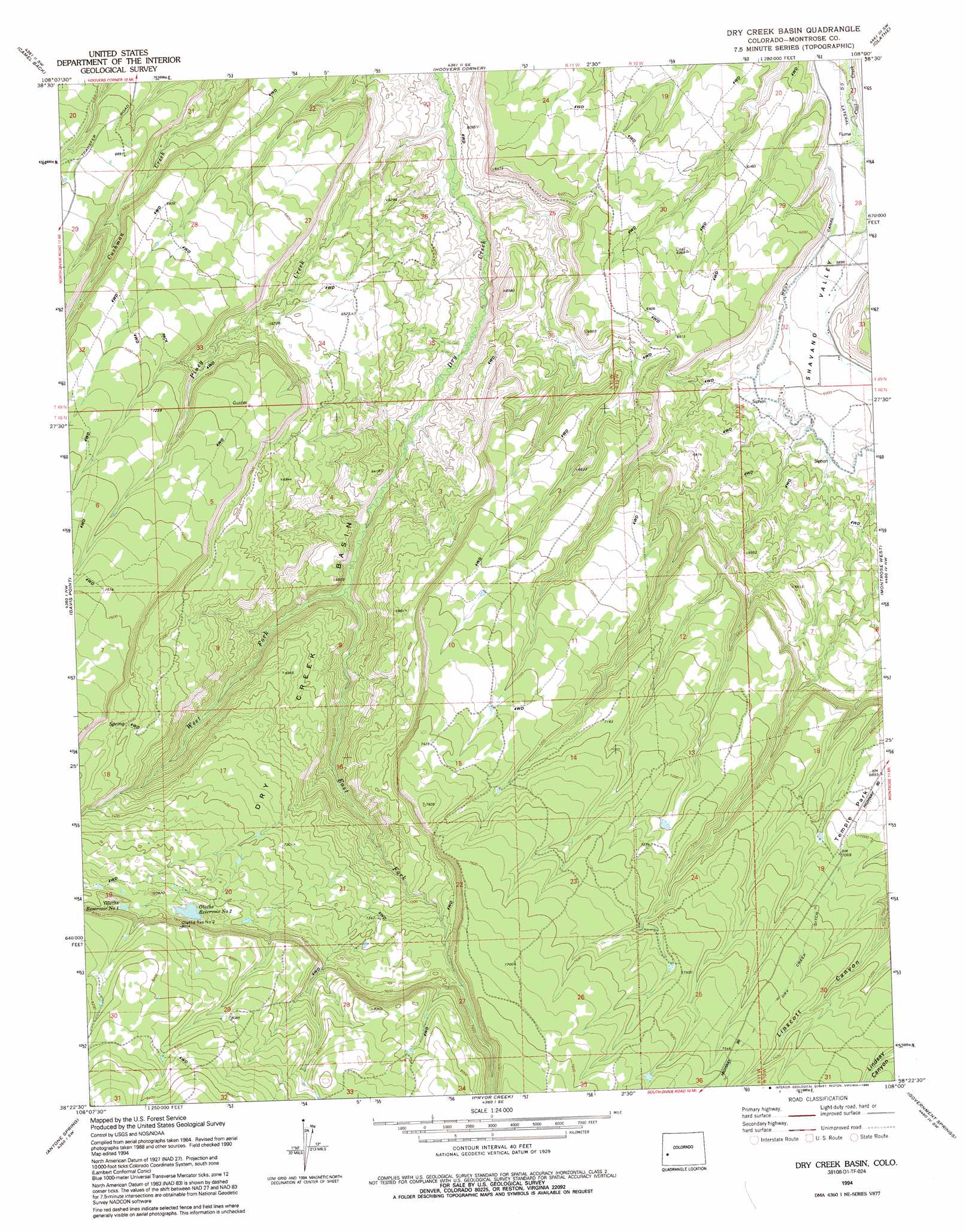
Dry Creek Basin Topo Map Colorado
To zoom in, hover over the map of Dry Creek Basin
USGS Topo Quad 38108d1 - 1:24,000 scale
| Topo Map Name: | Dry Creek Basin |
| USGS Topo Quad ID: | 38108d1 |
| Print Size: | ca. 21 1/4" wide x 27" high |
| Southeast Coordinates: | 38.375° N latitude / 108° W longitude |
| Map Center Coordinates: | 38.4375° N latitude / 108.0625° W longitude |
| U.S. State: | CO |
| Filename: | o38108d1.jpg |
| Download Map JPG Image: | Dry Creek Basin topo map 1:24,000 scale |
| Map Type: | Topographic |
| Topo Series: | 7.5´ |
| Map Scale: | 1:24,000 |
| Source of Map Images: | United States Geological Survey (USGS) |
| Alternate Map Versions: |
Dry Creek Basin CO 1973, updated 1975 Download PDF Buy paper map Dry Creek Basin CO 1973, updated 1975 Download PDF Buy paper map Dry Creek Basin CO 1994, updated 1994 Download PDF Buy paper map Dry Creek Basin CO 2010 Download PDF Buy paper map Dry Creek Basin CO 2013 Download PDF Buy paper map Dry Creek Basin CO 2016 Download PDF Buy paper map |
1:24,000 Topo Quads surrounding Dry Creek Basin
Good Point |
Roubideau |
Delta |
Olathe Nw |
Black Ridge |
Cottonwood Basin |
Camel Back |
Hoovers Corner |
Olathe |
Red Rock Canyon |
Moore Mesa |
Davis Point |
Dry Creek Basin |
Montrose West |
Montrose East |
Ute |
Antone Spring |
Pryor Creek |
Government Springs |
Colona |
Norwood |
Sanborn Park |
Hotchkiss Reservoir |
Horsefly Peak |
Ridgway |
> Back to 38108a1 at 1:100,000 scale
> Back to 38108a1 at 1:250,000 scale
> Back to U.S. Topo Maps home
Dry Creek Basin topo map: Gazetteer
Dry Creek Basin: Basins
Dry Creek Basin elevation 2065m 6774′Dry Creek Basin: Canals
West Canal elevation 1859m 6099′Dry Creek Basin: Dams
Citizens Dam elevation 2341m 7680′Dry Creek Basin: Flats
Temple Park elevation 2111m 6925′Dry Creek Basin: Mines
Dry Creek Prospect elevation 2009m 6591′Dry Creek Basin: Reservoirs
Citizens Reservoir elevation 2341m 7680′Olathe Reservoir Number 1 elevation 2369m 7772′
Olathe Reservoir Number 2 elevation 2343m 7687′
Dry Creek Basin: Streams
East Fork Dry Creek elevation 1911m 6269′Piney Creek elevation 1789m 5869′
West Fork Dry Creek elevation 1911m 6269′
Dry Creek Basin digital topo map on disk
Buy this Dry Creek Basin topo map showing relief, roads, GPS coordinates and other geographical features, as a high-resolution digital map file on DVD: