Bruin Point Topo Map Utah
To zoom in, hover over the map of Bruin Point
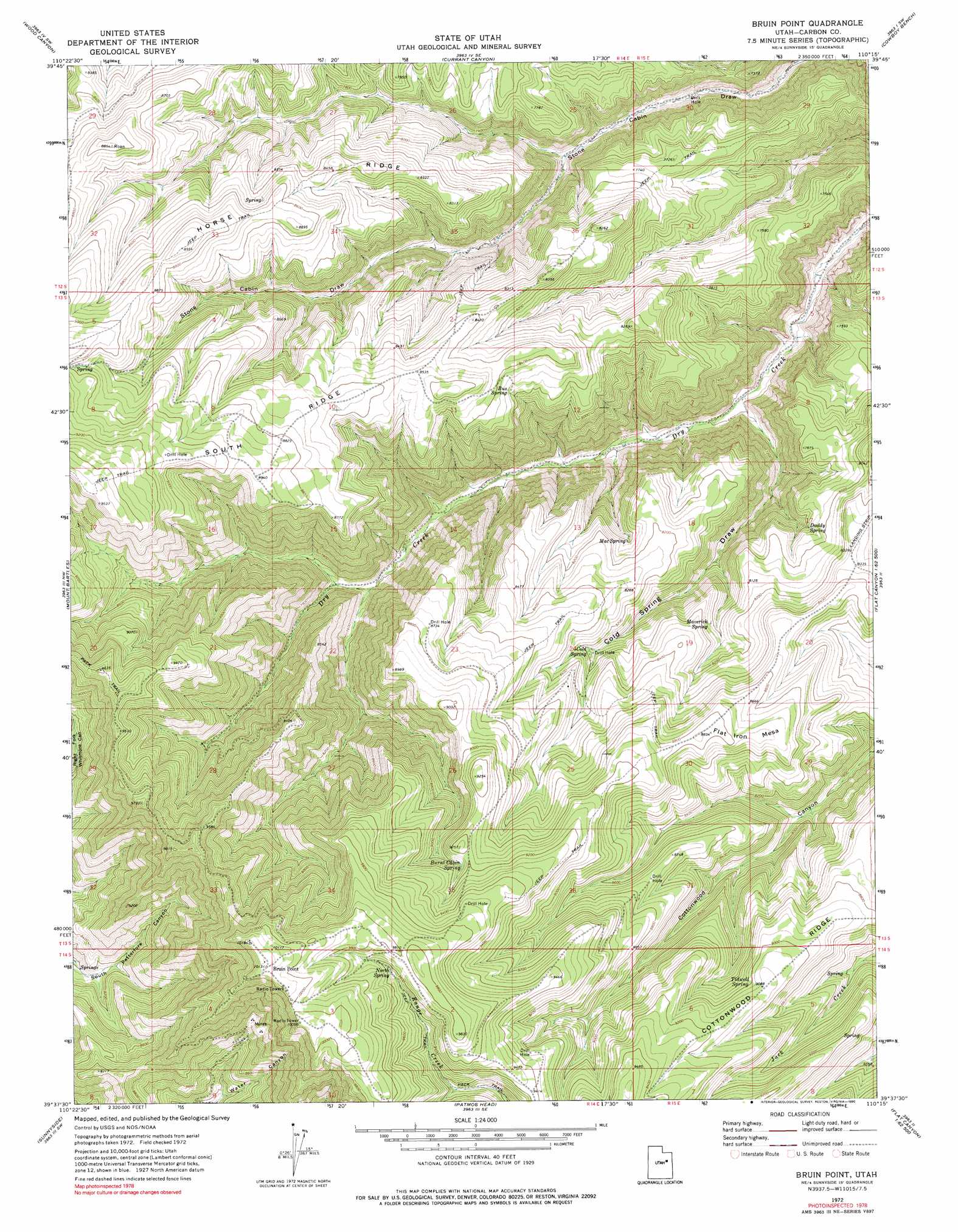
USGS Topo Quad 39110f3 - 1:24,000 scale
| Topo Map Name: | Bruin Point |
| USGS Topo Quad ID: | 39110f3 |
| Print Size: | ca. 21 1/4" wide x 27" high |
| Southeast Coordinates: | 39.625° N latitude / 110.25° W longitude |
| Map Center Coordinates: | 39.6875° N latitude / 110.3125° W longitude |
| U.S. State: | UT |
| Filename: | o39110f3.jpg |
| Download Map JPG Image: | Bruin Point topo map 1:24,000 scale |
| Map Type: | Topographic |
| Topo Series: | 7.5´ |
| Map Scale: | 1:24,000 |
| Source of Map Images: | United States Geological Survey (USGS) |
| Alternate Map Versions: |
Bruin Point UT 1972, updated 1976 Download PDF Buy paper map Bruin Point UT 1972, updated 1990 Download PDF Buy paper map Bruin Point UT 2011 Download PDF Buy paper map Bruin Point UT 2014 Download PDF Buy paper map |
1:24,000 Topo Quads surrounding Bruin Point
Lance Canyon |
Anthro Mountain |
Anthro Mountain Ne |
Gilsonite Draw |
Wilkin Ridge |
Minnie Maud Creek East |
Wood Canyon |
Currant Canyon |
Cowboy Bench |
Pinnacle Canyon |
Pine Canyon |
Mount Bartles |
Bruin Point |
Twin Hollow |
Cedar Ridge Canyon |
Sunnyside Junction |
Sunnyside |
Patmos Head |
Summerhouse Ridge |
Steer Ridge Canyon |
Mounds |
Cedar |
Lila Point |
Lighthouse Canyon |
Chandler Falls |
> Back to 39110e1 at 1:100,000 scale
> Back to 39110a1 at 1:250,000 scale
> Back to U.S. Topo Maps home
Bruin Point topo map: Gazetteer
Bruin Point: Flats
West Tavaputs Plateau elevation 2583m 8474′Bruin Point: Populated Places
Bruin Point elevation 3094m 10150′Bruin Point: Ridges
Horse Ridge elevation 2601m 8533′South Ridge elevation 2659m 8723′
Bruin Point: Springs
Burnt Cabin Spring elevation 2771m 9091′Bus Spring elevation 2524m 8280′
Cold Spring elevation 2503m 8211′
Daddy Spring elevation 2384m 7821′
Mac Spring elevation 2439m 8001′
Maverick Spring elevation 2458m 8064′
North Spring elevation 2911m 9550′
Tidwell Spring elevation 2742m 8996′
Bruin Point: Valleys
Cold Spring Draw elevation 2062m 6765′Bruin Point digital topo map on disk
Buy this Bruin Point topo map showing relief, roads, GPS coordinates and other geographical features, as a high-resolution digital map file on DVD: