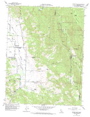
Potter Valley Topo Map California
To zoom in, hover over the map of Potter Valley
USGS Topo Quad 39123c1 - 1:24,000 scale
| Topo Map Name: | Potter Valley |
| USGS Topo Quad ID: | 39123c1 |
| Print Size: | ca. 21 1/4" wide x 27" high |
| Southeast Coordinates: | 39.25° N latitude / 123° W longitude |
| Map Center Coordinates: | 39.3125° N latitude / 123.0625° W longitude |
| U.S. State: | CA |
| Filename: | o39123c1.jpg |
| Download Map JPG Image: | Potter Valley topo map 1:24,000 scale |
| Map Type: | Topographic |
| Topo Series: | 7.5´ |
| Map Scale: | 1:24,000 |
| Source of Map Images: | United States Geological Survey (USGS) |
| Alternate Map Versions: |
Potter Valley CA 1960, updated 1969 Download PDF Buy paper map Potter Valley CA 1996, updated 2001 Download PDF Buy paper map Potter Valley CA 2012 Download PDF Buy paper map Potter Valley CA 2015 Download PDF Buy paper map |
| FStopo: | US Forest Service topo Potter Valley is available: Download FStopo PDF Download FStopo TIF |
1:24,000 Topo Quads surrounding Potter Valley
> Back to 39123a1 at 1:100,000 scale
> Back to 39122a1 at 1:250,000 scale
> Back to U.S. Topo Maps home
Potter Valley topo map: Gazetteer
Potter Valley: Canals
East Canal elevation 293m 961′Powerhouse Canal elevation 299m 980′
Potter Valley: Flats
Irishmans Flat elevation 900m 2952′McCreary Glade elevation 885m 2903′
Potter Valley: Populated Places
Pomo elevation 287m 941′Potter Valley elevation 289m 948′
Potter Valley: Ridges
Middle Mountain elevation 1025m 3362′Potter Valley: Springs
Pine Mountain Spring elevation 1169m 3835′Potter Valley: Streams
Adobe Creek elevation 293m 961′Bevans Creek elevation 281m 921′
Burright Creek elevation 270m 885′
Busch Creek elevation 287m 941′
Mewhinney Creek elevation 266m 872′
White Creek elevation 269m 882′
Williams Creek elevation 287m 941′
Potter Valley: Summits
Garrett Mountain elevation 1210m 3969′Kibbey Peak elevation 989m 3244′
Pine Mountain elevation 1239m 4064′
Potter Valley: Valleys
Potter Valley elevation 277m 908′Potter Valley digital topo map on disk
Buy this Potter Valley topo map showing relief, roads, GPS coordinates and other geographical features, as a high-resolution digital map file on DVD:


