Clymers Topo Map Indiana
To zoom in, hover over the map of Clymers
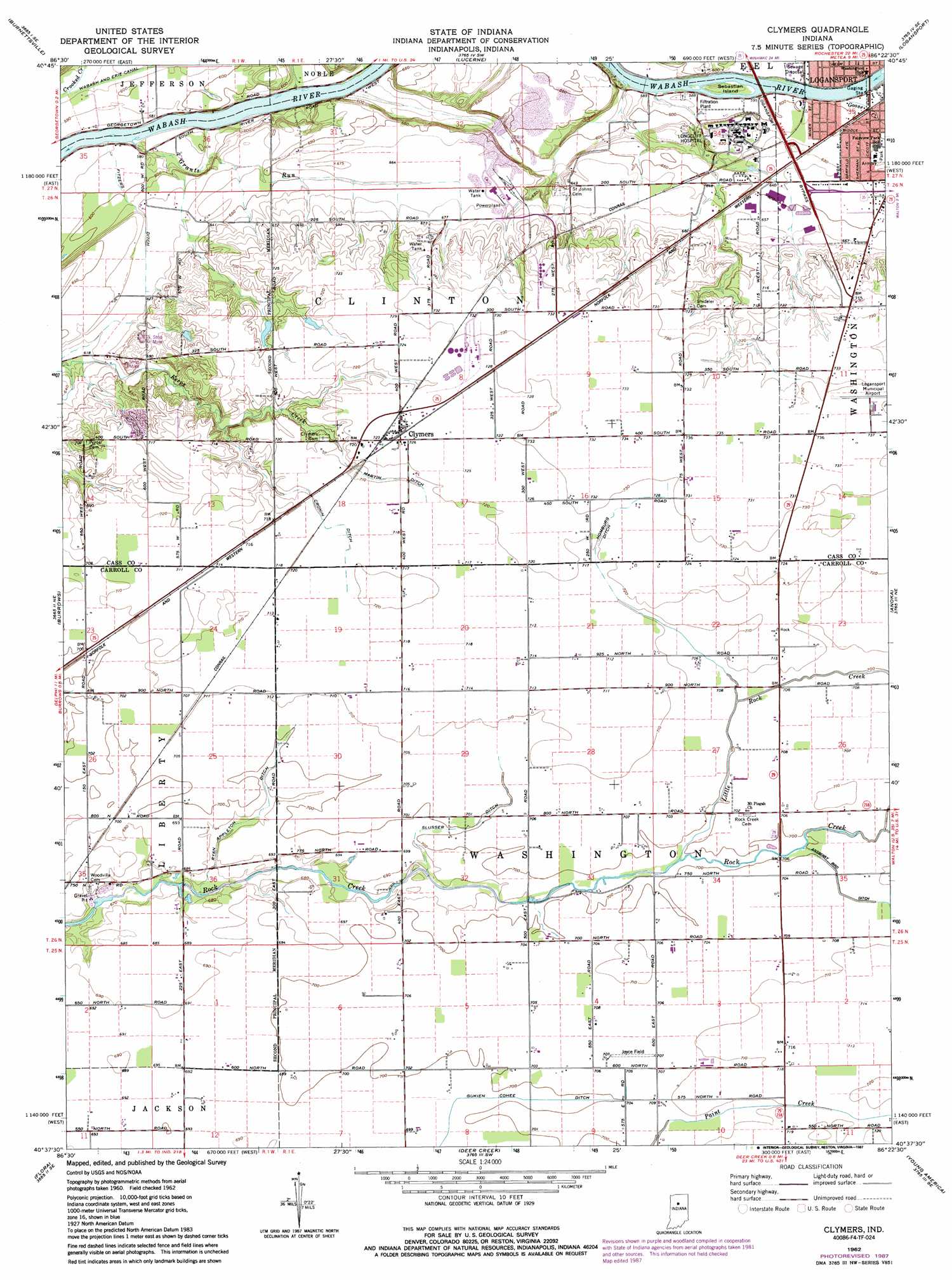
USGS Topo Quad 40086f4 - 1:24,000 scale
| Topo Map Name: | Clymers |
| USGS Topo Quad ID: | 40086f4 |
| Print Size: | ca. 21 1/4" wide x 27" high |
| Southeast Coordinates: | 40.625° N latitude / 86.375° W longitude |
| Map Center Coordinates: | 40.6875° N latitude / 86.4375° W longitude |
| U.S. State: | IN |
| Filename: | o40086f4.jpg |
| Download Map JPG Image: | Clymers topo map 1:24,000 scale |
| Map Type: | Topographic |
| Topo Series: | 7.5´ |
| Map Scale: | 1:24,000 |
| Source of Map Images: | United States Geological Survey (USGS) |
| Alternate Map Versions: |
Clymers IN 1962, updated 1964 Download PDF Buy paper map Clymers IN 1962, updated 1980 Download PDF Buy paper map Clymers IN 1962, updated 1987 Download PDF Buy paper map Clymers IN 2010 Download PDF Buy paper map Clymers IN 2013 Download PDF Buy paper map Clymers IN 2016 Download PDF Buy paper map |
1:24,000 Topo Quads surrounding Clymers
Buffalo |
Star City |
Grass Creek |
Fulton |
Macy |
Idaville |
Burnettsville |
Lucerne |
Logansport |
Twelve Mile |
Yeoman |
Burrows |
Clymers |
Anoka |
Onward |
Delphi |
Flora |
Deer Creek |
Young America |
Galveston |
Pyrmont |
Rossville |
Burlington |
Russiaville |
Kokomo West |
> Back to 40086e1 at 1:100,000 scale
> Back to 40086a1 at 1:250,000 scale
> Back to U.S. Topo Maps home
Clymers topo map: Gazetteer
Clymers: Airports
Joyce Airport elevation 215m 705′Logansport Municipal Airport elevation 223m 731′
Clymers: Canals
Cronin Ditch elevation 216m 708′Fitzers Ditch elevation 186m 610′
Gukien Cohee Ditch elevation 213m 698′
Homburg Ditch elevation 217m 711′
Martin Ditch elevation 216m 708′
Ryan Appleton Ditch elevation 208m 682′
Slusser Ditch elevation 212m 695′
Clymers: Islands
Sebastian Island elevation 180m 590′Clymers: Populated Places
Clymers elevation 221m 725′Clymers: Streams
Goose Creek elevation 176m 577′Grants Run elevation 171m 561′
Little Rock Creek elevation 212m 695′
Widow Creek elevation 213m 698′
Clymers digital topo map on disk
Buy this Clymers topo map showing relief, roads, GPS coordinates and other geographical features, as a high-resolution digital map file on DVD:
Northern Illinois, Northern Indiana & Southwestern Michigan
Buy digital topo maps: Northern Illinois, Northern Indiana & Southwestern Michigan