Karthaus Topo Map Pennsylvania
To zoom in, hover over the map of Karthaus
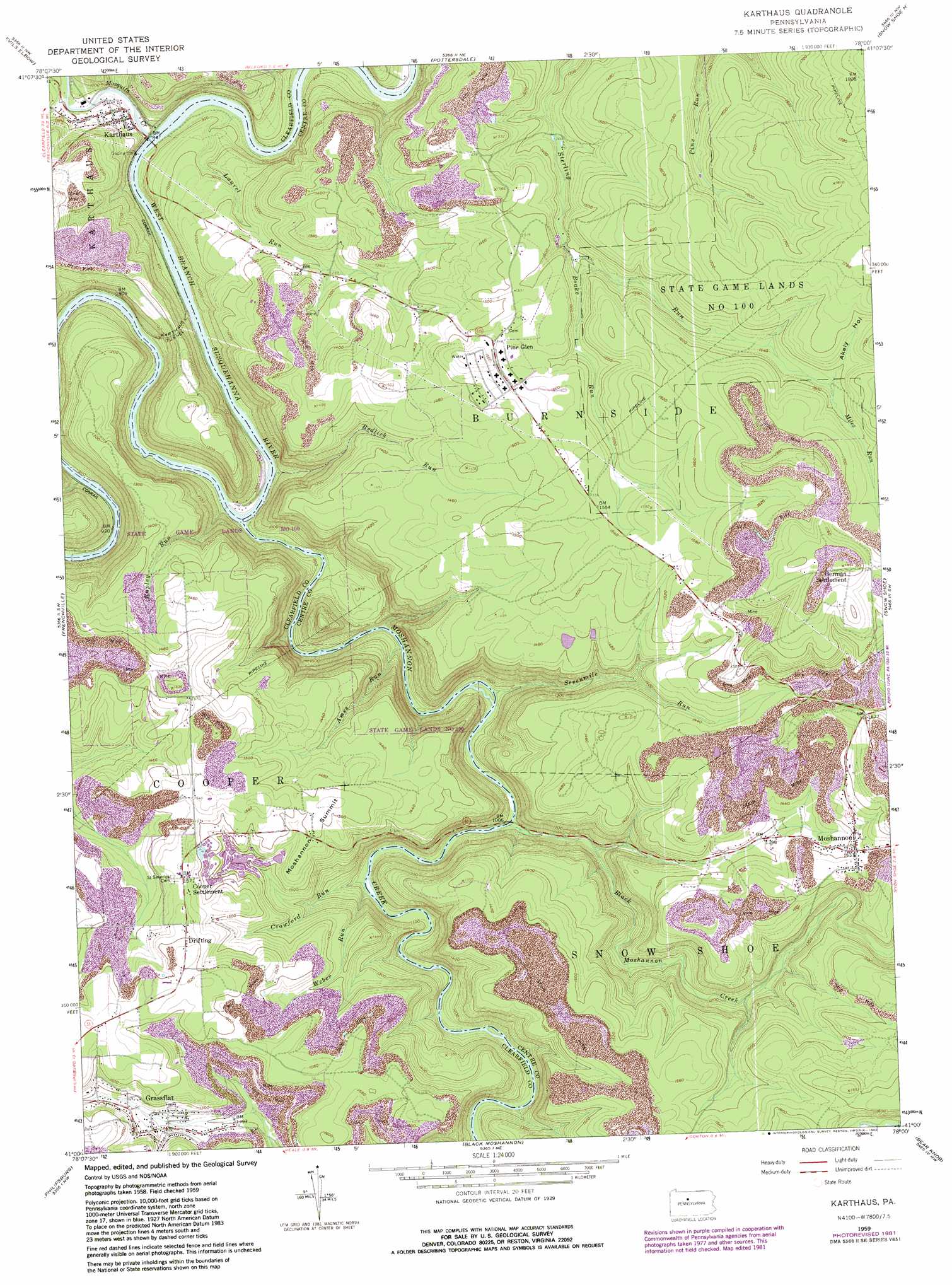
USGS Topo Quad 41078a1 - 1:24,000 scale
| Topo Map Name: | Karthaus |
| USGS Topo Quad ID: | 41078a1 |
| Print Size: | ca. 21 1/4" wide x 27" high |
| Southeast Coordinates: | 41° N latitude / 78° W longitude |
| Map Center Coordinates: | 41.0625° N latitude / 78.0625° W longitude |
| U.S. State: | PA |
| Filename: | o41078a1.jpg |
| Download Map JPG Image: | Karthaus topo map 1:24,000 scale |
| Map Type: | Topographic |
| Topo Series: | 7.5´ |
| Map Scale: | 1:24,000 |
| Source of Map Images: | United States Geological Survey (USGS) |
| Alternate Map Versions: |
Karthaus PA 1959, updated 1961 Download PDF Buy paper map Karthaus PA 1959, updated 1968 Download PDF Buy paper map Karthaus PA 1959, updated 1972 Download PDF Buy paper map Karthaus PA 1959, updated 1982 Download PDF Buy paper map Karthaus PA 1959, updated 1982 Download PDF Buy paper map Karthaus PA 2010 Download PDF Buy paper map Karthaus PA 2013 Download PDF Buy paper map Karthaus PA 2016 Download PDF Buy paper map |
1:24,000 Topo Quads surrounding Karthaus
Dents Run |
Driftwood |
Sinnemahoning |
Keating |
Renovo West |
The Knobs |
Devils Elbow |
Pottersdale |
Snow Shoe Nw |
Snow Shoe Ne |
Lecontes Mills |
Frenchville |
Karthaus |
Snow Shoe |
Snow Shoe Se |
Wallaceton |
Philipsburg |
Black Moshannon |
Bear Knob |
Bellefonte |
Houtzdale |
Sandy Ridge |
Port Matilda |
Julian |
State College |
> Back to 41078a1 at 1:100,000 scale
> Back to 41078a1 at 1:250,000 scale
> Back to U.S. Topo Maps home
Karthaus topo map: Gazetteer
Karthaus: Airports
Mountain Top Airport elevation 363m 1190′Karthaus: Parks
State Game Lands Number 100 elevation 504m 1653′Karthaus: Populated Places
Cooper Settlement elevation 476m 1561′Drifting elevation 490m 1607′
German Settlement elevation 560m 1837′
Grassflat elevation 448m 1469′
Karthaus elevation 276m 905′
Moshannon elevation 466m 1528′
Pine Glen elevation 465m 1525′
Karthaus: Springs
Big Sterling Spring elevation 427m 1400′Karthaus: Streams
Ames Run elevation 280m 918′Black Moshannon Creek elevation 302m 990′
Boake Run elevation 477m 1564′
Crawford Run elevation 319m 1046′
Curleys Run elevation 269m 882′
Laurel Run elevation 255m 836′
Miles Run elevation 481m 1578′
Moshannon Creek elevation 261m 856′
Mosquito Creek elevation 255m 836′
Redlick Run elevation 263m 862′
Rock Run elevation 280m 918′
Rupley Run elevation 265m 869′
Sevenmile Run elevation 292m 958′
Weber Run elevation 321m 1053′
Karthaus: Summits
Moshannon Summit elevation 464m 1522′Karthaus: Tunnels
Karthaus Tunnel elevation 367m 1204′Karthaus: Valleys
Akely Hollow elevation 487m 1597′Karthaus digital topo map on disk
Buy this Karthaus topo map showing relief, roads, GPS coordinates and other geographical features, as a high-resolution digital map file on DVD:
 map DVD")