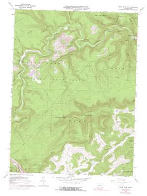
Snow Shoe Se Topo Map Pennsylvania
To zoom in, hover over the map of Snow Shoe Se
USGS Topo Quad 41077a7 - 1:24,000 scale
| Topo Map Name: | Snow Shoe Se |
| USGS Topo Quad ID: | 41077a7 |
| Print Size: | ca. 21 1/4" wide x 27" high |
| Southeast Coordinates: | 41° N latitude / 77.75° W longitude |
| Map Center Coordinates: | 41.0625° N latitude / 77.8125° W longitude |
| U.S. State: | PA |
| Filename: | o41077a7.jpg |
| Download Map JPG Image: | Snow Shoe Se topo map 1:24,000 scale |
| Map Type: | Topographic |
| Topo Series: | 7.5´ |
| Map Scale: | 1:24,000 |
| Source of Map Images: | United States Geological Survey (USGS) |
| Alternate Map Versions: |
Snow Shoe SE PA 1960, updated 1962 Download PDF Buy paper map Snow Shoe SE PA 1960, updated 1972 Download PDF Buy paper map Snow Shoe SE PA 1960, updated 1977 Download PDF Buy paper map Snow Shoe SE PA 1960, updated 1991 Download PDF Buy paper map Snow Shoe SE PA 1995, updated 1999 Download PDF Buy paper map Snow Shoe SE PA 2010 Download PDF Buy paper map Snow Shoe SE PA 2013 Download PDF Buy paper map Snow Shoe SE PA 2016 Download PDF Buy paper map |
1:24,000 Topo Quads surrounding Snow Shoe Se
> Back to 41077a1 at 1:100,000 scale
> Back to 41076a1 at 1:250,000 scale
> Back to U.S. Topo Maps home
Snow Shoe Se topo map: Gazetteer
Snow Shoe Se: Bends
Devils Elbow elevation 663m 2175′Snow Shoe Se: Populated Places
Kato elevation 350m 1148′Orviston elevation 264m 866′
Panther elevation 351m 1151′
Snow Shoe Se: Streams
Council Run elevation 290m 951′Eddy Lick Run elevation 309m 1013′
Hayes Run elevation 267m 875′
Laurel Run elevation 359m 1177′
Logway Run elevation 293m 961′
North Fork Beech Creek elevation 375m 1230′
Panther Run elevation 322m 1056′
Rock Run elevation 354m 1161′
Sandy Run elevation 349m 1145′
South Fork Beech Creek elevation 375m 1230′
Three Rock Run elevation 268m 879′
Two Rock Run elevation 270m 885′
Wolf Run elevation 339m 1112′
Snow Shoe Se: Trails
Marsh Creek Trail elevation 488m 1601′Rock Hollow Trail elevation 459m 1505′
Snow Shoe Se: Tunnels
Hogback Tunnel elevation 310m 1017′Snow Shoe Se digital topo map on disk
Buy this Snow Shoe Se topo map showing relief, roads, GPS coordinates and other geographical features, as a high-resolution digital map file on DVD:
New York, Vermont, Connecticut & Western Massachusetts
Buy digital topo maps: New York, Vermont, Connecticut & Western Massachusetts


