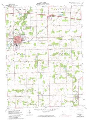
Montpelier Topo Map Ohio
To zoom in, hover over the map of Montpelier
USGS Topo Quad 41084e5 - 1:24,000 scale
| Topo Map Name: | Montpelier |
| USGS Topo Quad ID: | 41084e5 |
| Print Size: | ca. 21 1/4" wide x 27" high |
| Southeast Coordinates: | 41.5° N latitude / 84.5° W longitude |
| Map Center Coordinates: | 41.5625° N latitude / 84.5625° W longitude |
| U.S. State: | OH |
| Filename: | o41084e5.jpg |
| Download Map JPG Image: | Montpelier topo map 1:24,000 scale |
| Map Type: | Topographic |
| Topo Series: | 7.5´ |
| Map Scale: | 1:24,000 |
| Source of Map Images: | United States Geological Survey (USGS) |
| Alternate Map Versions: |
Montpelier OH 1961, updated 1963 Download PDF Buy paper map Montpelier OH 1961, updated 1973 Download PDF Buy paper map Montpelier OH 2010 Download PDF Buy paper map Montpelier OH 2013 Download PDF Buy paper map Montpelier OH 2016 Download PDF Buy paper map |
1:24,000 Topo Quads surrounding Montpelier
> Back to 41084e1 at 1:100,000 scale
> Back to 41084a1 at 1:250,000 scale
> Back to U.S. Topo Maps home
Montpelier topo map: Gazetteer
Montpelier: Airports
Woodruff Airport elevation 274m 898′Montpelier: Crossings
Bryan Montpelier Interchange elevation 271m 889′Montpelier: Parks
Beaver Creek Wildlife Area elevation 235m 770′Bible Park elevation 258m 846′
George Bible Park elevation 259m 849′
Opdyke Park elevation 240m 787′
Montpelier: Populated Places
Caster Subdivision elevation 237m 777′Cox Subdivision elevation 274m 898′
Daft Subdivision elevation 271m 889′
Deer Lick (historical) elevation 265m 869′
Hallock elevation 249m 816′
Hillcrest elevation 260m 853′
Holiday City elevation 274m 898′
Manleys Subdivision elevation 268m 879′
Maplecrest elevation 262m 859′
Montpelier elevation 261m 856′
Pulaski elevation 230m 754′
West Jefferson elevation 270m 885′
West View Subdivision elevation 262m 859′
Montpelier: Post Offices
Montpelier Post Office elevation 261m 856′Montpelier: Streams
Lost Creek elevation 219m 718′Nettle Creek elevation 259m 849′
Nettle Creek elevation 259m 849′
Montpelier: Woods
Davis Woods elevation 246m 807′Montpelier digital topo map on disk
Buy this Montpelier topo map showing relief, roads, GPS coordinates and other geographical features, as a high-resolution digital map file on DVD:
Northern Illinois, Northern Indiana & Southwestern Michigan
Buy digital topo maps: Northern Illinois, Northern Indiana & Southwestern Michigan


