Blakeslee Topo Map Ohio
To zoom in, hover over the map of Blakeslee
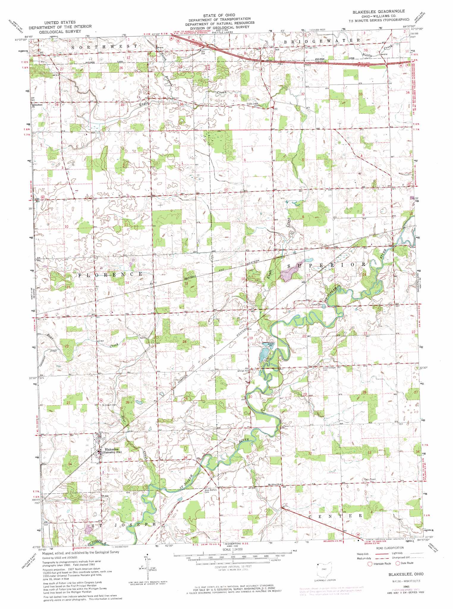
USGS Topo Quad 41084e6 - 1:24,000 scale
| Topo Map Name: | Blakeslee |
| USGS Topo Quad ID: | 41084e6 |
| Print Size: | ca. 21 1/4" wide x 27" high |
| Southeast Coordinates: | 41.5° N latitude / 84.625° W longitude |
| Map Center Coordinates: | 41.5625° N latitude / 84.6875° W longitude |
| U.S. State: | OH |
| Filename: | o41084e6.jpg |
| Download Map JPG Image: | Blakeslee topo map 1:24,000 scale |
| Map Type: | Topographic |
| Topo Series: | 7.5´ |
| Map Scale: | 1:24,000 |
| Source of Map Images: | United States Geological Survey (USGS) |
| Alternate Map Versions: |
Blakeslee OH 1961, updated 1963 Download PDF Buy paper map Blakeslee OH 1961, updated 1973 Download PDF Buy paper map Blakeslee OH 2010 Download PDF Buy paper map Blakeslee OH 2013 Download PDF Buy paper map Blakeslee OH 2016 Download PDF Buy paper map |
1:24,000 Topo Quads surrounding Blakeslee
California |
Camden |
Reading |
Frontier |
Pittsford |
Angola East |
Clear Lake |
Nettle Lake |
Pioneer |
Alvordton |
Hamilton |
Edon |
Blakeslee |
Montpelier |
West Unity |
Butler West |
Butler East |
Edgerton |
Bryan |
Evansport |
Saint Joe |
Hicksville |
Mark Center |
Sherwood |
Defiance West |
> Back to 41084e1 at 1:100,000 scale
> Back to 41084a1 at 1:250,000 scale
> Back to U.S. Topo Maps home
Blakeslee topo map: Gazetteer
Blakeslee: Dams
Browns Recreation Lake Dam elevation 261m 856′Blakeslee: Populated Places
Blakeslee elevation 263m 862′West Buffalo (historical) elevation 258m 846′
West Woodly Addition elevation 264m 866′
Blakeslee: Reservoirs
Browns Recreation Lake elevation 261m 856′Blakeslee: Streams
Bear Creek elevation 252m 826′Bear Creek elevation 252m 826′
Eagle Creek elevation 255m 836′
North Branch Eagle Creek elevation 274m 898′
Blakeslee digital topo map on disk
Buy this Blakeslee topo map showing relief, roads, GPS coordinates and other geographical features, as a high-resolution digital map file on DVD:
Northern Illinois, Northern Indiana & Southwestern Michigan
Buy digital topo maps: Northern Illinois, Northern Indiana & Southwestern Michigan