Little Dee Creek Topo Map Wyoming
To zoom in, hover over the map of Little Dee Creek
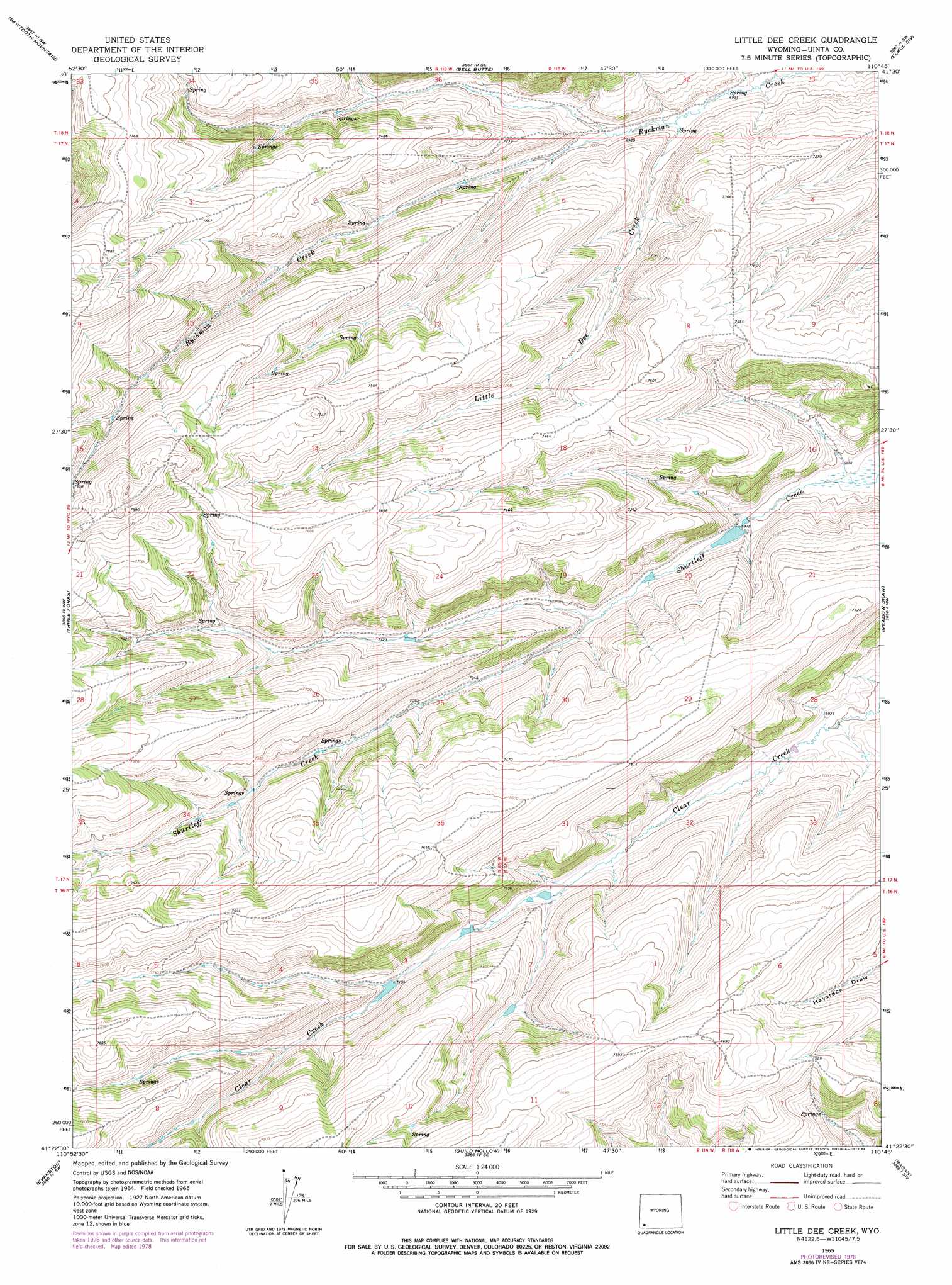
USGS Topo Quad 41110d7 - 1:24,000 scale
| Topo Map Name: | Little Dee Creek |
| USGS Topo Quad ID: | 41110d7 |
| Print Size: | ca. 21 1/4" wide x 27" high |
| Southeast Coordinates: | 41.375° N latitude / 110.75° W longitude |
| Map Center Coordinates: | 41.4375° N latitude / 110.8125° W longitude |
| U.S. State: | WY |
| Filename: | o41110d7.jpg |
| Download Map JPG Image: | Little Dee Creek topo map 1:24,000 scale |
| Map Type: | Topographic |
| Topo Series: | 7.5´ |
| Map Scale: | 1:24,000 |
| Source of Map Images: | United States Geological Survey (USGS) |
| Alternate Map Versions: |
Little Dee Creek WY 1965, updated 1968 Download PDF Buy paper map Little Dee Creek WY 1965, updated 1979 Download PDF Buy paper map Little Dee Creek WY 1965, updated 1984 Download PDF Buy paper map Little Dee Creek WY 2012 Download PDF Buy paper map Little Dee Creek WY 2015 Download PDF Buy paper map |
1:24,000 Topo Quads surrounding Little Dee Creek
Rex Peak |
Windy Point |
Bell Butte Ne |
Warfield Creek |
Elkol |
Woodruff Narrows |
Sawtooth Mountain |
Bell Butte |
Elkol Sw |
Cumberland Gap |
Neponset Reservoir Ne |
Three Forks |
Little Dee Creek |
Meadow Draw |
Bridger |
Murphy Ridge |
Evanston |
Guild Hollow |
Ragan |
Leroy |
Wahsatch |
Millis |
Sulphur Creek Reservoir |
Piedmont Reservoir |
Hague Creek |
> Back to 41110a1 at 1:100,000 scale
> Back to 41110a1 at 1:250,000 scale
> Back to U.S. Topo Maps home
Little Dee Creek topo map: Gazetteer
Little Dee Creek: Streams
Little Dee Creek elevation 2120m 6955′Little Dee Creek digital topo map on disk
Buy this Little Dee Creek topo map showing relief, roads, GPS coordinates and other geographical features, as a high-resolution digital map file on DVD: