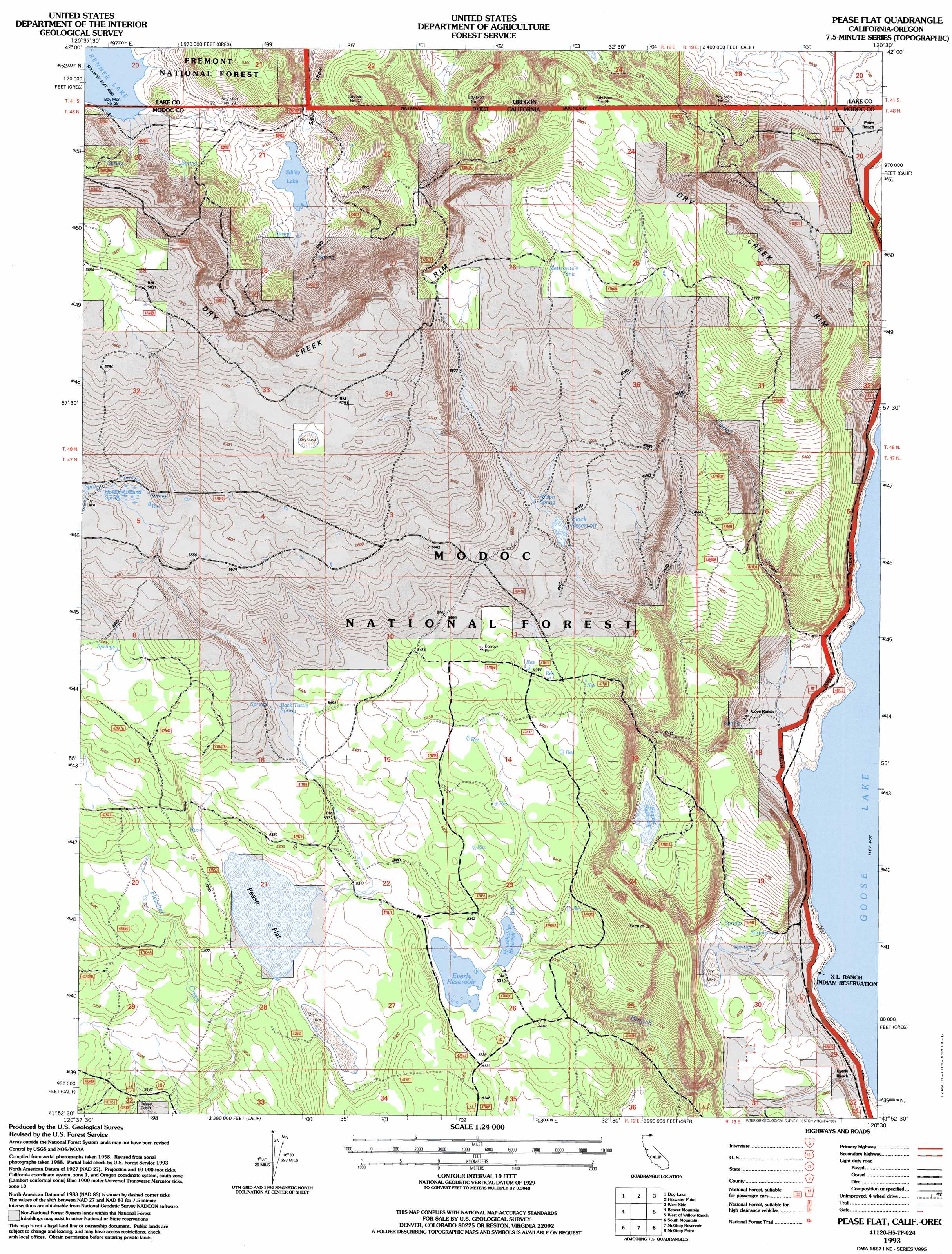
Pease Flat Topo Map California
To zoom in, hover over the map of Pease Flat
USGS Topo Quad 41120h5 - 1:24,000 scale
| Topo Map Name: | Pease Flat |
| USGS Topo Quad ID: | 41120h5 |
| Print Size: | ca. 21 1/4" wide x 27" high |
| Southeast Coordinates: | 41.875° N latitude / 120.5° W longitude |
| Map Center Coordinates: | 41.9375° N latitude / 120.5625° W longitude |
| U.S. States: | CA, OR |
| Filename: | o41120h5.jpg |
| Download Map JPG Image: | Pease Flat topo map 1:24,000 scale |
| Map Type: | Topographic |
| Topo Series: | 7.5´ |
| Map Scale: | 1:24,000 |
| Source of Map Images: | United States Geological Survey (USGS) |
| Alternate Map Versions: |
Pease Flat CA 1990, updated 1990 Download PDF Buy paper map Pease Flat CA 1993, updated 1997 Download PDF Buy paper map Pease Flat CA 2012 Download PDF Buy paper map Pease Flat CA 2015 Download PDF Buy paper map |
| FStopo: | US Forest Service topo Pease Flat is available: Download FStopo PDF Download FStopo TIF |
1:24,000 Topo Quads surrounding Pease Flat
Arkansas Flat |
Drews Reservoir |
Drews Gap |
Lakeview Airport |
Lakeview |
Strawberry Butte |
Dog Lake |
Fitzwater Point |
West Side |
Crane Creek |
Weed Valley |
Beaver Mountain |
Pease Flat |
West Of Willow Ranch |
Willow Ranch |
Hager Basin |
South Mountain |
Mcginty Reservoir |
Mcginty Point |
Sugar Hill |
Boles Meadows East |
Whittemore Ridge |
Dead Horse Reservoir |
Lauer Reservoir |
Davis Creek |
> Back to 41120e1 at 1:100,000 scale
> Back to 41120a1 at 1:250,000 scale
> Back to U.S. Topo Maps home
Pease Flat topo map: Gazetteer
Pease Flat: Cliffs
Dry Creek Rim elevation 1743m 5718′Dry Creek Rim elevation 1715m 5626′
Pease Flat: Dams
Enquist 158 Dam elevation 1565m 5134′Householder Dam elevation 1618m 5308′
Renner Sibley Creek 1119 Dam elevation 1518m 4980′
Pease Flat: Flats
Pease Flat elevation 1618m 5308′Pease Flat: Lakes
Renner Lake elevation 1513m 4963′Pease Flat: Reservoirs
Black Reservoir elevation 1664m 5459′Enquist Reservoir elevation 1565m 5134′
Everly Reservoir elevation 1621m 5318′
Householder Reservoir elevation 1618m 5308′
Meteorite Tank elevation 1726m 5662′
Pease Flat: Springs
Back Tuttle Spring elevation 1644m 5393′Hole-in-Ground Spring elevation 1702m 5583′
Poison Spring elevation 1670m 5479′
Pease Flat: Streams
Corral Creek elevation 1434m 4704′Gillum Creek elevation 1513m 4963′
Long Branch elevation 1435m 4708′
Pease Flat digital topo map on disk
Buy this Pease Flat topo map showing relief, roads, GPS coordinates and other geographical features, as a high-resolution digital map file on DVD: