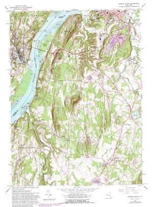
Hudson South Topo Map New York
To zoom in, hover over the map of Hudson South
USGS Topo Quad 42073b7 - 1:24,000 scale
| Topo Map Name: | Hudson South |
| USGS Topo Quad ID: | 42073b7 |
| Print Size: | ca. 21 1/4" wide x 27" high |
| Southeast Coordinates: | 42.125° N latitude / 73.75° W longitude |
| Map Center Coordinates: | 42.1875° N latitude / 73.8125° W longitude |
| U.S. State: | NY |
| Filename: | o42073b7.jpg |
| Download Map JPG Image: | Hudson South topo map 1:24,000 scale |
| Map Type: | Topographic |
| Topo Series: | 7.5´ |
| Map Scale: | 1:24,000 |
| Source of Map Images: | United States Geological Survey (USGS) |
| Alternate Map Versions: |
Hudson South NY 1963, updated 1965 Download PDF Buy paper map Hudson South NY 1963, updated 1970 Download PDF Buy paper map Hudson South NY 1963, updated 1981 Download PDF Buy paper map Hudson South NY 1980, updated 1981 Download PDF Buy paper map Hudson South NY 2010 Download PDF Buy paper map Hudson South NY 2013 Download PDF Buy paper map Hudson South NY 2016 Download PDF Buy paper map |
1:24,000 Topo Quads surrounding Hudson South
> Back to 42073a1 at 1:100,000 scale
> Back to 42072a1 at 1:250,000 scale
> Back to U.S. Topo Maps home
Hudson South topo map: Gazetteer
Hudson South: Airports
Green Acres Airport elevation 88m 288′Hudson South: Bridges
Rip Van Winkle Bridge elevation 4m 13′Hudson South: Capes
Brandow Point elevation 13m 42′Hudson South: Islands
Goat Island elevation 4m 13′Rogers Island elevation 0m 0′
Hudson South: Lakes
Bell Pond elevation 69m 226′Hudson South: Parks
Elliott Park elevation 25m 82′Olana Historic Site elevation 91m 298′
Wortman Square elevation 54m 177′
Hudson South: Populated Places
Bells Pond Mobile Home Park elevation 72m 236′Burden elevation 73m 239′
Catskill elevation 13m 42′
Cherry Hill elevation 64m 209′
Greendale elevation 5m 16′
Greenport Center elevation 53m 173′
Hamburg elevation 22m 72′
Humphreysville elevation 56m 183′
Linlithgo elevation 49m 160′
Livingston elevation 61m 200′
Oak Hill Landing elevation 5m 16′
Hudson South: Streams
Burget Creek elevation 0m 0′Catskill Creek elevation 0m 0′
Corlaer Kill elevation 0m 0′
Dubois Creek elevation 0m 0′
Foxes Creek elevation 0m 0′
Hallenbeck Creek elevation 0m 0′
Hans Vosen Kill elevation 8m 26′
Klein Kill elevation 3m 9′
Loomis Creek elevation 39m 127′
Mud Creek elevation 34m 111′
Mud Creek elevation 40m 131′
Ramshorn Creek elevation 0m 0′
Roeliff Jansen Kill elevation 0m 0′
Taghkanic Creek elevation 37m 121′
Hudson South: Summits
Becraft Hills elevation 100m 328′Blue Hill elevation 201m 659′
Church Hill elevation 147m 482′
Kykuit elevation 60m 196′
Mount Merino elevation 153m 501′
Mount Tom elevation 147m 482′
Hudson South: Swamps
South Bay elevation 2m 6′Hudson South digital topo map on disk
Buy this Hudson South topo map showing relief, roads, GPS coordinates and other geographical features, as a high-resolution digital map file on DVD:
New York, Vermont, Connecticut & Western Massachusetts
Buy digital topo maps: New York, Vermont, Connecticut & Western Massachusetts


