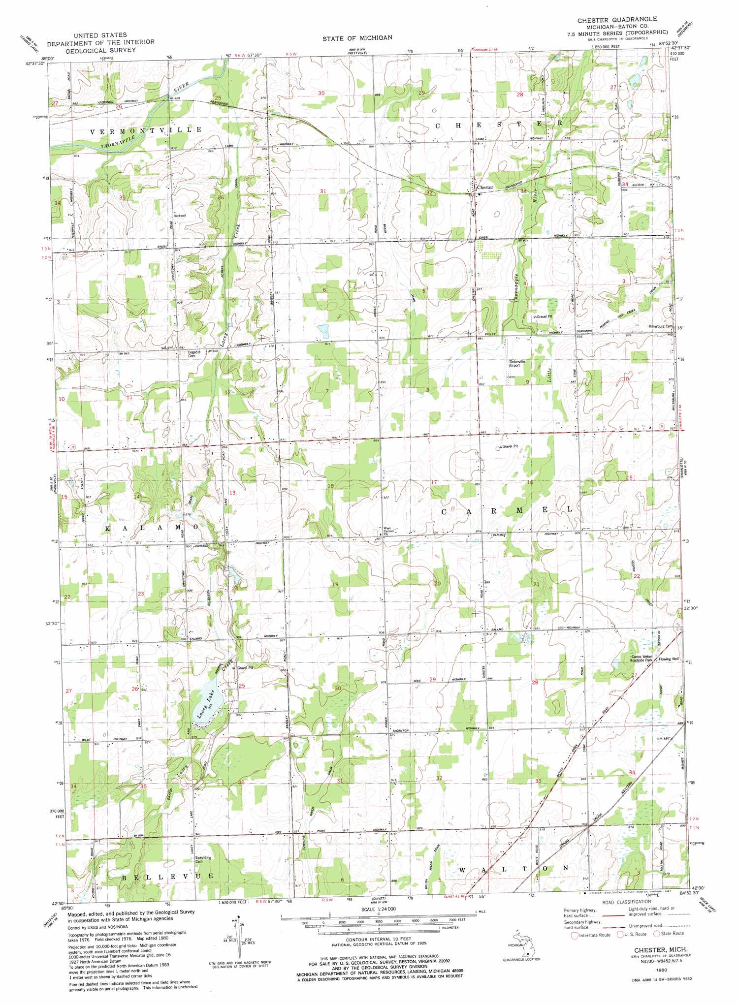
Chester Topo Map Michigan
To zoom in, hover over the map of Chester
USGS Topo Quad 42084e8 - 1:24,000 scale
| Topo Map Name: | Chester |
| USGS Topo Quad ID: | 42084e8 |
| Print Size: | ca. 21 1/4" wide x 27" high |
| Southeast Coordinates: | 42.5° N latitude / 84.875° W longitude |
| Map Center Coordinates: | 42.5625° N latitude / 84.9375° W longitude |
| U.S. State: | MI |
| Filename: | o42084e8.jpg |
| Download Map JPG Image: | Chester topo map 1:24,000 scale |
| Map Type: | Topographic |
| Topo Series: | 7.5´ |
| Map Scale: | 1:24,000 |
| Source of Map Images: | United States Geological Survey (USGS) |
| Alternate Map Versions: |
Chester MI 1980, updated 1981 Download PDF Buy paper map Chester MI 1980, updated 1981 Download PDF Buy paper map Chester MI 2011 Download PDF Buy paper map Chester MI 2014 Download PDF Buy paper map Chester MI 2017 Download PDF Buy paper map |
1:24,000 Topo Quads surrounding Chester
Lake Odessa |
Woodbury |
Portland South |
Eagle |
Wacousta |
Woodland |
Saubee Lake |
Hoytville |
Needmore |
Dimondale |
Maple Grove |
Nashville |
Chester |
Charlotte |
Eaton Rapids |
Bedford |
Bellevue |
Olivet |
Duck Lake |
Springport |
Battle Creek |
Ceresco |
Marshall |
Northwest Albion |
Northeast Albion |
> Back to 42084e1 at 1:100,000 scale
> Back to 42084a1 at 1:250,000 scale
> Back to U.S. Topo Maps home
Chester topo map: Gazetteer
Chester: Airports
Wend Valley Airport elevation 262m 859′Chester: Lakes
Lacey Lake elevation 266m 872′Chester: Parks
Carlos Weber Roadside Park elevation 269m 882′Chester: Populated Places
Carlisle elevation 280m 918′Chester elevation 277m 908′
Chester: Post Offices
Carlisle Post Office (historical) elevation 280m 918′Chester Post Office (historical) elevation 277m 908′
Chester: Streams
Fish Creek elevation 258m 846′Gayton and Powers Extension Drain elevation 254m 833′
Hill Drain elevation 254m 833′
Lacey Creek elevation 250m 820′
Nye and Eaton Drainage elevation 254m 833′
Powers Ditch elevation 250m 820′
Chester digital topo map on disk
Buy this Chester topo map showing relief, roads, GPS coordinates and other geographical features, as a high-resolution digital map file on DVD:
Northern Illinois, Northern Indiana & Southwestern Michigan
Buy digital topo maps: Northern Illinois, Northern Indiana & Southwestern Michigan