Woodland Topo Map Michigan
To zoom in, hover over the map of Woodland
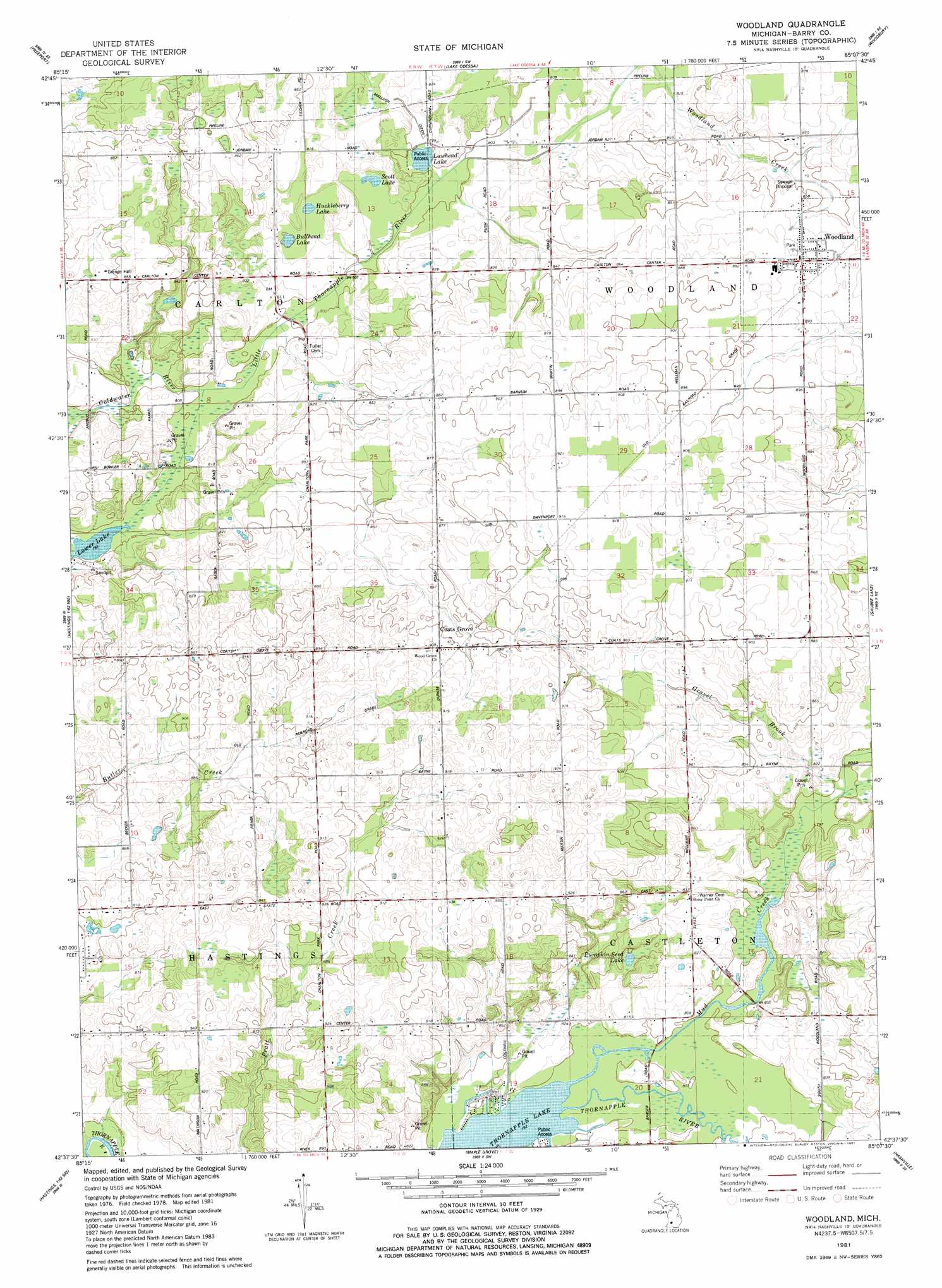
USGS Topo Quad 42085f2 - 1:24,000 scale
| Topo Map Name: | Woodland |
| USGS Topo Quad ID: | 42085f2 |
| Print Size: | ca. 21 1/4" wide x 27" high |
| Southeast Coordinates: | 42.625° N latitude / 85.125° W longitude |
| Map Center Coordinates: | 42.6875° N latitude / 85.1875° W longitude |
| U.S. State: | MI |
| Filename: | o42085f2.jpg |
| Download Map JPG Image: | Woodland topo map 1:24,000 scale |
| Map Type: | Topographic |
| Topo Series: | 7.5´ |
| Map Scale: | 1:24,000 |
| Source of Map Images: | United States Geological Survey (USGS) |
| Alternate Map Versions: |
Woodland MI 1981, updated 1981 Download PDF Buy paper map Woodland MI 2011 Download PDF Buy paper map Woodland MI 2014 Download PDF Buy paper map Woodland MI 2016 Download PDF Buy paper map |
1:24,000 Topo Quads surrounding Woodland
Cascade |
Lowell |
Saranac |
Ionia |
Portland North |
Alto |
Freeport |
Lake Odessa |
Woodbury |
Portland South |
Middleville |
Hastings |
Woodland |
Saubee Lake |
Hoytville |
Cloverdale |
Dowling |
Maple Grove |
Nashville |
Chester |
Delton |
Banfield |
Bedford |
Bellevue |
Olivet |
> Back to 42085e1 at 1:100,000 scale
> Back to 42084a1 at 1:250,000 scale
> Back to U.S. Topo Maps home
Woodland topo map: Gazetteer
Woodland: Lakes
Bullhead Lake elevation 243m 797′Huckleberry Lake elevation 245m 803′
Lawhead Lake elevation 241m 790′
Lower Lake elevation 241m 790′
Pumpkin Seed Lake elevation 255m 836′
Scott Lake elevation 246m 807′
Thornapple Lake elevation 242m 793′
Woodland: Parks
Woodland Town Hall Historical Marker elevation 266m 872′Woodland: Populated Places
Coats Grove elevation 277m 908′Woodland elevation 265m 869′
Woodland: Post Offices
Coats Grove Post Office (historical) elevation 276m 905′Gerkey Post Office (historical) elevation 249m 816′
Woodland: Streams
Gravel Brook elevation 242m 793′Little Thornapple River elevation 243m 797′
Mud Creek elevation 242m 793′
Woodland digital topo map on disk
Buy this Woodland topo map showing relief, roads, GPS coordinates and other geographical features, as a high-resolution digital map file on DVD:
Northern Illinois, Northern Indiana & Southwestern Michigan
Buy digital topo maps: Northern Illinois, Northern Indiana & Southwestern Michigan