Masonville Topo Map Iowa
To zoom in, hover over the map of Masonville
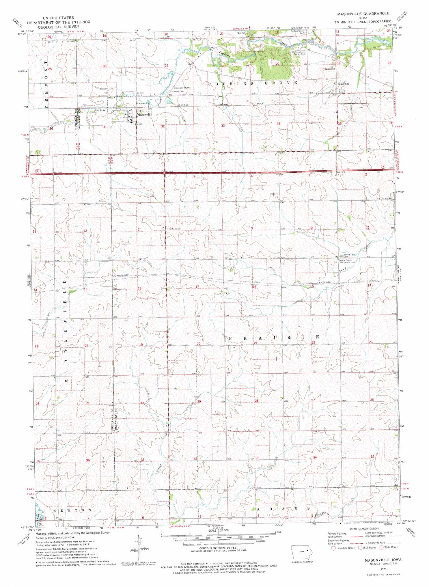
USGS Topo Quad 42091d5 - 1:24,000 scale
| Topo Map Name: | Masonville |
| USGS Topo Quad ID: | 42091d5 |
| Print Size: | ca. 21 1/4" wide x 27" high |
| Southeast Coordinates: | 42.375° N latitude / 91.5° W longitude |
| Map Center Coordinates: | 42.4375° N latitude / 91.5625° W longitude |
| U.S. State: | IA |
| Filename: | o42091d5.jpg |
| Download Map JPG Image: | Masonville topo map 1:24,000 scale |
| Map Type: | Topographic |
| Topo Series: | 7.5´ |
| Map Scale: | 1:24,000 |
| Source of Map Images: | United States Geological Survey (USGS) |
| Alternate Map Versions: |
Masonville IA 1973, updated 1977 Download PDF Buy paper map Masonville IA 2010 Download PDF Buy paper map Masonville IA 2013 Download PDF Buy paper map Masonville IA 2015 Download PDF Buy paper map |
1:24,000 Topo Quads surrounding Masonville
Stanley |
Arlington |
Strawberry Point |
Edgewood |
Garber |
Oelwein Se |
Lamont |
Dundee |
Thorpe |
Greeley |
Quasqueton |
Winthrop |
Masonville |
Manchester |
Earlville |
Walker |
Troy Mills |
Coggon |
Ryan |
Hopkinton West |
Center Point |
Lafayette |
Central City |
Prairieburg |
Anamosa Ne |
> Back to 42091a1 at 1:100,000 scale
> Back to 42090a1 at 1:250,000 scale
> Back to U.S. Topo Maps home
Masonville topo map: Gazetteer
Masonville: Parks
Coffins Grove County Park elevation 293m 961′Masonville: Populated Places
Masonville elevation 311m 1020′Masonville: Post Offices
Barryville Post Office (historical) elevation 324m 1062′Coffin's Grove Post Office (historical) elevation 295m 967′
Masonville Post Office elevation 311m 1020′
Masonville: Streams
Prairie Creek elevation 298m 977′Masonville digital topo map on disk
Buy this Masonville topo map showing relief, roads, GPS coordinates and other geographical features, as a high-resolution digital map file on DVD: