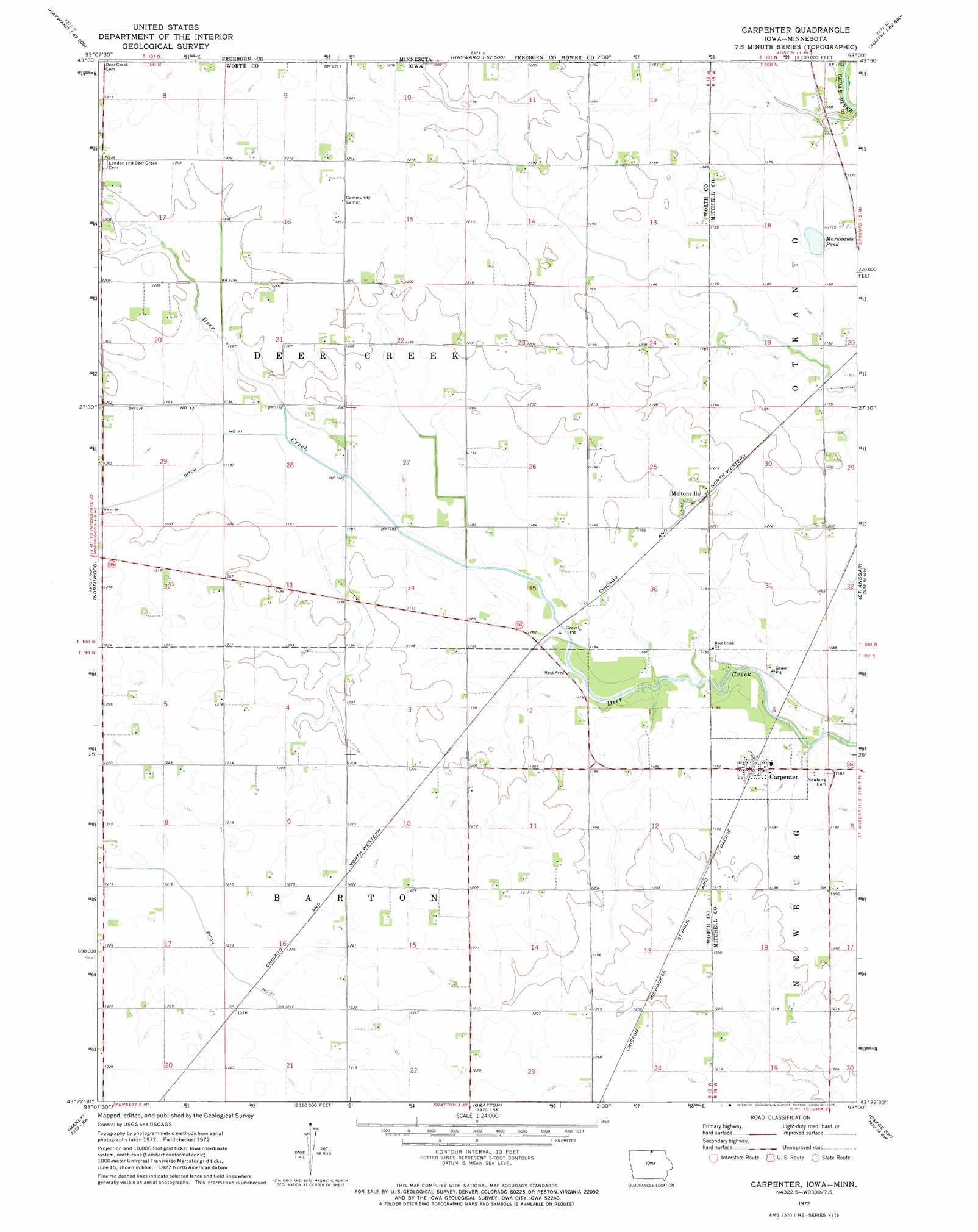
Carpenter Topo Map Iowa
To zoom in, hover over the map of Carpenter
USGS Topo Quad 43093d1 - 1:24,000 scale
| Topo Map Name: | Carpenter |
| USGS Topo Quad ID: | 43093d1 |
| Print Size: | ca. 21 1/4" wide x 27" high |
| Southeast Coordinates: | 43.375° N latitude / 93° W longitude |
| Map Center Coordinates: | 43.4375° N latitude / 93.0625° W longitude |
| U.S. States: | IA, MN |
| Filename: | o43093d1.jpg |
| Download Map JPG Image: | Carpenter topo map 1:24,000 scale |
| Map Type: | Topographic |
| Topo Series: | 7.5´ |
| Map Scale: | 1:24,000 |
| Source of Map Images: | United States Geological Survey (USGS) |
| Alternate Map Versions: |
Carpenter IA 1972, updated 1975 Download PDF Buy paper map Carpenter IA 2010 Download PDF Buy paper map Carpenter IA 2013 Download PDF Buy paper map Carpenter IA 2015 Download PDF Buy paper map |
1:24,000 Topo Quads surrounding Carpenter
Albert Lea East |
Hayward |
Austin West |
Austin East |
Brownsdale |
Glenville |
Myrtle |
London |
Lyle |
Rose Creek |
Fertile Ne |
Northwood |
Carpenter |
Saint Ansgar |
Stacyville |
Fertile Se |
Manly |
Grafton |
Osage Sw |
Osage |
Clear Lake East |
Mason City |
Nora Springs |
Rudd |
Orchard |
> Back to 43093a1 at 1:100,000 scale
> Back to 43092a1 at 1:250,000 scale
> Back to U.S. Topo Maps home
Carpenter topo map: Gazetteer
Carpenter: Forests
Deer Creek Forest elevation 359m 1177′Carpenter: Lakes
Markhams Pond elevation 356m 1167′Carpenter: Parks
Deer Creek Wildlife Area elevation 361m 1184′Carpenter: Populated Places
Carpenter elevation 363m 1190′Meltonville elevation 366m 1200′
Carpenter: Post Offices
Carpenter Post Office elevation 363m 1190′Meltonville Post Office (historical) elevation 366m 1200′
Otranto Post Office (historical) elevation 351m 1151′
Carpenter digital topo map on disk
Buy this Carpenter topo map showing relief, roads, GPS coordinates and other geographical features, as a high-resolution digital map file on DVD: